Note: This description is based on my perceptions from just two runs of this reach, one at 1600cfs ('high water') and the other at 1200cfs ('moderate water'). As with all reaches, and paddlers, your preferences and impressions may vary.

|
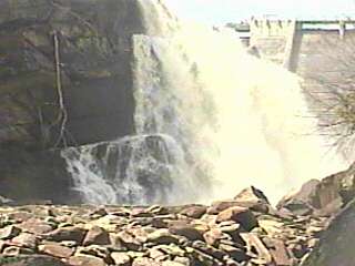
As you reach the parking area near the dam at Victoria Falls, you are greeted with a view of a section of the old flume which has been preserved (above left). The old wood and barrel-stave flume was replaced (in 2001) by a metal tube.
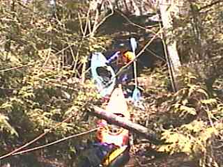
Carry down a gully through the woods, and find a way to climb down the final steep sandstone face (above right).
|
|
|
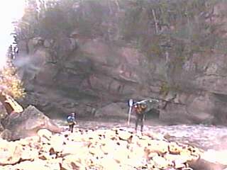
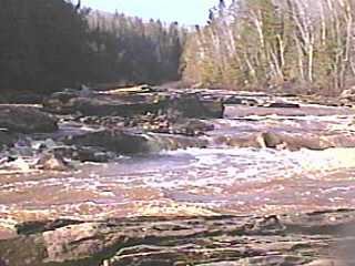
You will most immediately be upon a rubble shoals alongside a high wall (above left). I highly recommend carrying upstream to a rock/gravel-bar to view the base of the falls (above right). (Note: Technically, this is not "Victoria Falls". That lies buried in the pool behind the dam. This is just the spillway overflow from the dam, returning to the natural river channel.)
|
|
|
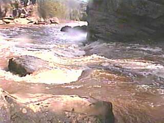
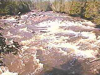
From this put-in you get a sweet rip-roaring start as the river heads south through diagonal waves, toward a tall vertical rock-face where it is forced left around a huge boulder with a potentially playable wave/hole. Turning south again, action is a bit tamer, passing through a fairly manageable series of waves and holes (above right). Many of the features are formed by transverse splines of bedrock, causing numerous potentially sticky pourovers.
|
 After a couple hundred yards of that action, the river is split by an island (above 1200cfs, otherwise right channel is dry or barely a trickle). Most of the flow heads to the left, where a large wave/hole lies alongside a huge overhanging rock on the island (photo at left). A center-channel slide angles left-to-right, while the left drops off into a diagonal hole (@1200cfs). A couple waves lead to a good eddy (river-left) where you can 'stage' for the next drop.
|


|
|
A high hump of rock on the left shore (photo above left) and the steep rock face of the island (right shore) funnel the flow to the next action. A few diagonal waves and offset holes lead to Three Fingers (photo above right). The river slopes away quickly across three splines of rock (completely covered at 1600cfs, partially exposed and/or visible at 1200 or less), as the water accelerates to rush into a rock-walled flume. A few center-river rocks (unnoticed at 1600cfs, pourovers at 1200cfs) lead to a decent eddy to the right (at the lower end of the flume) where you can savor the prior drop and 'collect' for the next one. At high water there will be exploding waves at the mouth of the flume, while more moderate levels will leave the exit much more manageable.
|
|
|
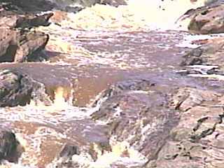
From here, the water fans out as the island ends, and the lesser flow from the right channel rejoins (out of photo to your left). To river-right and center are numerous pour-overs and boulder sieves (above left). It appeared there may be viable lines at moderate levels (I.E., at 1200cfs and under), but this is untried and untested (by me) as a route thus far. Relatively straight ahead (away from the left bank), a rock jumble (above right) precedes a pour-over and short pool, leading to a horizon line above a sloping bedrock slide (barely 'grunge-able' at 1200cfs).
|
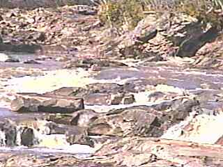
 Our route of choice (after the island channel and 'Three Fingers) on both runs I've made has been to head far to the left. Splines of rock (more-or-less parallel to the left river bank) direct more of the flow to spill down a series of pour-overs (photo at left). Try to keep from dropping into any of these too sideways, or too 'deep' (I.E., keep the bow up), or you may be stopped for an awkward surf in this steep-stepped series. At the base of the slide, a handful of offset boulders create slots, pourovers and holes to be dodged or punched.
Note: Vidcaps (photos) from run at estimated 1200 cfs (2002.05.05).
|
The next quarter mile mostly subsides to class II-III, with just one more slightly bigger drop in the middle, partway down. As the river approaches (and twists left at) a high eroded clay bank, the action subsides to class II boulderbed, then (as the outflow from the powerhouse channel rejoins the river) quiets out almost completely to provide swift flowing water for a mile or so to the confluence with the Middle Branch. From here down to the take-out bridge the river is totally flat.
WARNING! BEWARE!!
EXTREME HAZARD!!!
The river bed throughout the rapids stretch of this run is littered full of iron hoops. (Look at the short section of the former penstock near the dam to see examples.) These hoops are wrapped into, under, and around rocks in the riverbed in such a way as to snag anything under the surface of the water. At low-to-moderate levels many may be visible; at high levels virtually all will be unnoticeable. It is my understanding there are people involved in clearing most of these from this run. However, until this effort is complete, any flip or swim should be considered to be VERY life threatening. The size, volume, and nature of the river are likely to make any rescue or retrieval very difficult. |