![]()
![]()
| Return to the "Put-in" (Home page) | Format of descriptions | Disclaimers |
| RIVER: | Pike River, S.Branch, Big South Falls section |
| LOCATION: | Marinette County, W of Amberg |
| PUT-IN: | Mathis Lake Road |
| ALT.PUT-IN: | Forbes Road |
| TAKE-OUT: | Old roadway and bridge at confluence of N.&S. Branches |
| ALT.TAKE-OUT: | Veterans Park -or- Dave's Falls Park |
| SHUTTLE: | From Dave's Falls County Park, proceed left (N) on U.S.141 to CTH.V into Amberg. Left (W) 2-3 blocks to where "V" goes left (S), where you will turn right (N) a couple blocks, then left (W) onto Dow Dam Road/Benson Lake Road. Proceed 3.0 mi to Mathis Lake Road, left (S) 0.6 mi to the river, or another 0.2 mi on Dow Dam Road to Smiley Road, right (N) 2.0 mi to Forbes Road, left 0.2 mi to the river. |
| DIST: | 3-9 miles |
| TIME: | 1-4 hours |
| CLASS: | I-IV |
| CHARACTER: | Flat water and technical rapids (pool/drop). |
| GAUGE: | U.S.G.S. gauge (after confluence with N.Branch); min=?, opt=?, high=?
Needs the gauge at Hwy.141 bridge to be 1' or better to be entertaining. |
| SEASON: | Generally runnable in spring and early summer or rainy periods. |
| ANALYSIS: | (Note: data for combined flow of N.Branch and S.Branch)
Min.=70 cfs; 90%=100 cfs; 10%=370 cfs; Max.=2130 cfs; 10/90=3.7 > 300 cfs = 54 days/yr, 41/41yrs > 600 cfs = 11 days/yr, 37/41yrs > 900 cfs = 2 days/yr, 21/41yrs > 1,200 cfs = 1 day/yr, 8/41yrs |
|
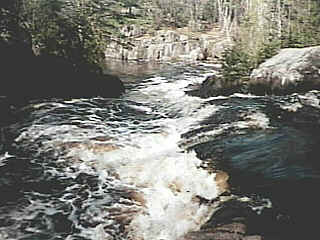
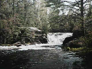
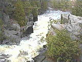
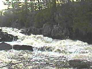
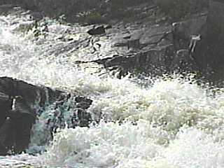
| Much flatwater, punctuated by short, often rocky rapids and generally good scenery. A good, ½ mile class II rapids starts at Mathis Lake Road. About a mile from that bridge you will encounter Big South Falls. Take out river right to scout this 10-12 foot drop which funnels down to a narrow chute, then into a pool with large rock-wall cliffs to the east. |
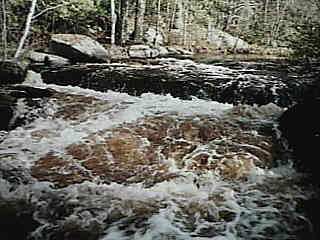 Shortly downstream, the river drops over a Surprise Ledge into an ugly looking hole formed by jumbled rock on both shores as well as down the middle. Much lesser rapids and flatwater follow until the confluence with the north branch, and the take-out for a short trip.
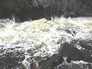
(Note: These three vidcaps (photos) from low-water scout (1992.07.12).) If continuing beyond the confluence, the river becomes wider with the increased flow from the other branch, and some easy boulder bed rapids will be encountered. |
|
|
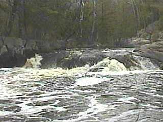
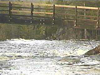
Take out just beyond the railroad bridge as the river turns sharply right and you hear the next falls. Scouting Upper Dave's may be done from the island or the shores. To the left of the island is a boulder choked channel which would only be runnable at high water levels. To the right, a 5-6' falls drops into a potentially sticky hole (above left).
The river heads left out of the large pool and passes under a foot-bridge (above right). A small, sometimes surfable wave may form under this bridge. Take out river right to scout Dave's Falls. |
|
| I have heard that this has been run (some rumors even say intentionally backwards just for a different thrill!) but personally I have not been much tempted, mostly due to the big holes and punishing shallow ledges in the lower part of the falls. |
|