![]()
![]()
| Return to the "Put-in" (Home page) | Format of descriptions | Disclaimers |
| RIVER: | Pike River, S.Branch, Horseshoe Falls section |
| LOCATION: | Marinette County, W of Amberg |
| PUT-IN: | Old County A Road, one car space adjacent to river, 0.25 upstream from the culvert where the river crosses under road |
| TAKE-OUT: | remote access off F.S.510 |
| SHUTTLE: | Note: since the put-in is far more easily
reached and identified, this description will vary from the normal pattern,
and be from the put-in to the take-out.
From the put-in, proceed 1.0 mi. (N) on Old County A road. Turn right (E) on Trout Haven Road, proceed 2.5 mi. to intersection with 12'Falls Road (to North) and F.S.510 (to South). Turn right (S) on F.S.510, proceed 1.5mi. to intersection where F.S.510 loops back onto itself. Turn right (SSW) and proceed 0.7 mi. just past slight downgrade, turn right on ungraded track 0.2 mi. to dead-end/campsite. The river is about 30 yards down a path to the west. (You will probably wish to look at the river here before running, to be able to identify the take-out.) |
| DIST: | 4.0 miles |
| TIME: | 3.0 hours |
| CLASS: | I-IV |
| CHARACTER: | Pool/drop. Rock garden rapids, and two larger falls/rapids. |
| GAUGE: | U.S.G.S. gauge (after confluence with N.Branch, well downstream); min=?, opt=?, high=?
Probably needs the gauge at Hwy.141 bridge to be 1' or better to be entertaining. |
| SEASON: | Generally runnable in spring and early summer or rainy periods. |
| ANALYSIS: | (Note: The data is for the combined flow of N.Branch and S.Branch, well downstream)
Min.=70 cfs; 90%=100 cfs; 10%=370 cfs; Max.=2130 cfs; 10/90=3.7 > 300 cfs = 54 days/yr, 41/41yrs > 600 cfs = 11 days/yr, 37/41yrs > 900 cfs = 2 days/yr, 21/41yrs > 1,200 cfs = 1 day/yr, 8/41yrs |
|
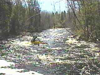
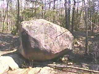
| From the put-in one quickly encounters about a half mile of rock garden rapids (class I-II), passing through the road culverts, and leading to a huge boulder on the right shore where the river takes a sharp left turn. You will hear and see the first significant drop. Scouting may be done from the right shore, but generally should not be necessary. |
|
|
Erratic Ledge is a sweet little double-drop ledge with a good pool below. At good water-levels, some play may be possible here.
Some more rock-garden rapids lead around a bend before the gradient peters out. For the next mile or so the river flows through an open, marshy area. After is passes under some high-tension power lines and re-enters a wooded area, some snags will be encountered, including an old log bridge embedded in the river, complete with large spikes sticking up, so beware. An overhead cable signals the start of some easy rapids, which build to a nice long boulder-garden drop. |
|
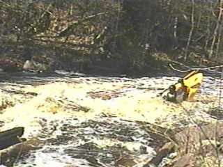
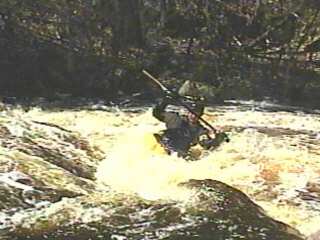
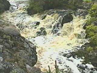
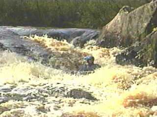
| Easy rapids and flatwater for about 10 minutes brings you to a small island and Split Falls. Scouting recommended (either side). This sliding-sluice with about 8' total drop is best run to the right, along the wall, through a couple of good holes. With enough water, it may be possible to go left of the rock/island then drop down a steeper, more rocky pitch (above right photo) into the outflow from the right side. In either case, be aware of shallow rock in the lower part of the drop. A short pool gives way to some easy (II) boulder garden rapids, then flat water. |
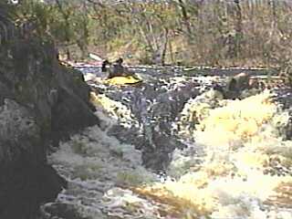
 After a few minutes again you will hear the pounding of a falls. A river left take-out is advised to scout Horseshoe Falls. The river makes a short, steep slide into a hole and a surging eddy. The river swings sharply to the right over another series of shallow ledges. Just below this are some scenic bluffs on the right and there may be some water flowing in over boulders and through trees. This is not a side-stream, but an overflow channel from the stretch of river you just paddled, since the river has just looped around on itself!
|
 Ten minutes of flats will again bring you to a constriction and a pleasant little Double-Drop Canyon. Some play may be possible here.
 |
 Another 3 minutes will bring you to a small rock-dam rapids, which is the last rapids on the run. A brief flatwater paddle will bring you to the suggested take-out.
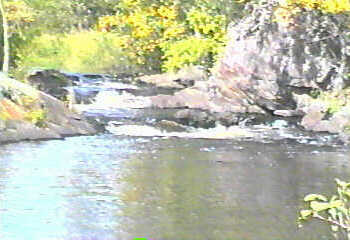
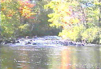
Note: Final two vidcaps from low-water scout (1992.09.12). All others from good (moderate) water runs. |