An Afternoon on the Rock
River
A Field Journal in pictures
A Field Journal in pictures
I have lived near the Rock River for most of
my life, except for the four years I lived in Texas and the six in Milwaukee.
It is located in southeastern Wisconsin, starting in the Horicon Marsh
and leaving Wisconsin by Janesville and Beloit. The watershed area of
the Rock is enormous.
This area of Wisconsin is known more for their lakes than rivers. The main reason I chose the Rock over the Oconomowoc River is because of the wonderful meanderings of the Rock. The Oconomowoc seems to be more waterways between the lakes than an actual river. I remember as a little girl driving to Watertown along State Highway 16 and seeing how the Rock had flooded the bridge leading to Kanow County Park (they eventually rebuilt the bridge high enough so the river didn't flood it), and how the wayside just past Kanow was always underwater in the spring. It's a guarantee.
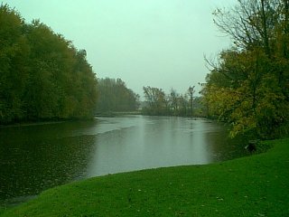
On the afternoon of Saturday, October 13th, 2001, we went to take pictures of the Rock just outside of Oconomowoc, WI. Although officially for a class, the pictures show a slice of life on the river. It was a rainy day, so we were not lucky enough to find any wildlife (or even fish!), but we were able to get some great pictures of fall in Wisconsin, as well as some insight into how humans affect the waterways around them.
The primary area I looked at was a small wayside (rest area) about three miles west of Oconomowoc. The Rock takes a loop around a small outcropping of land, forming a natural peninsula. This area has been made into a small parking lot, boat launch, and other man made features. We then went upriver to Kanow County Park and up the Rock River Road to see the effect of the local farms on the river.
The pictures:
Rest Area (16 pictures over four pages)
Rock River Road (8 pictures over two pages)
This page hosted by Geocities
This area of Wisconsin is known more for their lakes than rivers. The main reason I chose the Rock over the Oconomowoc River is because of the wonderful meanderings of the Rock. The Oconomowoc seems to be more waterways between the lakes than an actual river. I remember as a little girl driving to Watertown along State Highway 16 and seeing how the Rock had flooded the bridge leading to Kanow County Park (they eventually rebuilt the bridge high enough so the river didn't flood it), and how the wayside just past Kanow was always underwater in the spring. It's a guarantee.
On the afternoon of Saturday, October 13th, 2001, we went to take pictures of the Rock just outside of Oconomowoc, WI. Although officially for a class, the pictures show a slice of life on the river. It was a rainy day, so we were not lucky enough to find any wildlife (or even fish!), but we were able to get some great pictures of fall in Wisconsin, as well as some insight into how humans affect the waterways around them.
The primary area I looked at was a small wayside (rest area) about three miles west of Oconomowoc. The Rock takes a loop around a small outcropping of land, forming a natural peninsula. This area has been made into a small parking lot, boat launch, and other man made features. We then went upriver to Kanow County Park and up the Rock River Road to see the effect of the local farms on the river.
The pictures:
Rest Area (16 pictures over four pages)
Rock River Road (8 pictures over two pages)
This page hosted by Geocities