Location:
From St. Paul's Catacomb keep on walking/driving to the west until you reach the main road. A country lane marked Santa Katerina takes you to an open space near Ghar Barka. Take the road to the left towards the hamlet of Santa Katerina, and look for a quarry in the fields to the right. A large Girna ( corbelled hut ) can be noted on a quarry's edge and is reached through the path found near the gate of the quarry. One of the entrances to l-Ghar tal-Iburdan may be found within 15 metres to the west of this Girna.
Description:
This interesting cave complex would have probably been destroyed unnoticed were it not for a newspaper article published in the late sixties.(1) The author, Pisani Bonavia, attempts to identify this cave with the elusive Qasam il-Gewwieni cave complex repeatedly documented in nineteenth century literature. The location of l-Ghar tal-Iburdan to the south-west of Mdina and away from cliffs make such a possibility unlikely and the number of localities proposed for reidentification of the Qasam il-Gewwieni caves still await toponymic confirmation.(2)
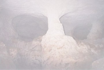
In the following years, the newspaper article appears to have attracted the attention of the archaeologist Rita Virzì Hägglund, then occupying the post of lecturer in archaeology at the University of Malta. After conducting a series of visits to the complex, she was granted permission to excavate the caves. Excavations were limited to two out of the three rock cut caves identified at the site.(3) One particular cave (Ipogeo A) had a number of interesting features. These included two elliptical window-like openings (Photo 1) through which a rubble-filled corridor led to an elongated room, finishing in an alcove-like structure (Photo 2). Excavations conducted within this cave revealed a fire-hardened floor consisting of beaten earth underlying a hearth. The latter contained pottery dateable to the third to the fifth century AD, remains of burnt material and animal bones. A medieval cup decorated in brown and green was found above these remains but separated from them by a powdery layer from which two modern buttons were retrieved. More Roman pottery (interestingly lying over specimens of flint) was found in a trench cut just beyond the entrance of this cave (Ipogeo A).
The archaeologist supervised two further trenches made in another cave (Ipogeo B) but finds were restricted to a depression within the central part of this cave. Here pottery datable to the third to the fifth century AD was found within two deposits lying over a layer of beaten earth. A hearth and remains of a pot were also found.
During the excavations, Virzì Hägglund was assisted for two days by about twenty students from the University of New York under the direction of Dr. Eugene Sterud. Although no significant artifacts or stratigraphy were encountered during their investigations, a pair of cart-tracks were found outside the mouth of the cave.(4)
The conclusions that can be drawn from the above account are numerous, many already pointed out by Virzì Hägglund herself. The area, if not the cave itself, could have already been frequented since prehistoric times, but more substantial use of the site was made during the late Roman period. While space within the cave was created by rock cutting, attempts were also made to provide a more level floor in parts of it. The presence of two hearths and meal remains point towards the use of the site for habitation purposes during the late Roman period. Nothing in the excavated material appears to suggest use for ritual practices. The presence of the medieval cup fragment attests further to the repeated multi-period human use of the cave complex. The description of the cups find spot does not suggest continuity between the Roman and Medieval periods but on the other hand does not exclude it.
Since these excavations, another cave (witnessing use during the Roman period) was discovered during the environmental survey of the Bristol-CambridgeYorkMalta project, the latter better remembered for uncovering the Gozo Stone Circle.(5) This cave, excavated at Rabat (Gozo), contained over two metres of deposit. The mollusc assemblage in the redeposited topsoil, which through pottery sherds were dated to the first and second centuries AD, was indicative of a relatively well-vegetated, possibly wooded local environment. Levels of the next two centuries were composed of subsoil materials with fauna typical of exposed, lightly vegetated habitats. This cave sequence revealed that the soil erosion occurring in late prehistory intensified, progressing to completion by the Roman occupation of the islands.(6)
The close proximity of these two caves to an urban centre would appear to support Virzì Hägglunds hypothesis, namely that the economic crises and Vandalic invasions in Sicily resulted in local insecurity leading to widespread cave use during the late Roman period.(7) Reservations have been expressed on this hypothesis (8) and these opinions are further supported by the widespread occurrence of hypogea throughout the Maltese Islands, which can be interpreted as indicative of several communities in the Maltese countryside during the later part of the Roman period. A more complete and reliable interpretation could hopefully be attempted in the coming months when studies into the trading patterns of Roman Malta will finally come to print.(9)
Beyond its archaeological interest, the more recent history of L-Ghar tal-Iburdan is still largely unknown. Farmers living in the vicinity, however, still recall use of the cave as a World War II shelter by a family from Rabat. One of the survivors, over ninety years old, lived in the vicinity until a few years ago. In subsequent years the site was frequented by Italian men, arousing suspicious thoughts in the nearby residents. Since then the cave has been uninhabited, providing an ideal undisturbed habitat for an important bat colony. The cave is now an important winter roost for the Lesser Horse-Shoe Bat (Rhinolophus hipposideros) with up to 60 individuals wintering there, thus making this the largest concentration for this species in the Maltese Islands. The Mouse-eared Bat (Myotis blythi punicus) is present in the cave throughout the year in small numbers while the Grey Long-eared Bat (Plecotus austriacus) (2-3 individuals) is present mainly in autumn.(10)
Safeguarding our Heritage
The preservation problems faced by l-Ghar tal-Iburdan, the islands better known Roman troglodytic settlement, are shared by a number of other archaeological sites on the islands. Collapses within the cave caused by the nearby quarrying activity were already documented in the seventies, but now the quarry has extended to touch the northern and eastern limits of the cave complex, breaching the complex on the northern side. Such damage not only threatens the very existence of the site itself, but has claimed forever the surrounding landscape before any survey of the area was performed. Although quarrying is an important industry, it provides a considerable negative impact on our countryside and heritage. Like l-Ghar tal-Iburdan, cart-ruts, tombs, other archaeological remains and our landscape remain in peril close to quarries at Ta Alla u Ommu, Ta Zuta, Misrah Ghar il-Kbir and tal-Knejjes. In such a small country the need to import construction material should be seriously considered before it is too late. Until then appropriate choice of site for quarrying, constant monitoring and any necessary action should be enforced to allow better preservation of our heritage.
To anyone interested in heritage preservation, recent incidents around the cave complex should serve as an eye opener to a more widespread phenomenon prevalent on the islands. A few years back, an impressive girna, located at the edge of the quarry and made of sizable stones, collapsed. To ensure preservation of this rural heritage and to provide a useful landmark separating the quarry from the caves, the Planning Authority (now MEPA) immediately addressed the situation by asking for a reconstruction of the girna.(11) In the following months, a girna was reconstructed, but of smaller stones and closer to the caves. The result is that further parts of the cave complex could be destroyed in coming years, conveniently concealed by the aggregate mound, which has since filled a good part of two caves within the complex. While these events could possibly be coincidental, one has to be cautious that this is not another example of slow concealment and encroachment on our archaeological heritage. Degradation of garigue, burial of tombs for agriculture and bird-trapping sites, covering of megaliths and failure to report sites are a continuous threat to our archaeological legacy. The national move towards heritage conservation is not uncommonly in conflict with other personal interests be it of agricultural, industrial or leisure in purpose. Occasionally outright destructive, human degradation of heritage sites is more commonly slow and silent, managing to escape law enforcement. This situation asks for an easily accessible and reliable documentation of the state of conservation of each site and their continuous monitoring. The setting up of heritage wardens or more efficient monitoring body is long overdue and we are likely to loose more sites if more procrastination in this area continues.

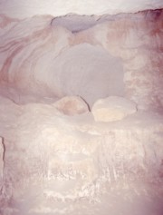
A further serious threat to our heritage comes from lack of adequate reports to accompany excavations carried out on our islands. L-Ghar tal-Iburdan has been spared the worse by receiving a good description of the deposits found on site (12) and an interpretation in a scholarly journal.(13) Notwithstanding, just thirty years after, only the main features mentioned in the report can be re-identified on site. Other areas, including those containing signs of excavation, remain difficult to reconcile with the report itself (Photos 3 and 4).(14) Furthermore an academic interpretation of the finds is still problematic as the photographs and drawings of the site are not available.(15) This problem, which does not only affect this site, is serious and has to be urgently addressed in its own right. Advances in archaeological methods are useless if the results remain unknown or unsatisfactory. To our quest for knowledge this practice is destroying the very evidence we need to reconstruct our prehistory and history. Considering the irreversible nature of excavation only a serious report, with plans to preserve the finds and site, come close to justifying excavation of any site. The case of l-Ghar tal-Iburdan also teaches us that those involved should strive at producing reports which are of such standard as to provide the possibility of answering problems and questions that are likely to emerge in the future study of our past. Ensuring adequate financial and human resources backed up by the necessary legislation to address this problem should become a priority in the coming years. Striving towards success in this field will certainly serve as a catalyst for studying our interesting past and ensures a firmer ground to our interpretations.

Finally it appears that the enjoyable discovery of our past still remains alien to many. While the nation strives to preserve archaeological sites for future generations, experience of such heritage has still to make its way home for many living today. Reactions to recent incidents at Mnajdra reveal that the Maltese are sensitive to cultural issues and will answer positively if the opportunity is presented to them. The challenge that faces our country in the coming years is to develop these sentiments into a familiarity and pleasurable discovery of heritage sites. The future lies in making available what is now consumed by the academics and melitensia collectors, to children and the general public.
Meanwhile, for the more intrepid of the latter, with the use of a torch, some difficulty and not without risk, L-Ghar tal-Iburdan remains accessible. In so doing it is advisable to treat the new inhabitants with respect; to help the survival of the colony, bats are best left undisturbed, visits limited to few persons at one time and reserved for the month of September.
Acknowledgements
Without the help of those who communicated information and listed in the endnotes, Mons. John Azzopardi, Mr. Keith Buhagiar, Ms. Isabelle Vella Gregory, Mr. Alex Camilleri, Mr. Adrian Mifsud and the anonymous resident at Tad-Dahla, writing this article would not have been possible. My gratitude is extended to them all.
End Notes
1. A. Pisani Bonavia, (1968), Kasam el Gewieni, The Times [Malta], 27 January 1968.
2. For details on the Qasam il-Gewwieni cave see C. Vassallo, (1876), Dei Monumenti antichi del Gruppo di Malta - Cenni storic: Periodo Fenicio ed Egizio, 49, Malta. Also in A.A. Caruana, (1882), Report on the Phoenician and Roman Antiquities in the Group of the Islands of Malta, 25, Malta.
3. Summarized and adapted here from the original reports, R. Virzì Hägglund, (1973), Saggi di scavo nel complesso ipogeico di Ghar ta Iburdan (Rabat), Handwritten and Typewritten versions of the report submitted to the Valletta Museum of Archaeology on 18 th April 1973. VMA, DAG.16.900 (Box No. 6b) TS 33. Page references are made to the handwritten report, available to the author as a photocopy.
4. E-mail communication Dr. Eugene Sterud 21st June 2002. An area with cart-ruts, 300 metres to the south west of the cave complex, was pointed out to the present author by Mr. Timmy Zammit. A longer trail of cart-ruts and a number of surface quarries were noted, by the present author, 180 metres to the west of the caves.
5. See pages 107, 108 and Table 7 in C. O. Hunt, (1997),Quaternary deposits in the Maltese Islands: a microcosm of environmental change in Mediterranean lands, in Geojournal 41.2, 101-109.
6. C. Hunt, ibid., 1997, 108. I am grateful to Mrs. Katrin Fenech for helping me correlate deposit layers described in the text and tables of this article.
7. R. Virzì Hägglund, (1976), Ghar ta Iburdan, un insediamento trogloditico in eta tardo Romana, in Kokalos Vol. XXII-XXIII, 396-399.
8. A. Bonanno, (1981)Malta in the Third Century, in A. King and M. Henig (eds.), The Roman West in the Third century. BAR International Series 109, 506-513.
9. B. Bruno (forthcoming), Malta in eta romana e bizantina, Economia di un archipelago al centro del Mediterraneo. News of its impending publication was given in the Easter Issue (2001) of the journal Treasures of Malta.
10. E-mail communication Mr. John J. Borg 5 th August 2002.
11. Personal communication Mr. Joseph Magro-Conti.
12. Virzì Hägglund, ibid., 1973.
13. Virzì Hägglund, ibid., 1976.
14. Photographs have been taken by the present author. Attempts have been made to compare the features shown with Virzì Hägglunds report. Retracing Mr. J. Cachia who had helped Virzì Hägglund in her excavations may help re-identify the features mentioned in the report.
15. A. Bonanno, (1996), The Study of Archaeology in Malta, in Malta Archaeological Review, Issue 1, 6.
GO BACK
Contact author by
E-Mail