|
|
|
Situs
Webmapping
Melihat peta di web secara interaktif ? Ini bukan
sensasi lagi. Banyak pihak yang telah mengaplikasikan untuk berbagai
keperluan. Di Indonesia juga sudah dimulai. Mau lihat
contoh-contohnya ? Silakan simak dibawah ini. |
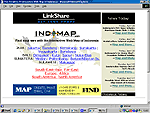 INDOMAP
find your way with the interactive web map of Indonesia. Layanan
meliputi Jakarta, Bandung, Semarang, Surakarta, Yogyakarta,
Surabaya, Denpasar, Kuta, Sanur, Nusa Dua, Medan, Palembang, Batam,
Makasar. INDOMAP
find your way with the interactive web map of Indonesia. Layanan
meliputi Jakarta, Bandung, Semarang, Surakarta, Yogyakarta,
Surabaya, Denpasar, Kuta, Sanur, Nusa Dua, Medan, Palembang, Batam,
Makasar. |
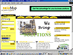 NusaMap
easy guide of Indonesia, dapat menampilkan lokasi yang
diinginkan dengan fasilitas Find Location (by address:
province, city, postal code; dan by City Landmark). Baru meng-cover
Jakarta dan Bali. Sedang dikembangkan juga untuk fasilitas WAP,
Palmtop, Realtime traffic reports dan Driving Directions. NusaMap
easy guide of Indonesia, dapat menampilkan lokasi yang
diinginkan dengan fasilitas Find Location (by address:
province, city, postal code; dan by City Landmark). Baru meng-cover
Jakarta dan Bali. Sedang dikembangkan juga untuk fasilitas WAP,
Palmtop, Realtime traffic reports dan Driving Directions. |
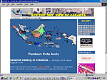 Kota-kota
panduan kota anda, baru meng-cover kota Jakarta. Menjanjikan
untuk memberi informasi mengenai peta lokasi untuk memudahkan
mendatangi lokasi tersebut. Kota-kota
panduan kota anda, baru meng-cover kota Jakarta. Menjanjikan
untuk memberi informasi mengenai peta lokasi untuk memudahkan
mendatangi lokasi tersebut. |
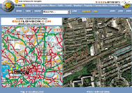 BuzzLondon
 Online London information and webguide - powered by
Intergraph. Explore the UK capital using images, maps, and webcams.
Take a virtual London tour!
BuzzLondon
BuzzLondon Online London information and webguide - powered by
Intergraph. Explore the UK capital using images, maps, and webcams.
Take a virtual London tour! |
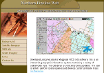 Northern
Pipeline This interactive site was developed by Canadian
Geomatic Solutions Ltd. using Autodesk MapGuide. The site provides
data for a proposed Northern pipeline project (Mapguide Viewer
required).
Northern
Pipeline This interactive site was developed by Canadian
Geomatic Solutions Ltd. using Autodesk MapGuide. The site provides
data for a proposed Northern pipeline project (Mapguide Viewer
required). |
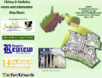 Hampshire County Assessor
This site from Hampshire County, West Virginia gives a lot of
details about the history of the county, information about the
office and how they do taxes. It also has the County Regulations
(Subdivision, Salvage Yard, Flood Plain and Building Permit) and an
interactive map of the entire county down to parcels with linked
information showing info such as: owner, address, value etc. This
map also shows the flood zone, and is put on a backdrop of USGS topo
maps.
Hampshire County Assessor
This site from Hampshire County, West Virginia gives a lot of
details about the history of the county, information about the
office and how they do taxes. It also has the County Regulations
(Subdivision, Salvage Yard, Flood Plain and Building Permit) and an
interactive map of the entire county down to parcels with linked
information showing info such as: owner, address, value etc. This
map also shows the flood zone, and is put on a backdrop of USGS topo
maps. |
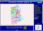 Kent County Planning
This site will allow viewers to query certain land use information
down to the parcel level. Information such as parcel zoning,
acreage, building permit, property location, building type, year
built, and land use application information (conditional use,
rezoning, and text amendment). Each query search is dependent on the
nine Hundred’s that make up Kent County. Note, the Autodesk
Mapguide plugin is required.
Kent County Planning
This site will allow viewers to query certain land use information
down to the parcel level. Information such as parcel zoning,
acreage, building permit, property location, building type, year
built, and land use application information (conditional use,
rezoning, and text amendment). Each query search is dependent on the
nine Hundred’s that make up Kent County. Note, the Autodesk
Mapguide plugin is required. |
 Mapsimple
- MapSimple is an interactive gateway to local information built for
the public. The interface environment is built from a public-centric
perspective that allows the general public to access power of GIS
and layered spatial information. This site provides access to child
care, school site, elections and local building information for the
Metropolitan Bakersfield area.
Mapsimple
- MapSimple is an interactive gateway to local information built for
the public. The interface environment is built from a public-centric
perspective that allows the general public to access power of GIS
and layered spatial information. This site provides access to child
care, school site, elections and local building information for the
Metropolitan Bakersfield area.
|
 The
City of Huntsville Maps On-line - This Geomedia WebMap
powered site serves a data base which is a direct copy of that used
by the City of Huntsville, Alabama to conduct their utilities and
urban Planning activities. The database is comprised of over 750
files containing the graphical representations of the features of
the city, and a relational database that stores all the associated
information about individual
The
City of Huntsville Maps On-line - This Geomedia WebMap
powered site serves a data base which is a direct copy of that used
by the City of Huntsville, Alabama to conduct their utilities and
urban Planning activities. The database is comprised of over 750
files containing the graphical representations of the features of
the city, and a relational database that stores all the associated
information about individual |
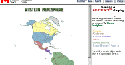
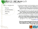 US
Mexico DDViewer 3.1 - US-Mexico Demographic Data Viewer is
an interactive application that provides rapid, interactive data
mapping, viewing, and analysis of more than 200 socioeconomic
variables that are congruent between the United States and Mexico.
US
Mexico DDViewer 3.1 - US-Mexico Demographic Data Viewer is
an interactive application that provides rapid, interactive data
mapping, viewing, and analysis of more than 200 socioeconomic
variables that are congruent between the United States and Mexico. |
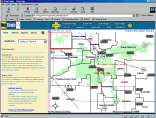
 New Jersey Spatial Data
Clearinghouse - This well known site from the New Jersey
State Government hosts several Interactive Mapping Applications.
View watershed management areas, the NJDOP Permit Facility Locator,
and the NJ GIS Community Profile.
New Jersey Spatial Data
Clearinghouse - This well known site from the New Jersey
State Government hosts several Interactive Mapping Applications.
View watershed management areas, the NJDOP Permit Facility Locator,
and the NJ GIS Community Profile. |
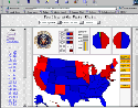
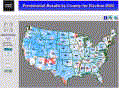 Election Results with Maptitude
- Our friends at Caliper Corp. have developed a very nifty webmaping
site using Maptitude. Additional details listed
here describe in detail how they produced this exciting
interactive WebMapping site highlighting the 2000 US Presidential
election results by County. Election Results with Maptitude
- Our friends at Caliper Corp. have developed a very nifty webmaping
site using Maptitude. Additional details listed
here describe in detail how they produced this exciting
interactive WebMapping site highlighting the 2000 US Presidential
election results by County. |
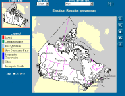 Official
site of election results from the 37th. general election in
Canada. This site is your gateway to interactive mapping of the
results of Canada's general election, held November 27, 2000. You'll
find an unofficial map of election results, "make a map",
information on the Parliament, and most important, Provisional
real-time election results are presented online. Results will be
updated every two minutes. Official
site of election results from the 37th. general election in
Canada. This site is your gateway to interactive mapping of the
results of Canada's general election, held November 27, 2000. You'll
find an unofficial map of election results, "make a map",
information on the Parliament, and most important, Provisional
real-time election results are presented online. Results will be
updated every two minutes. |
 Dave Leip's Atlas of US
Presidential Elections is a fascinating gateway to current
and historical election results. Use the nifty interactive mapper to
view thematic maps of election results by State or by Year. The site
is fast, simple to navigate, and very interesting... a must see for
anyone researching presidential elections. Dave Leip's Atlas of US
Presidential Elections is a fascinating gateway to current
and historical election results. Use the nifty interactive mapper to
view thematic maps of election results by State or by Year. The site
is fast, simple to navigate, and very interesting... a must see for
anyone researching presidential elections. |
 Project
WILDSPACE is a new interactive web site featuring
Environment Canada’s activities in wildlife monitoring and
research in Ontario and beyond. The WILDSPACE Ontario web site is
designed to assist users in learning about some of this research,
and provides access to a wealth of information on wildlife,
particularly bird species and their habitats. They also provide
migratory range mapping for approx. 430+ species, available through
the "SPECIES" component. Project
WILDSPACE is a new interactive web site featuring
Environment Canada’s activities in wildlife monitoring and
research in Ontario and beyond. The WILDSPACE Ontario web site is
designed to assist users in learning about some of this research,
and provides access to a wealth of information on wildlife,
particularly bird species and their habitats. They also provide
migratory range mapping for approx. 430+ species, available through
the "SPECIES" component. |
 NETSOLUT
is the developer of the interactive mapping technology MapTP which
is in use in various environments (fleet management, call center
applications, location visualisation in websites) and which brings
vector information into the client application. Clients include
DaimlerChysler and IBM. NETSOLUT
is the developer of the interactive mapping technology MapTP which
is in use in various environments (fleet management, call center
applications, location visualisation in websites) and which brings
vector information into the client application. Clients include
DaimlerChysler and IBM. |
|
| Sumber, al: GIS
webmapping channel, Surfing on Google. |
|