
Friday, May 11, 2001, 8:05 a.m. - Mile 2070.2 - Cortez, CO

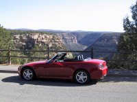
After checking out of the motel, I head east on Highway 160 towards Mesa Verde National Park, right into the sun. It's cool this morning, but a short sleeve shirt is warm enough. The top of the windshield blocks the sun well enough, so there's no need for a hat yet.
9:01 a.m. - 2102.0 - Cliff Palace at the far end of Mesa Verde

Once again I fail to note the time I enter a national park. I drive to the far end of the park to view the largest set of ruins. It's amazing that people built and lived in the rock houses up on the cliffs like that. If you've never been to Mesa Verde before, you really need to take a few tours to see it all up close. This park isn't like Grand Canyon or Teton where you can enjoy it from a distance.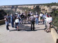

I notice that Mesa Verde has a tunnel through the hillside, which seems to be a popular thing in the national parks. There are also tunnels in Zion and Bryce Canyon that I've visited so far. The road into the park winds up the mountainside and is an interesting drive. I keep the speed down because I'm in a national park.10:10 a.m. - Mile 2126.2 - Back to the park entrance
I really want to drive Highway 145 through the Colorado mountains, but it looks like it will be 200 miles compared to about 75 miles if I go out on Highway 666. I've pretty much decided I won't be able to make it to my daughter's house in Provo before dark if I drive the extra distance.10:25 a.m. - Mile 2135.5 - Junction of 160 and 145
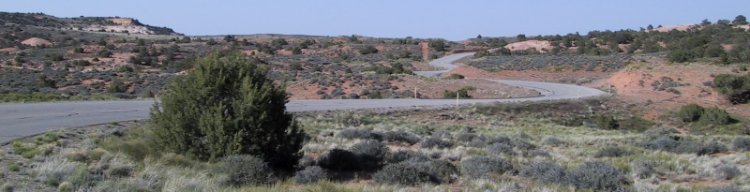
I decide that it's only been a few weeks since I stayed with my daughter, so I decide to drive Highway 145 anyway. I'll just stop in and say hi as I pass through tomorrow. The road starts right across from the gas station. It goes along the San Juan river for many miles. It's springtime here with the small leaves on the trees a light green color.


I also find it hard to stop and take pictures with a nice clear road in front of me and several cars back there somewhere. There is not a lot of traffic on this road.
I notice that car is down on power at the altitude I'm driving. The power feels more like a Miata or something. Lizard Head pass is 10,222 feet. The highest pass I go through is Red Mountain Pass at an altitude of 11,018 feet. It's hard to even get the car moving when pointed uphill.11:35 a.m. - Mile 2208.0 - Junction to Telluride
This is the first time that my car has seen snow. There's none on the road, of course, but quite a bit still on the side of the road.Mile 2217.0 - Sawpit
I'm back down to an altitude of 7554 feet and the Honda's power is much better. I'm wondering what kind of engine has decent power above 10,000 feet.12:33 a.m. - Mile 2258.4 - Naturita
I had planned to go back to Highway 666 using Highway 141, but decide to take the more direct route to my next scheduled stop in Utah by taking Highway C-90 west. At this point I'm sorry that I bothered taking 145, since I don't think it was really worth the extra distance. I've heard quite a few people rave about the Colorado Rockies, but I'm not that impressed with what I've seen. I much prefer the Wasatch mountains in Utah and other parts of the Rockies in Wyoming, Idaho, and Montana.Mile 2260.7 - Junction of C-90 west to Utah
Highway C-90 is mostly high altitude farm country. The roads are reasonably straight and only mildly interesting. However, I liked C-90 better than Highway 145.1:07 p.m. - Mile 2295.3 - Utah border
At the Utah border, the road changes to Highway 46. The road is almost instantly both rougher and tighter. At mile 2308.3 I go through the small town of La Sal.
1:27 p.m. - Mile 2317.4 - La Sal Junction
I turn right at the La Sal Junction and head towards Moab on Highway 191. This is a bigger, higher speed highway than the ones I've been on so far today.1:45 p.m. - Mile 2339.3 - Moab, Utah
Moab is a reasonably large town. I stop for gas and to eat lunch. This is the place to stay if you want to visit Arches, Canyonlands, or Dead Horse Point. I'm back on the road at 2:20 p.m. and thinking that I'm not as far behind schedule as I thought I should be when I reached Moab.Mile 2346.0 - Entered Arches National Park
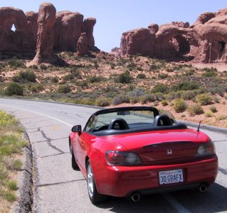
Once again I missed noting the time of entering a national park, but at least I noted the mileage. Arches has many beautiful and unique rock formations. I'm sorry that I haven't left enough time to hike to Delicate Arch, the one shown on the Utah license plates. It takes about an hour and a half to hike there and back and it's a very impressive piece of rock. At least I've seen it before when I was quite a bit younger.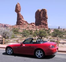

I drive around the park looking at all of the interesting stuff you can see from the view areas. I'm still quite impressed with it all.

3:30 p.m. - Mile 2370.0 - Leaving Arches
I leave Arches and head for Canyonlands, which is just up the road a few miles and on the other side of the highway.3:37 p.m. - Mile 2377.1 - Junction of Highway 313
I turn left off of Highway 191 onto Highway 313 headed towards Canyonlands National Park. I really like the road heading into the park. It has lots of interesting curves.
3:55 p.m. - Mile 2392.3 - Left to Dead Horse Point
I turn left on West 313 to visit Dead Horse Point State park before going to Canyonlands. I've been here before and the view is just amazing. At least it's now paved all the way to the top, unlike the last time I was here.Mile 2398.9 - Entrance to Dead Horse Point State Park
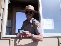
I get charged $4.00 to enter the State Park. I comment that it's too bad I can't use my National Park pass there and the ranger points to the sign in clear view stating specifically that park passes are not accepted there. I meant it as kind of a joke, but apparently lots of people are put out by having to pay to get into the park.

I take a few panorama pictures and a few regular pictures at the top, then head back out to go to Canyonlands. I leave the park at 4:24 p.m. heading back towards the regular Highway 313.4:24 p.m. - Mile 2408.6 - Crossroads
I turn left at the crossroads and head 4.5 miles towards the entrance to Canyonlands.4:45 p.m. - Mile 2416.6 - Canyonlands National Park Entrance
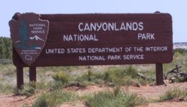
The roads through Canyonlands are fun to drive on. There are sections that they could have easily made straight, but they're full of curves anyway. Whoever laid out these roads must have either owned a sports car or a motorcycle.
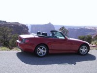
I drive to all the main lookouts and find this to be just as impressive as what I saw at the Grand Canyon.
5:37 p.m. - Grand View Lookout

After visiting the last lookout point, I'm finally heading out of the park.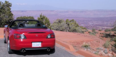
6:00 p.m. - Park exit
Once again I marvel at the wonderful roads in this particular park. They're smooth, have many curves, and there is little traffic. I notice that every single sharp curve has a little yellow 20 mph warning sign on it coming down off of the mesa. I'm guessing that they must have run out of signs for other speeds, because some of them should be marked more like 35 mph.6:15 p.m. - Mile 2472.5 - Highway 191 Junction
When I get back to Highway 191, I turn left and start heading towards Provo.6:32 p.m. - Mile 2493.5 - Junction of I-70 West
When I get to I-70, I realize that this is one section of freeway that I can't avoid. I just turn on the cruise control and head to the next section of Highway 191 North.6:50 p.m. - Mile 2517.8 - Junction of Highway 191
I finally head north on West 6/North 191 towards Price Utah. This is another road where the cruise control helps quite a bit. There's not much of interest in the 60 mile trip to Price, and I've already seen enough for one day anyway.7:40 p.m. - Mile 2578.6 - Downtown Price
I have dinner at a Subway that used to be some other type of drive-in hamburger stand. The teenagers in there are impressed with my car and offer to trade me for their new Escort. I tell them I'm tempted.I don't really need gas, but I need to clean the bugs off of the windshield, so I look for a gas station. I find a Texaco in the middle of town, but they're closed. Then I remember that I didn't really need gas anyway, and they have the best windshield cleaning stuff I've seen so far. I get the windows nice and clean there and appreciate a place where they'll leave stuff like that out after they're closed.
At about 8:00 I leave Price and continue on Highway 6 towards Provo. It's starting to get dark when I'm only about halfway there, but traffic is moving along nicely. Seeing all of the traffic coming the other way reminds me that this is Friday evening, the start of a weekend. There's so much traffic coming the other way that it's nearly impossible to pass anybody except for in a passing lane. Some guy in a white Neon wants to keep a faster pace than me, so I let him by the first chance I get. I catch up with him several times before he finally gets away. It seems that he has a harder time passing slower cars than I do, since he doesn't have the same sort of acceleration as the S2000. I'm tempted to pass him once, but decide that it just wouldn't be nice, since I really don't want to go quite as fast as he does when the road is clear.
I don't really look at the map, since I've been to Provo dozens of time and end up going quite a bit out of my way. I drive all the way to I-15 before working my way back to Highway 89. I should have just turned off of 6 onto 89 when I had the chance.
Since I can't remember exactly how to get to my daughter's house, I finally have to stop and get the address out of my suitcase in the trunk. I'm thinking of stopping to ask for directions, but asking a stranger "Can you tell me where my daughter lives?" doesn't seem too useful. I'm thankful that Provo has the typical Utah addresses of a north/south number and an east/west number. It's much easier to figure out where you need to go from a given point than in cities that have street names only.
9:20 p.m. - Mile 2661.8 - Provo, Utah
I finally make it to my daughter's house and everyone is still up. I'm done driving for a couple of days and going to spend time with family for the full weekend.
Previous Next Home Site Map
Copyright (c), 2001 by Scott R. Nelson
Page last updated July 9, 2001
ScottRNelson@HotMail.com