| Click here for homepage! | Íslenska útgáfan er hér! |
| This was a trip organized by Ferđafelag Islands. The hiking route is relatively flat and therefore rather easy but a few glacial rivers had to be crossed. The distinctive feature of this trip is the remoteness and inaccessibility of the area. For instance I didn't see any sheep north of Blautakvisl river. The Thjorsarver wetlands is an important nesting area for pink footed geese. The weather was fine the whole time. |
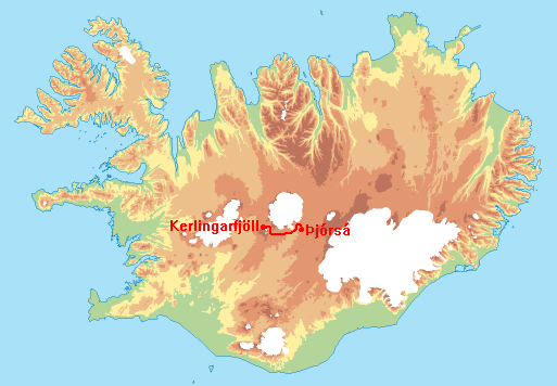
The trip started on the banks of Thjorsa river by waiting for the ferryman. The group was ferried across the deepest part of Thjorsa. The first part of the route was up along the banks of Thjorsa river. Even though this was the best route available, caution had to be applied when crossing treacherous marshes. A camp was made south of Mt. Arnarfell.
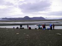
A daytrip up to Mt. Arnarfell started slowly because the vegetation was noteworthy. Here in the southern slopes of Mt. Arnarfell vegetation reaches higher (almost 1000m) above sea level than anywhere else in Iceland. The last part of the route is a steep slope with loose rocks and gravel where one step upwards can result in two downwards. On top of Mt. Arnarfell (the greater) there is good view of Mt. Arnarfell (the lesser), Hofsjokull glacier and the Thjorsarver wetlands. The route downwards the western slopes of the mountain was rather steep at the beginning but improved as we progressed downwards. On the way back we passed a gulley between Mt. Arnarfell and Mt. Kerfjall.


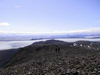
This day was spent hiking from Mt. Arnarfell, along Mulajokull glacier and then camping at Nautalda hill. Two large rivers are enroute and several smaller ones. It was possible to cross Arnarfellskvisl river by a glacial bridge but Miklakvisl river had to be forded. Nauthagakvisl river and some of the Mulakvislar rivers had also to be forded. It was possible to tiptoe over and jump across some of the smaller rivers. Most of the route lies over old glacial moraines called Mular. These are vegetated hills which are good nestsites for geese. Along the route a centuries old geese corrall could be seen. From there is a nice view towards Mt. Hjartafell (heart mountain), which is aptly named.
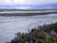
This day I was forced to, due to foot injury, to skip a daytrip to Mt. Lonstindur. Instead I made the short trip up to Nautalda hill which offers a good view over the southern part of Thjorsarver Wetlands and the many rivers snaking across the wetlands.


The day started hiking from Nautalda hill across Blautukvislareyrar. Some of the Blautukvislar rivers could be crossed without getting ones feet wet but I had to ford one of them. From there the route was to a hut called Setrid. From there the course was set to the Kerlingarfjoll mountains and camp was set up at Efri-Kisubotnar gulley.


From Efri-Kisubotnar gulley the route taken was north of the Kerlingarfjoll mountains. It was possible to walk along a 4wd track all the way to a hut in Hveragil gulley on the west side of the Kerlingarfjoll mountains where the trip ended.

