|
|
|
Satellite Images of Venice, Florida
These images were captured (legally)
from
the Microsoft Terraserver web site. The Terraserver site allows you
to search for satellite images of just about
the entire US.
All of these images can be enlarged
by clicking
on them.
(This is very much recommended to see all
of the detail possible!) |
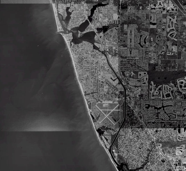
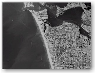
Overall View of Venice
This is pretty much all of Venice... there
is a little cut off to the South and East. |
 |
- On the left is West, the Gulf of Mexico.
- About a sixth of the way down the coast is
a break, that is Venice Inlet.
The lower
bay at the inlet is Roberts
Bay, the upper
is Dona Bay.
- From those bays, you can follow a line of
water south... that is the Intracoastal waterway
that makes a portion of Venice into an island.
- On the southern tip of the island is the
Venice Municipal Airport which has the dubious
distinction of hosting for flight lessons
some of the terrorists who attacked the US
on September 11th, 2001.
|
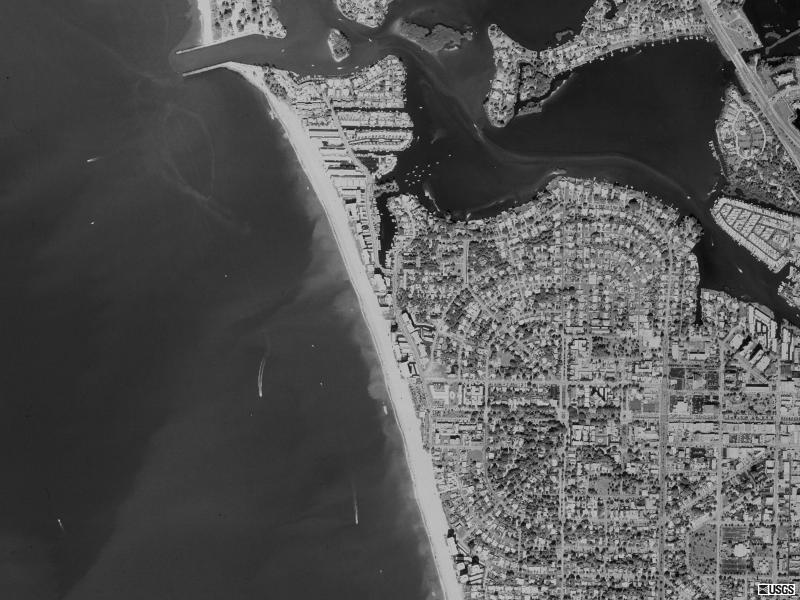
Venice Inlet and the Esplanade
Here we have zoomed in one step from the
previous image. |
 |
- Venice inlet with the jetties sticking out
is at the very top of the image.
- The Esplanade is one road that follows the
beach in Venice for a stretch. There is a
large concentation of high rise units and
hotels that you may be able to pick out.
- Some of the streets in Venice help form a
large circle in this area. Down the middle
of the circle, from east to west, is Venice
Avenue.
|
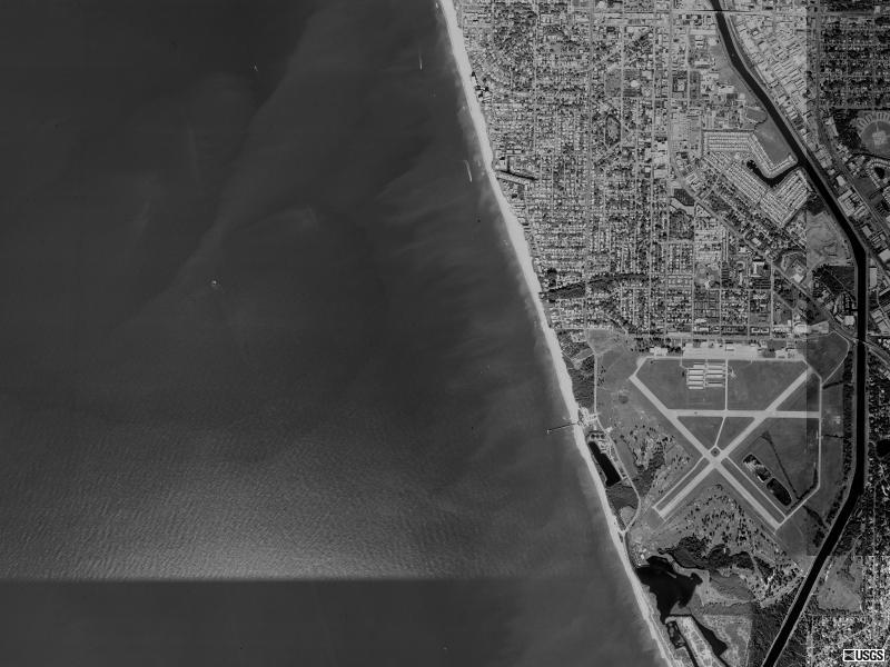
Southern Venice and the Pier
This image is at the same scale as the previous.
|
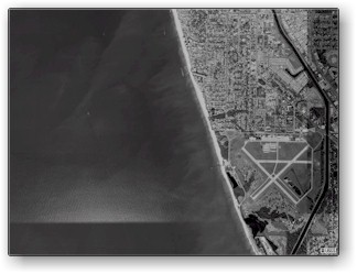 |
- Very clearly shown is the Venice Municpal
Airport.
- The Intracoastal Waterway, winding from North
to South, is on the right side of the image.
- Sticking out into the water, directly west
of the airport, is the Venice Fishing Pier
|
|
|