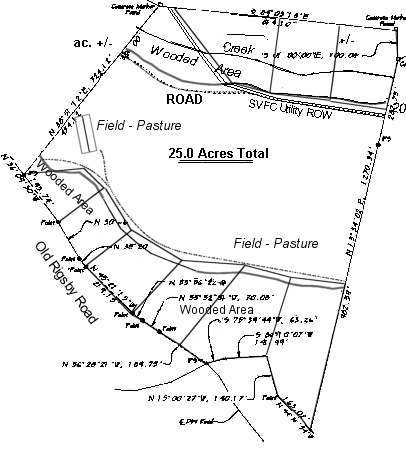
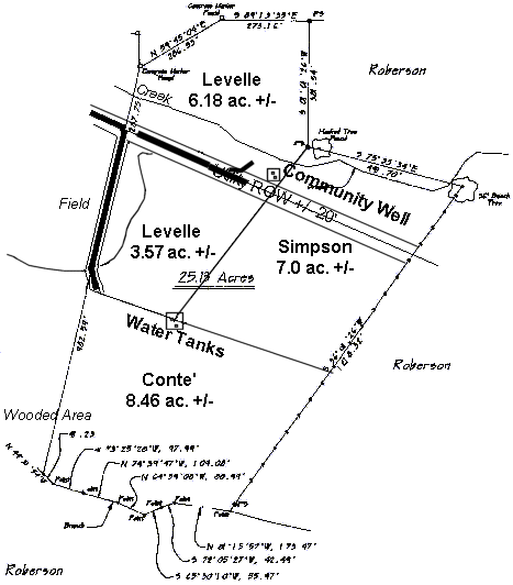
Sequatchie Valley Farm
A SafeHaven Community
SVFC,Inc. Maps Page

Arial Maps of the Pikeville and SE Tennessee area.
Arial Pikeville Chattanooga Pikveille Area SE Tennessee Region Highway 30E

Survey Maps of the Property by Parcel.
Tract 'A' 19 acres Tract 'B' 25 acres Tract 'C' 25.13 acres
Click on a picture to see a larger view.
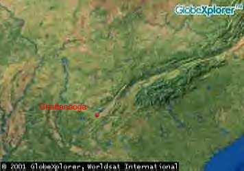
Topographical Maps
Topo of property and area

To learn more about this SafeHaven Community click here


Are you looking for a safehaven community?
This could be it!

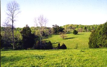
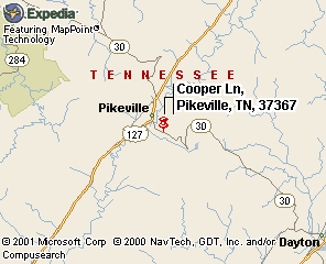
Pikeville, Tennessee, is less than an two miles away. And "Fall Creek Falls State Park" is on top of the West Ridge of Sequatchie Valley.

across the road across the road

Make Your Selection Here!
Home Page
Photographs
Demographics and History of Pikeville
Local Events in SE Tennessee
Sequatchie Valley Area
Topo Map and Site Survey

Send Page To a Friend

fall creek falls fall creek falls
More Pictures from Pikeville and Fall Creek Falls.

Send Page To a Friend


Copyright © 2001, 2002 Webmaster Inc. All rights reserved.