Libby Tandem and the Stoker
|
Libby Tandem and the Stoker |
We flew from Faro, Portugal into the new Munich International Airport to the east of Munich. Our carrier was LTU and they transported our tandem at no extra cost. We had a problem finding our way out of the airport but eventually obtained some advice and a map from a friendly Avis representative. She directed us to follow the signs to the small town of Erding some 15 km away where we stayed in a Pension Garni, a small hotel serving only breakfast. We now know that a cycle track (Radweg) enters and leaves the airport area but we doubt if many people would be able to direct cyclists to it. This web site gives details of long distance bike routes in Bavaria.(in German)
Guide Books and maps: Two problems: the guide was two or three years old and not always accurate as to campsites. The cycle path seldom passed through villages and towns which I enjoy cycling through. Often the way into these towns was not clearly marked. Annoying when you are looking for a cup of coffee or a lunch break! We used the Michelin Map No 426 1 :400 000 AUSTRIA Bayernnetz fur Radler is available at Tourist Information Offices and shows all long distance cycle routes in Bavaria (Bayern) Germany.
The Ride:
The Road: 2. 366 km to Vienna along the Danube Cycle Trail (Donau Radweg.) which goes on both sides of much of the Danube. It is ideal for families and first time touring cyclists The biking is easy on hardtop cycle paths, very minor roads and along levees above the river.
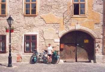
Accommodation
Route Describtion Day 1. Munich International Airport to Erding along Road No. 388. (15 km) At the entrance to the town information boards show location of hotels and cheaper pensions. Day 2. Erding to Eggenfelder (77 km) An easy ride with a few low hills in a pretty agricultural countryside. Day 3: Eggenfleder to Passau (78 km) A pleasant ride until Neuburg am Inn when 388 climbed steeply into the forests above Passau before coming down into the town. At this point look out for the Inntal Radweg which would take you along the Inn River into Passau. This very attractive town, worth a day sightseeing, is at the point where two rivers, the Inn and the Ilz, flow into the Danube. Day 4: Passau to Feldkirchen 73 km We biked along the north bank till the hamlet of Au. There the Danube makes an s-bend through hard granite of the area. We took the cycle ferries about 4 km to Grafenau so we could continue along the north bank. At Untermühl we were ferried again on a little cycle ferry around the steep rocky obstruction to the path. It is apparently possible to carry your bike up and down this but not if you have a laden tandem! We camped that night at the Badeseen (bathing lakes) three km from Feldkirchen. Day 5: Feldkirchen to Grein 92 km We set off on the north bank and about 6 km from our campsite we crossed to the south at the Otterheim-Wilhering power station (kraftwerk) and biked along the road through the city of Linz where we crossed to the north again. At the next power station we crossed south again and headed inland on the bike path among apple orchards and massive ancient farmhouses to Enns. As we had visited the infamous Munchhausen Concentration camp on a previous visit we stayed on the south bank finally crossing the bridge 2 km from Grein. Day 6: Grein to Melk (54 km) We biked back to the bridge to the south side all the way to the town of Melk with its stunning Benedictine Monastery. Day 7: Melk to Tulln (89 km) 2 km outside Melk we crossed the bridge to the north bank and biked that side as far as the Alterwörth power station where we went south again. Between Spitz and Dürnstein we cycled among the vineyards of the Wachau, a lovely area. The cycle path also went along levees. It is very exposed and that day a very strong east wind made cycling difficult. Bad weather struck most of Austria but all we had was the vicious wind! Day 8: Tulln to Vienna (33 km) along the south bank.
|