|
| This plan may help to interpret
the view of the valley slopes around sump shaft. This is a complex area
of remains containing the structures associated with the extraction of
ores from the Northern lodes. The winding engine at Sump shaft provided
the power to wind at Pearce's through a set of flat rods. |
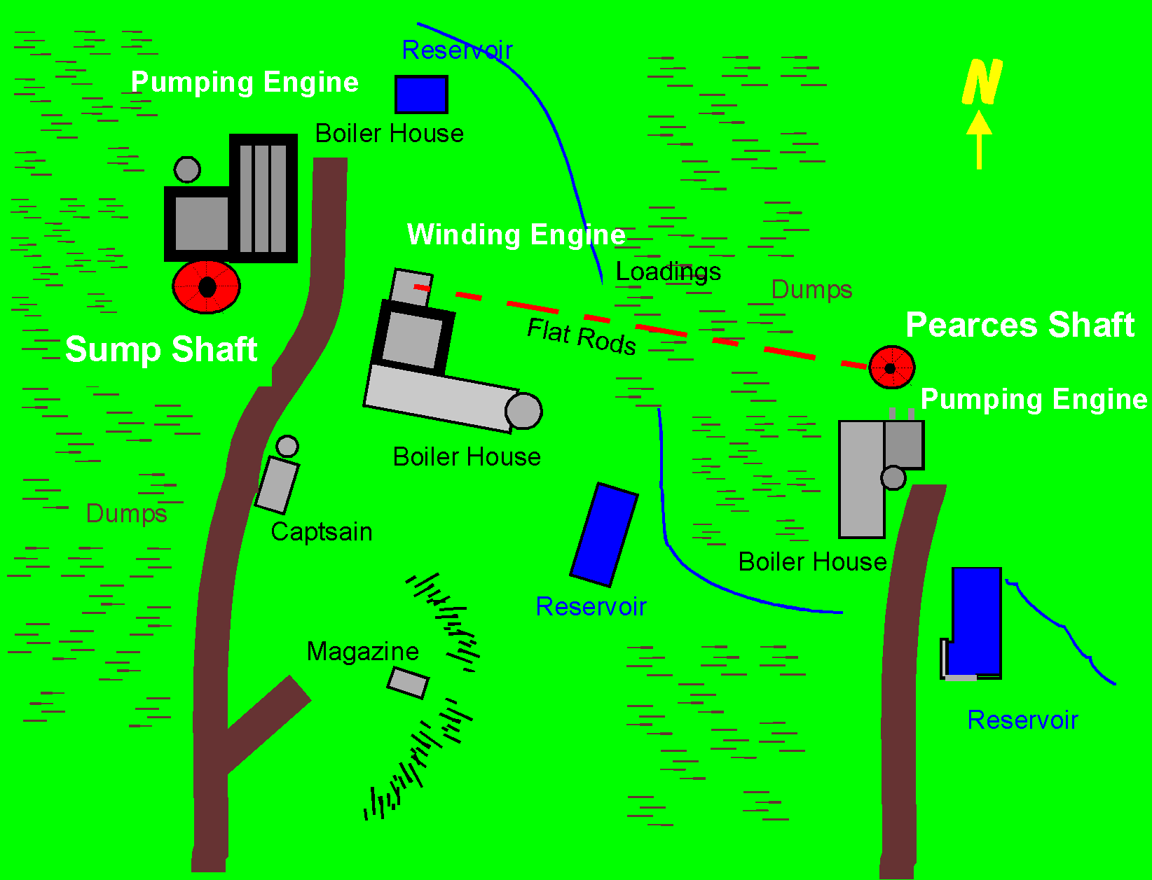
| The
Plan of The Sump Shaft area. The Seaton River and the Footpath are towards
the left. |
Although
the site appears to be freely accessible to the public it is on private
land and no formal right of ways exist.
Like
all mine sites dangers exist, many hidden.
This
web site is aimed as a resource to those using the public right of way
and cannot encourage visitors to the mine workings itself. |
 |
TeamManley
|
|
|
|
|
|
