
![]() Calgary's skyline from Scotman's Hill. The hill was appearently named after the stereotypically cheap Scots who, instead of paying the admission to get into Stampede Park to watch the horseraces, would watch for free from this cliff above the Elbow River. In the foreground is Stampede Park and the Saddledome (formerly the Candian Airlines Saddledome and the Olympic Saddledome). In the background is Downtown (presently sprouting cranes and buildings like a suburban lawn sprouts dandelions). The phallic symbol in the centre of the photograph is the Calgary Tower (formerly the Husky Tower).
Calgary's skyline from Scotman's Hill. The hill was appearently named after the stereotypically cheap Scots who, instead of paying the admission to get into Stampede Park to watch the horseraces, would watch for free from this cliff above the Elbow River. In the foreground is Stampede Park and the Saddledome (formerly the Candian Airlines Saddledome and the Olympic Saddledome). In the background is Downtown (presently sprouting cranes and buildings like a suburban lawn sprouts dandelions). The phallic symbol in the centre of the photograph is the Calgary Tower (formerly the Husky Tower).
|
|
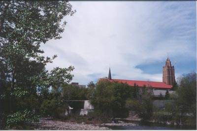
The C-Train (Light Rail Transit) has just pulled out of Erlton-Stampede station and is proceding south into the Cemetery Hills tunnel (yes, it is on the wrong track, the southbound track was being serviced). In the background are Union Cemetery, Macleod Trail, and the Shaw Cable TV receiver station. The Cemetery Hills actually contain five separate graveyards (Burnsland, Union, Chinese, Jewish, and St. Mary's), the Monastery of the Sacred Blood, as well as neighbourhoods for the non-dead. Macleod Trail was once Calgary's "main drag" and is named after Col. Macleod, who named the city in 1884. | 
|
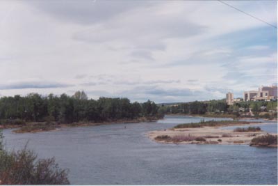
The Bow River winds past the slopes at Sunalta, just west of Crowchild Trail. The river flows out of the Rocky Mountains 120 km to the west and meanders through Calgary exiting at the far south end of the city. In the centre of the main channel, a man is standing on a sandbar flyfishing.![]()
| 
|
| |

|