Kahoolawe,
Hawaii
Location: 20.6N, 156.6W
Elevation: 1,475 feet (450 m)
 Kahoolawe,
a single shield volcano, consists of a nearly filled caldera and a rift zone
that trends to the southwest. Kahoolawe is about 12 miles (20 km) across and
the smallest of the major Hawaiian Islands. This photo is looking to the east.
Photo by Jack Lockwood, U.S. Geological Survey, March 31, 1984.
Kahoolawe,
a single shield volcano, consists of a nearly filled caldera and a rift zone
that trends to the southwest. Kahoolawe is about 12 miles (20 km) across and
the smallest of the major Hawaiian Islands. This photo is looking to the east.
Photo by Jack Lockwood, U.S. Geological Survey, March 31, 1984.
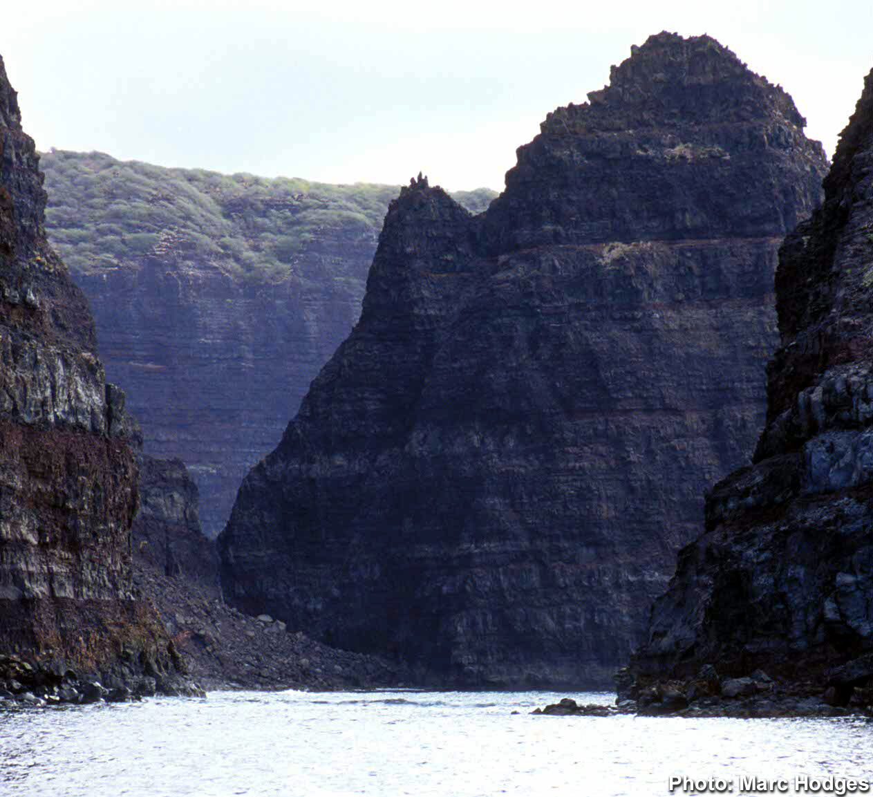
Kahoolawe is made of tholeiitic
and alkalic basalt of the shield and capping stages. A rock from the capping
stage has been dated at about 1 million years old. This photo is looking to
the east. Kanapou Bay, on the east side of the island, marks he location of
the caldera. Photo by Jack Lockwood, U.S. Geological Survey, March 31, 1984.
During the rejuvenated stage a small number of eruptions occurred near Kanapou
Bay. The age of these rocks are unknown.
From
Luamakika, the 1,477-foot-high crater that's  the
highest point on Kahoolawe, you get a sweeping view of Lanai, Molokai and South
Maui. Across the channel, Haleakala, the 10,000-foot peak on Maui, dominates
the view. It's beautiful and majestic, but it is Kahoolawe's cruelest enemy.
The entire island of Kahoolawe sits in Haleakala's rain shadow. The windward
side of Maui gets up to 350 inches of rain a year, but Kahoolawe, sitting in
the lee of the massive volcano, gets barely 25 inches a year. This, the smallest
of the major Hawaiian islands, is also the driest.
the
highest point on Kahoolawe, you get a sweeping view of Lanai, Molokai and South
Maui. Across the channel, Haleakala, the 10,000-foot peak on Maui, dominates
the view. It's beautiful and majestic, but it is Kahoolawe's cruelest enemy.
The entire island of Kahoolawe sits in Haleakala's rain shadow. The windward
side of Maui gets up to 350 inches of rain a year, but Kahoolawe, sitting in
the lee of the massive volcano, gets barely 25 inches a year. This, the smallest
of the major Hawaiian islands, is also the driest.
Despite
its unpromising conditions, Kahoolawe has a firm place in Native Hawaiian history.
In ancient times, the channel between  Kahoolawe
and Lanai was called Kealaikahiki, Ñthe pathway to Tahiti.æ It
was here that the voyaging canoes left on their perilous journeys to the islands
of Southern Polynesia. One of Kahoolawe's peaks held a school for navigation
by the stars, which was the Hawaiians' method for finding their way across the
vast expanses of the Pacific. There were also religious and fishing shrines
and a major quarry for making adz, an axlike tool formed of hard stone. For
several centuries, the island supported a settlement of hundreds of Hawaiians.
That settlement left a priceless archaeological record, largely because hardly
anyone has lived on the island since.
Kahoolawe
also has a stirring modern history“as the site of a major conflict between
the Native Hawaiians and the federal government. In 1898, when the United States
annexed the islands, the federal government took over 200,000 acres of Hawaiian
crown lands, including the 28,776 acres of Kahoolawe. During World War II, the
military used the uninhabited island as a shelling range. After the war, the
island was turned over to the Navy, which used it for training activities“live-fire
naval shelling, practice bombing runs, combined air-sea-and-amphibious operations.
You could hear the explosions quite clearly from the luxury resorts on South
Maui.
In
1976, a small boatload of Hawaiian activists occupied the island despite the
dangers of the shelling. A year later, two others died trying to rescue some
of their fellows from the island. That was one of the defining moments of the
Hawaiian Renaissance“the movement that brought a revival of Hawaiian culture
in the islands. It also galvanized statewide opposition to continued military
use of the island. Finally, in 1993 the federal government stopped the bombing
and handed Kahoolawe back to the Hawaiian people.
Congress ordered a major ten-year
ordnance cleanup on the island in order for it to become a cultural preserve.
Casual visits are, of course, discouraged. There is no fresh water on the
island, little  shelter
outside of the old Navy camp at Smugglers Cove and the only way in is by wading
through the surf to the Native Hawaiian camp at Hakioawa. In addition to this,
there's the danger posed by 50 years of shells and bombs dropped
on the island“some of which remain unexploded!
shelter
outside of the old Navy camp at Smugglers Cove and the only way in is by wading
through the surf to the Native Hawaiian camp at Hakioawa. In addition to this,
there's the danger posed by 50 years of shells and bombs dropped
on the island“some of which remain unexploded!
Home
Maui
Lanai
Oahu
Molokai
Molokai Activities

I
got these images off of Google
and if the owner would like me to take them off, you can email
me.