|
Surrounding Area
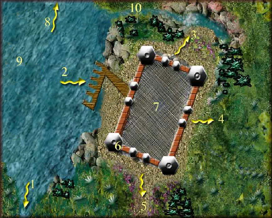
1. Nyoka River leading towards Schendi.
2 Docks and wooden walk to the front gate.
3. Gate and path to lagoon.
4. Jungle paths to Askari Village.
5. Caravan Road.
6. Guard towers at each corner.
7. Fort interior, see close up.
8. To marshes between Lake Ushindi and Lake Ngao.
9. Lake Ushindi
10. Tributary to lagoon
Fortress of Ngao

1. Guard towers.
2. Gated path to the lagoon.
3. Gated wooden walk to docks.
4. Sentry posts.
5. Caravan Road.
6. Gathering place.
7. Medical Wing.
8. Outdoor servery.
9. Chief Hellsponts' harem and home.
10. Chief Hellsponts' gardens.
11. Outdoor fire and gathering place.
12. Market.
13. Guest huts.
14. Members huts. Listed on the message board.
15. Smithy, Tannery, Glass Kiln.
16. Peasants and merchants homes and businesses.
17. Slave pens.
|