|
|
|
Trails
|
 |
|
| Skirt Mountain |
|
|
 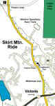
Click to Download Map
|
To get to Skirt Mountain is pretty easy, if
you have a good sense of direction (just kidding). Heading out of Victoria on the Trans
Canada take a right at the new Millstream Road overpass (take Millstream North). Your
first landmark on this road will be the Log House Pub which is on your right on Treanor
Road. Keep going straight. Your next landmark will be the entrance to Western Speedway,
again on your right. Continue about a 1/2 mile passed this until you come to the power
lines going across the road. There is a parking lot located here and access to the trails
is via a trail off the left side of the road directly underneath the
powerlines. From this
point you follow the fire road up to the top and follow one of two dozen trails (all
single track) down. Some of the trails you could end up on have names such as "Root
66", "Suicide", and "Look Out". If your looking for a quick and
dirty ride, this is the place.
|
|
|
|
|
|
|
|
|
| Tour de Dump |
|

Click for Detailed Map |
This ride is located at the Hartland Dump.
This is the only designated mountain biking area on Vancouver Island. To get there take
West Saanich Road until about the 5400 block and turn left on Hartland Road. Be careful
because it is very easy to miss. Follow this road to the very end. You will come to the
gates of the dump and just to the right you will see a parking lot. Just pull up and start
unloading the bikes. To get to the trails, take the path that is located immediatly across
from the entrance to the parking area. This is an excellent site for the beginner to the
expert. There are so many rides in this area that to enjoy it to the maximum, try to hook
up with someone who knows the area. Usually you can find someone in the parking lot to
ride with.
|
|
|
|
|
|
|
|
|
| Burnt Bridge |
|
|

Click for Detailed Map
|
Burnt Bridge is in the Shawnigan Lake area
which is located about 45 minutes north of Victoria on the Trans Canada Highway. Take the
Shawnigan Lake West exit. Follow this road until you hit the first paved road on the left.
Take this road until you reach it's end (you can't miss it, it has a stop sign at the end
of it). Turn left here and follow the paved (which turns into gravel) road until you come
to the Koksilah River Park. You can't miss it because it looks like a four way
intersection. The trails start across the bridge over the Koksilah River. Take care
going through the gate. The best way to go after you cross the bridge is to take the left
fire road and head for the top. You can pick up a number of trails that go off to
the right from here.
|
|
|
|
|
|
|
|
|
| Harbourview Road |
|
|
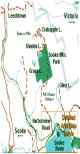
Click for Detailed Map
|
Harborview was the first organized moutain
bike ride I went on back in '93. The group was made up of riders from Goldstream Cycle and
a Sooke bike shop (I forget their name). This ride is mostly on fire roads. It does,
however, offer some excellent technical downhill riding. The only problem is that you have
to go up the hill in order to come down. There are two lakes located in the area,
Crabapple and Shields Lake. This is a really great ride in the summer. You sweat like a
pig getting up to one of the lakes, jump in for a swim, and then kamakazee downhill.
That's if your into that sorta thing! One warning, well two actually: Front shocks are a
must (full suspension even better) and take along a spare tub. Back in '93 we had 17 flats
for the day (mostly snake bites) out of 15 people. |
|
|
|
|
|
|
|
|
| Mt. Tzouhalem |
|
|

Click for Detailed Map
|
Mt. Tzuhalem is one of the best rides I have
come across in Duncan. Entering Duncan on the Trans Canada coming from Victoria,
turn left at the Chevron Station onto Trunk Road. Continue down Trunk Road until you come
to a "Y" in the road. Continue on left. This will be Maple Bay Road.
Continue along Maple Bay Road until you reach Kingsview on your right. On Kingsview
there should be a playground on your left just a short jaunt up the road. You can
either park here, or continue to the top. If you park at the playgrounds, remember
that when you finish your ride you should take a trail called "B1" which will
take you out where you parked. It's a lot more fun to exit via "B1" than
it is to ride or drive down the road from the top. |
|
|
|
|
|
|
|
Last Update: 06/06/2001
|
|
|
|
|
|
Index
|
|
|
|
|