Porkies

- Left Escanaba at 10 am
- Snagged some fruit from Tracy’s Grandparents
- Very rainy drive to Northwest U.P.
- Listened to Oldies Station from Ironwood or something – it was Memorial Day Weekend, and they had a Veteran’s tribute thing
- Dock of the Bay became a recurring theme on this trip (mosquitoed and whistled several times)
- Arrived at Ontonagon – bank temperature sign said 34! CHIPPER!
- Got to ranger office and it was very windy. Original plan was to take Lake Superior Trail but ranger warned us otherwise (super muddy). Also warned us we had to cross the rivers several times if we took the Carp River Trails
- Not raining at the time we left for Lake of the Clouds, which was going to be our base with the car.
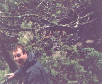
- Took picture of girls posing as rabid squirrels (been in woods for three days – musta made them go insane – luckily we didn’t need to go insane)
- Left Lake of the Clouds (which was in the clouds) at around 4 pm
- Took Big Carp River Trail
- Elevation dropped sharply after a short distance
- Fruit helped us conserve water this day – important later
- Began raining pretty hard around 5:30 pm
- Set up camp around 5:45 near another tent by the river, too wet to cook anything, so we snagged some Chewies, Little Debbie’s, and Capri Sun’s for dinner
- Very muddy trails, shoes got wet immediately
- Made Levels of Difficulty for swamp crossings – mostly level 1 and 2 today
1. Easy
2. Small but Annoying
3. Large and Annoying
4. Large and Challenging
5. Large and Nearly Impossible to cross without plunging into the alligator infested swamp (OK, no alligators, but there were plenty of bloodthirsty moes) River Crossing where you had to get wet don’t count
- Went to bed pretty early, as it was still raining pretty hard
- Put up food on bear pole
- Was very cold – wore three layers to bed, plus had sleeping bags.
Mileage: ~ 5 miles (Big Carp River Trail)
- Woke up around 8 am, shivering
- Ate Chewies and Bags of Cereal for Breakfast
- Knew we had to cross the river at some point (GREAT!!)
- 1st River Crossing – hopped across on rocks – last jump was a doozy! – no casualties
- 2nd River Crossing – no rocks this time, no logs either – rocks were underwater and very uncomfortable w/o shoes on – Bri took pants off ‘cause he didn’t want them to get wet. That didn’t happen again as pants were getting wet enough from trees on the side of the trail anyway. Water was insanely cold. Put shoes (and pants) back on when we got to the other side (30 feet or so). Deepest crossing (that we had to walk through) of the trip (maybe knee deep at most)
- Stopped at Shining Cloud Falls – took pictures from pretty steep cliff
- Reached Lake Superior Trail at about 1 pm
- Snagged some lunch (more chewies, Little Debbie’s and Country Time’s) and at a homemade campsite that was really well-made: rock floors, huge rock fire pit, benches and all. VERY WINDY off Lake Superior!
- Took Lake Superior Trail West from the mouth of the Big Carp River to the mouth of the Little Carp River. Thankfully a bridge at Big Carp River.
- Were glad to see planks along the Lake Superior trail to protect us from the mud.
- Reached Little Carp River Trail.
- Began a light annoying rain
- Saw Traders Falls– pretty impressive
- 3rd River Crossing – about 1 mile in from shore - not as deep but most annoying – island in the middle – stayed there for 5 minutes to recuperate – pretty strong current.
- (maybe) Ate mushy chicken morsels with something (dumplings, Chunky, or something else)
- Met up with 1 guy and 6 or 7 boys who were fishing in the river (not for carp)
- Saw Explorers Falls – not that impressive
- Saw Trappers Falls – see picture – pretty cool
- 4th River Crossing – ‘friendly’ log bridge over unfriendly 4-foot deep raging river – most difficult river crossing – must have good balance for this one – see Tracy’s picture
- Started to get annoyed ‘cause we couldn’t find a camp site and it was getting later in the day. We were getting pretty wet, tired, and frustrated when we said we were going to make a campsite if we didn’t find one in the next 15 minutes (this is around 5 pm)
- Amusing way to find campsite – were talking and Brian said ‘There’s gotta be a campsite coming up pretty quick’, as he looks off the trail and spots a fire ring down a hill by the river. He says ‘like right down there’ and points to the fire ring.
- Swamp crossing recap – nothing more than Level 3, but just you wait
- Quick tent set up – again no dinner as we weren’t that hungry from eating the debatable food mentioned earlier.
- Buried food under leaves away from tent
- Many UNO games this evening
- Famous lines of the night ‘Skip Skip D’oh!’ and ‘That would be a very, very.... bad thing.’
- Even colder this evening
- Fell asleep to the roaring rapids in the river
Mileage:
Today: ~ 10 miles (4 Big Carp River Trail, 1 Lake Superior Trail, 5 Little Carp River Trail)
Total: 15 miles
- First thing in the morning: “CHEWIE!!!!”
- Still drizzling, but looks like it’s going to clear up
- Saw 3 bald eagles in a matter of 30 seconds
- Saw Greenstone Falls – pretty impressive – could almost walk across the top to get a view from above
- Most swamp crossings between the intersection of Cross Trail and LCR Trail and the Beaver Creek Trail were incredibly difficult – 4’s and 5’s with one huge level 5 with many balancing acts required
- Huge Level 5 was called Muerte Swamp
- 5th River Crossing – maze o’ fallen trees that Tracy negotiated first w/o his pack and then with his pack – kinda shaky, but better than rocks – no casualties again
- Stopped for a minute at Lily Pond – bridge over mini-stream that ran into it – cool secluded area with bird dive bombing for tasty morsels – appropriately named, as there were tons o’ lilies
- More chock full o’ fun swamp crossings on the North Side of Lily Pond
- Saw sunlight for the first time around 2 pm, clouds finally started to break up
- Finally began ascent out of swampiness toward Mirror Lake
- Passed Mirror Lake cabins and friendly dog
- Camped on the North side of Mirror Lake at the end of the Little Carp River Trail
- Had to cross mini-stream to get to campsite
- Sunny evening, could actually cook, took picture of first hot meal – beef stew and Spaghettios - DELECTABLE
- Brian gashed hand breaking wood for fire
- Dog and family ran by as we were cleaning up
- Put up food on bear pole again
- Had huge campfire and stayed up pretty late
Mileage:
Today: ~ 6 Miles ( LCRT swamps!)
Total: 21 Miles
- Great morning, woke up and snagged some more cereal for breakfast
- Were running kinda low on water, but knew we were getting ready to head up to the car, and we still had plenty of Capri Sun’s, Country Times’s and water up at the car
- Packed up pretty quickly and left camp around 10 am
- Took North Mirror Lake Trail
- Sunny and warmer today, unfortunately means more moes
- Elevation rose slightly before plunging into the awful, the sinister, the deadly Mosquito Valley where many an adventurer has succumbed to the wrath of bloodthirsty insects
- Descent into Mo Valley was incredibly muddy and slippery, there was a stream running down the slope in the trail which made it a joy to walk on.
- Through the woods, we kept spotting the cliff we would eventually have to climb to get back up to the car and our gear.
- After an endless battle with moes, we arrived at the Southwest shore of the Lake of the Clouds and a bridge that had a refreshing and moe-repelling breeze.
- Took a backpack chucking break on the bridge while preparing for the chipper climb ahead.
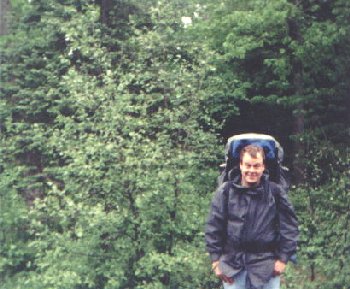
- Climbed incredibly steep, switchbacking trail to the Lake of the Clouds escarpment, where we chucked our packs again and checked out the Lake from above – this time we could actually see the lake – some guy took a picture of us (no rabid squirrel pose, though)
- Scuttled to car, and turned on radio while relaxing, heard Paul Harvey tell us about gamma rays threatening the earth and causing mutations (in Tracy’s Mom especially – see webpage). Quote from U of Minnesota Astronomer: “This is weird.” Well, thanks a lot for clearing that up.
- Decided to leave packs in car and take cameras on the Big Carp River Trail for a mile to snag some clear sky pictures - Took some clear sky pictures on the Big Carp River Trail - Came back to car and decided to try the Escarpment Trail - Escarpment Trail was the best trail we took, great views overlooking the whole park, plus it was a great day, warm and sunny (‘bout time) - Beginning of the Escarpment Trail was ‘hilly’, ‘very hilly’, ‘up-and-down hilly’, and even ‘sideways hilly.’ After hiking for a while we said ‘Hill yeah.’ Many good photos from here. - Decided to pass up chipper campsite ‘cause some experienced snot and his dog were occupying the awesome campsite on the top of a hill. - So we made our own campsite as it was getting towards dusk - We became mutant lizards (darn gamma rays) - Actually, we just broke the law of the Porkies and made our own fire pit to snag another hot meal. - Sampled some more beef stew - Hung food in tree back in the woods, actually stayed in tree all night - Major winds this night (30-50 mph), lifted entire tent up on a few occasions - Clear night, moon was pretty bright - Not nearly as restful as the Mirror Lake campsite
Mileage:
Today: ~ 12 Miles (4 North Mirror Lake Trail, 5 Big Carp River Trail, 3 Escartment Trail)
Total: 33 Miles
- Woke up to gather up the windblown tent
- Descended off the escarpment to the Government Peak Trail
- Decided to sample the Overlook Trail
- About a mile in on the Over look Trail, Tracy spotted a fawn in the trail. It was trying to hide in the middle of the trail. The doe was off in the woods to the side of the trail.
- Started hearing a low rumbling in the distance, thought it was the factory in White Pine causing the noise
- Noise continued, started to suspect it was thunder after a while
- Knew it was thunder and found a trail shelter on the map down the Government Peak trail
- Attempted to get to the trail shelter, but to no avail
- Thunderstorm hit as we were descending off the overlook trail
- Whipped out rain jackets and ponchos and headed to the Government Peak Trail
- Thankfully, it was a short storm and the sun came out not long after we got on the Goverment Peak Trail.
- Kept having promise of Trap Falls up ahead on the Goverment Peak Trail trail, so we pressed on to that location to have lunch.
- Stopped at Trap Falls for lunch. Got some good pictures, sampled chewies and Country Time’s
- Went across the river to check out the trail shelter just past the falls. Really easy river crossing on rocks.
- Climbed Government Peak, swatting annoying black flies all the way
- Met a couple and their mini-dog (with pack) at the peak – they were eating bagels and something that looked like cream cheese (guess it could be molded cheese or imitation s’morsels)!
- Wind was keeping away most o’ da flies
- Decided to snag a campsite on the western side of the peak – hoping for a good sunset
- Great view of a valley off to our West
- Had Nuclear Poliwhirl Brain for dinner (actually they were spaghettios again)
- Ten minutes before sunset, clouds rolled in from the west = D’OH!
- Line of the day: “SNAG ‘EM!!!!!!!!!!!!!!!!” after Tracy has to draw 12 UNO cards. It echoes through the park and probably scares away many possible predators and/or other hikers
- Other entertainment for the evening: Rolling up flies on the inside of the tent into balls
- Went to sleep pretty late again
Mileage:
Today: 8 Miles (1 Escartment Trail, 3 Overlook Trail, 4 Goverment Peak Trail)
Total: 41 Miles
- Woke up way before dawn to another low rumbling in the distance
- We knew better this time, as we expected another storm
- Just lay there waiting for it to get to the peak
- As dawn broke, the rain and lightning reached the peak
- As we were discussing whether to leave and head down the peak, lightning struck within a ˝ mile of us, ending that discussion as we decided to wait it out
- Rolled up some more flies and played some more UNO
- Pet flies were getting shot with rubber bands
- Mutated hand rope tricks
- As you can tell 4 days of rain were beginning to get to us
- Waited pretty long after the storm ended to let the tent dry out a bit.
- Left camp at around 10 am
- Descended peak into the valley
- Of course, we hit a rather large and rather deep stream that we had to cross. Had to balance on loose logs and then lunge for your life onto a muddy steep bank. Again, no casualties.
- Quickly discovered the moes were out for dinner.
- Thankfully, we hit Mosquito Haven Lake and had a break from the gnawing on our skin.
- Unfortunately, there were a ton of pretty tough swamp crossings between Mosquito Haven Lake and the North Mirror Lake Trail where we used up all but one remaining Capri Sun
- Ran into a couple of campers at the NMLT/GPT intersection who were quite muddy and drinking water in front of us. We had to take a break, though.
- After a quick break, we headed back up the North Mirror Lake Trail toward the Lake of the Clouds, which meant another trip into Mosquito Valley – oh joy!
- This time was just as bad, but even muddier because of the recent rains
- Passed a family of Packer Fans just on the North Side of Moe Valley and warned them of the chipperness ahead.
- Sampled our last Capri Sun on the Bridge over the Lake of the Clouds. Prepared for the climb ahead.
- Tracy stopped about ˝ way up and Brian continued to a bench near the top, where he waited for quite a while. Finally Tracy got up there after encountering some technical difficulties with the backpack (stewpid strap)
- Got up to the car and downed a 32 ounce Gatorade in about 15 seconds.
- Original plan was to drive down to Presque Isle Area and sample the numerous waterfalls down there, as well as a stop by Summit Peak.
- However, plans changed as we saw the storm clouds in the western sky. Not wanting to spend another day on a rainy, stormy trail, we decided to head for the comfiness of home. Looking back it was a good decision as the Northwest U.P. was mauled by some severe thunderstorms that night with hail!
- After making up our minds, we changed out of the nasty, mud-encrusted clothes we had on and headed down to the campground to snag a shower in some warm water.
- At the campground showers we heard some strange noises coming from one of the showers (think Herbal Essences shampoo commercial), then two people came out of the shower as Tracy was finishing his shower (oh I get it now)
- Then we headed into the Ranger Office again to get a refund for the extra day we paid for camping and to snag some souvenirs. Bri got a mug while Tracy snagged a shirt.
- Next we raced to Marquette to the American store to try to get Tracy’s computer.
- We passed through such urban areas like Nisula (Sniz-ula) and some other towns
- We also saw some mini-kids in the back of the car in front of us brawling with pillows (What else are you going to do in (Sniz-ula?)
- Getting into Marquette, we hoped American would still be open
- After hearing the Backstreet Boys for the 57th time on the way back we pulled into the parking lot of American just in time. We thought we’d take a nap on their recliner selection, but figured we’d better get to the computer.
- After snagging the CPU, we decided to get a box of cracker jacks, I mean we went to Bonanza to snag some big time scrumptiou-licious morsels of succulence to dine upon. Brian took a picture of Tracy posing with his taco and the rest of the dining room looked stunned (like the flies after getting hit with rubber bands)
- We then stopped by Ryan Hansen’s place in Marquette for a while to check up on a hockey game. After nearly falling asleep in the living room, we headed back to Escanaba
- Tracy was a corpse for most of the trip back to Escanaba, but then we arrived back home some time in the late evening just in time to see the first Severe Thunderstorm Warnings get issued for Ontonagon County
Mileage (on foot):
Today: 7 Miles (3.5 GPT, 3.5 NMLT)
Total: 48 Miles (Heck let’s call it a 50-miler!)
 1 1 |
 2 2 |
 3 3 |
 4 4 |
 5 5 |
 6 6 |
 7 7 |
 8 8 |
 9 9 |
 10 10 |
 11 11 |
 12 12 |
