
|
Hike: The Dupont Trail
Date: Saturday, February 7, 1998
Weather: Clear and sunny in the morning, overcast in the afternoon
|
Time Started: 9:18 AM
Time Finished: 8:47 PM
Round trip duration: ~ 11.5 hours
|
Party: Grant Tokumi, Wayne Shibata, & Alex Okihara |
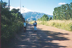 The beginning part of the trail starts off on a road next to Waialua High School.
The road is a couple of miles long, but luckily, we caught a ride with a group
of people passing by in a truck. In the background is the massive Mt. Ka'ala.
The beginning part of the trail starts off on a road next to Waialua High School.
The road is a couple of miles long, but luckily, we caught a ride with a group
of people passing by in a truck. In the background is the massive Mt. Ka'ala.
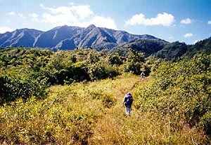 After hopping over a fence, we started our journey through the pastures. There
were many cows along the way.
After hopping over a fence, we started our journey through the pastures. There
were many cows along the way.
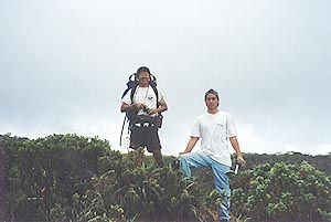
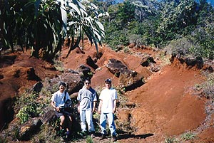 We decided to take our first group shot at an eroded section. The trail climbed
gradually from the bottom to here, where it started to get steep.
We decided to take our first group shot at an eroded section. The trail climbed
gradually from the bottom to here, where it started to get steep.
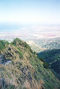 After some time and some very steep climbing, we looked back at the distant North
Shore.
After some time and some very steep climbing, we looked back at the distant North
Shore.
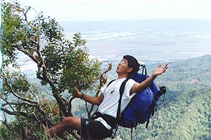 Here's Grant hanging on for dear life!
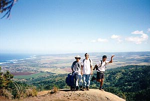 It started to get very hot, so we decided to take another break and another
group shot. Grant is so happy, he starts to dance!
It started to get very hot, so we decided to take another break and another
group shot. Grant is so happy, he starts to dance!
 Along the way were some steep, crumbly, and badly eroded sections. Thin cables
were there for assistance.
Along the way were some steep, crumbly, and badly eroded sections. Thin cables
were there for assistance.
 Wayne and Grant approach the 30 foot drop, probably the most scary part of the hike.
The section, however, is only near-vertical.
Wayne and Grant approach the 30 foot drop, probably the most scary part of the hike.
The section, however, is only near-vertical.
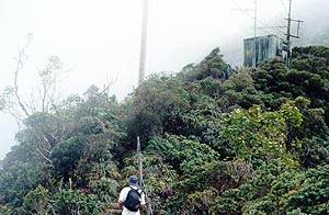
 After the steep drop, we started to encounter very overgrown blackberry bushes, which
I call thorny bushes. The thorny bushes are EVIL. Luckily, I wore long pants and was
armed with Wayne's machete. However, the machete was dull and proved ineffective in
clearing the thorny bushes. After some trailclearing, we made it to the first
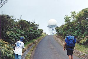
radar installation.
After the steep drop, we started to encounter very overgrown blackberry bushes, which
I call thorny bushes. The thorny bushes are EVIL. Luckily, I wore long pants and was
armed with Wayne's machete. However, the machete was dull and proved ineffective in
clearing the thorny bushes. After some trailclearing, we made it to the first
radar installation.
 Further up, we encountered stairs and another shack.
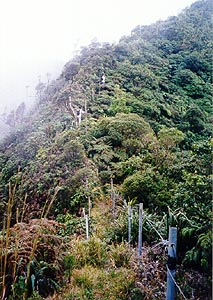 The climb was steep, and we started our walk in the clouds.
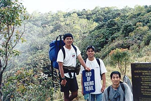 Finally, we reached the sign marking the end of the hiking trail.
 However, we decided to continue up on the road in search of the bog.
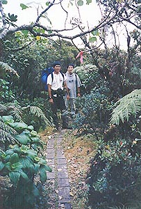
 After going the wrong way, we finally made it to the boardwalk, and then to
a sign marking the Ka'ala natural reserve.
After going the wrong way, we finally made it to the boardwalk, and then to
a sign marking the Ka'ala natural reserve.
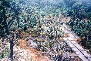
 The boardwalk is there to protect the native plants. Markers are provided
along the way also.
The boardwalk is there to protect the native plants. Markers are provided
along the way also.
 There is also a lot of moss in the bog.
 Continuing on, we made it out past the bog, overlooking the
Wai'anae Ka'ala Trail . The overcast weather made it very cold up there.
Continuing on, we made it out past the bog, overlooking the
Wai'anae Ka'ala Trail . The overcast weather made it very cold up there.
 After lunch at 4 PM, we decided that we didn't want to chance getting stuck
in the dark on the way down. We decided to walk down the road and find our way
back. To save our knees from excess abuse, we alternated walking forward with
walking backward and walking sideward.
After lunch at 4 PM, we decided that we didn't want to chance getting stuck
in the dark on the way down. We decided to walk down the road and find our way
back. To save our knees from excess abuse, we alternated walking forward with
walking backward and walking sideward.
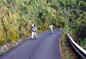
 The sun started to set, and we were still walking down the 6 mile long road.
 Finally, we made it out, climbing over a gate. Lights near Waialua High
School guided us back safely to our car.
Finally, we made it out, climbing over a gate. Lights near Waialua High
School guided us back safely to our car.
|