northwest match anglers
South Ridge Park Directions
Warning:
The following directions may not be 100% accurate.
It is advisable to use a map before heading out to any venue.
Where feasible, door to door directions can be attained by Mapquest.
***clicking on the street map below will open a new browser and launch Mapquest
Directions supplied are from selected points North, South, East or West of the venue.
-
Start out by going South on Barrington Road/IL-59
-
Continue going on Barrington Road/IL-59(South) for about 11 miles
- - Note that Barrington Road will also be named:
- - Hough Street
- - Hawthorne Road
- - Dundee Road(IL 59/68)
-
Look for Algonquin Road(IL-62) after 59 merges with 68
-
Take a left onto Algonquin Road/IL-62 (South East)
-
Continue SE on Algonquin for just over a mile and turn left onto Huntington Blvd(North)
-
Proceed North on Huntington Blvd for about three blocks and take a right onto Freeman Road(East)
-
After about two - three blocks look for the lake on your left.
- - Total distance is about 14 miles
-
Start out by going North on Main Street
-
Continue North on Main Street(which will become Schmale Road) for about 3 miles
-
Turn right onto North Ave/IL-62(East) and continue East for about 1 mile
-
Take a left onto Bloomingdale Road(North)
-
Proceed North on Bloomingdale Road, which will become Roselle Road after about 5 miles
-
Continue North on Roselle Road for about 8 miles
-
Turn left onto Algonquin Road/IL-62(West) and continue on for about 2.5 miles
-
Take a right onto Huntington Blvd(North) and proceed about three blocks
-
Turn right onto Freeman Road(East)
-
After about two - three blocks look for the lake on your left.
- - Total distance is about 19 miles
-
Start out by going West on Willow Road
-
Continue West on Willow Road which will become Palatine Express
-
Merge onto IL-53(South)
-
Continue North on IL-53(South) for about two miles and take the West Euclid Ave exit
-
Turn right to get onto Euclid Ave(West) and continue on for about 2.5 miles
-
Take a left onto Roselle Road(South) and go about four blocks
-
Turn right onto Algonquin Road/IL-62(West) and continue on for about 2.5 miles
-
Take a right onto Huntington Blvd(North) and proceed about three blocks
-
Turn right onto Freeman Road(East)
-
After about two - three blocks look for the lake on your left.
- - Total distance is about 19 miles
-
Start out by going East on IL-72(Oak Knoll Dive)
-
Continue going East on IL-72 looking for Thurnau Rd
-
Take a left onto Thurnau Rd(North) to connect onto IL-20/72
-
Turn right onto IL-20/72(East), which becomes IL-72 and continue on
- - Note - IL-72 will also be named
- - Elgin St
- - Higgins Rd
- - Main St
-
When IL-72 becomes Main St, look for IL-68(Dundee Road)
-
Take a slight left onto Dundee Road IL-68(North East)
-
Continue on IL-68 for about 5 miles when it will intersect with Algonquin Rd(IL-62)
-
Turn slight right onto IL-62(East/South East) and continue on for about 3.5 miles
-
Take a left onto Huntington Blvd(North) and proceed about three blocks
-
Turn right onto Freeman Road(East)
-
After about two - three blocks look for the lake on your left.
- - Total distance is about 21 miles
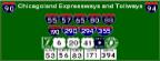
Map of the South Ridge Park area

|
Still lost? Try one of the following services:
Maps On US - An interactive mapping service or
Expressway Information - Locate construction zones, exit numbers etc.
Maps On Us
|
Expressway Information
|

|
|