northwest match anglers
Pickeral Lake Directions
Warning:
The following directions may not be 100% accurate.
It is advisable to use a map before heading out to any venue.
Where feasible, door to door directions can be attained by Mapquest.
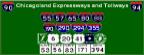
***clicking on the street map below will open a new browser and launch Mapquest
Directions supplied are from selected points North, South, East or West of the venue.
-
Start out by going South on IL-31
- - Note that IL-31 will also be named:
- - Main St
- - Western Ave
- - State St
-
Continue on IL-31(South) until you reach the US-20(East) exit(about 15 miles)
-
Stay left to exit onto US-20(East) and proceed East(you will cross over the Fox River)
-
After you cross the Fox, you will want to get onto IL-25/Saint Charles St(South)
- - To get onto IL-25(South)
- - Turn right and merge onto Grace St(South)
- - Take a left onto Bluff City Blvd(East)
- - Turn right onto IL-25/Saint Charles St(South)
-
Proceed about 2.5 miles on IL-25/Saint Charles St(South) and look for the Dunham Road turnoff
- - If you reach Army Trail Road, you have gone too far South. If so, turn left
onto Army Trail Road(East) and you will run into Dunham Road.
- - You can then turn left onto Dunham Road(North) to backtrack.
-
Continue South on Dunhan Road and keep a quick lookout for Stearns Road
-
Take a left onto Stearns Road(East)
-
Continue East on Stearns Road until you reach Powis Road(1st street on your right?)
-
Turn right onto Powis Road(South) and continue on to the lot entrance (past the railroad tracks)
-
Turn right at the lot entrance(horse trailer parking will be to the left), and follow the road to the parking area.
- - Total distance is about 20 miles
-
Start out by going East on I-80
-
Continue on IL-80(East) to the I-55 interchange
-
Take the I-55(N) exit (exit 126B) towards Chicago
-
Continue on I-55(North) for about 7 miles to the US-30 exit
-
Exit onto US-30(North/West) (exit number 257) towards Aurora/Joliet
-
Continue on US-30(North/West) which will merge with IL-59
- - Note that US-30 will also be named:
- - Plainfield Road
- - Joliet Road
-
Stay on IL-59/Division St(North)
-
Continue North and West on IL-59 for about 23 miles until you reach Army Trail Road
-
Turn left onto Army Trail Road (West)
-
Continue on Army Trail Road for about 1.5 miles when you will see Powis Road on your right
-
Turn right onto Powis Road(North) and head to the lot parking area
-
Turn left at the lot entrance(horse trailer parking will be to the right), and follow the road to the parking area.
- - Total distance is about 40 miles
-
Get onto the Kennedy Expressway/I-90(West)
-
Continue on the Kennedy/I-90(West) to the IL-59 exit(milepost 19)
-
Take the IL-59/Sutton Road exit(South)
- Note - there is a 25 cent toll at this exit
-
Continue South on IL-59/Sutton Road until you reach Stearns Road(about 10 miles)
-
Turn right onto Stearns Road(West)
-
Keep an eye out for Powis Road(on your left) - Munger road will be the road before it
-
Take a left onto Powis Road(South) and head to the lot parking area
-
Turn right at the lot entrance(horse trailer parking will be to the left), and follow the road to the parking area.
- - Total distance is about 34 miles
-
Start out by going East on IL-64/Main St/North Ave
-
Continue going East on IL-64 for about 50 miles and look for Smith Road(on your left)
-
Turn left onto Smith Road(North)
-
Smith Road will become Powis Road and continue(North) on to the parking lot area
-
Turn left at the lot entrance(horse trailer parking will be to the right), and follow the road to the parking area.
- - Total distance is about 53 miles
Map of the Pickeral Lake area

|
Still lost? Try one of the following services:
Maps On US - An interactive mapping service or
Expressway Information - Locate construction zones, exit numbers etc.
Maps On Us
|
Expressway Information
|

|
|