schedule
Are you on my route? Know of something I should check out on my route? Are you hosting and want me to mention your name? Send me a message and I will add it to my notes.
| Date | Starting From | Miles to Go | Total Milage | Notes |
| June 30 | Montreal | 51.6 | 0 | I have a place to stay here |
| July 1 | Val David | 30.5 | 51.6 | I have a place to stay here |
| July 2 | Mont-Tremblant | 60.1 | 82.1 | I have a place to stay here |
| July 3 | Mount-Laurier | 178.9 | 142.2 | securing a place to stay here |
| July 6 | Val-D'Or | 42.9 | 321.1 | I have a place to stay here |
| July 7 | Landrienne | 122 | 364 | I have a place to stay here |
| July 9 | Matagami | 44.1 | 486 | I have a place to stay here |
| July 15 | Radisson | 372 | 858 | |
| July 28 | Km 666 | 480 | 1338 | turn around point |
| August 9 | Radisson | 264 | 1818 | |
| August 13 | Nemiscau | 196 | 2082 | |
| August 16 | Chibougamau | 144 | 2280 | I have a place to stay here |
| August 19 | St-Felicien | 210 | 2438 | securing a place to stay here |
| August 22 | Trois-Rivieres | 84.1 | 2633 | securing a place to stay here |
| August 23 | Montreal! | 2767.1 | I have a place to stay here | |
maps
This is my full trip map. Paved roads wind up the Eastern Hudson Bay (The Western side is Polar Bear National Park) and then inland along the unpaved Trans-Taiga Road. Browned out roads are unpaved (and on some maps do not exist! see below.)
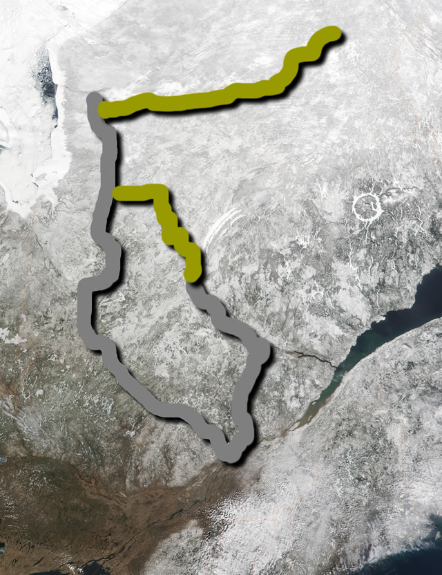
Below is only a partial map of my trip (excluding July 15 - August 9). The mapping site doesn't seem to have the rest of my route accessible by roads.