|
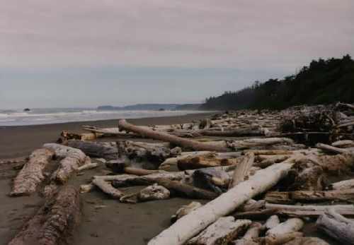 |
This is Ruby Beach, Olympic National Park in Oregon. Here the ocean slams into to coastline,
leaving sea stacks and large piles of enormous logs washed onto the beach. Sea stacks are the
large rock outcroppings that did not erode as fast as the surrounding shore, and are left to
be pounded by the surf. Many of the sea stacks are covered with either trees, or inhabited by
sea lions. |
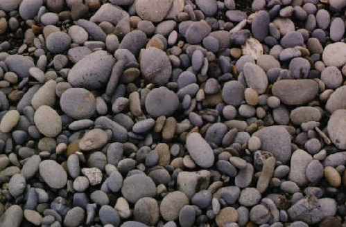 |
The beach is composed of collections of multi-colored rocks, and sand. The water was colder
than the Atlantic Ocean, but not frigid. The tide was low at the point when I was at Ruby, so
the shore allowed walking along the beach. Tides change quickly and can trap you between the
surf and the unscalable cliffs. |
 |
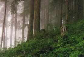
Up from the shoreline at Ruby Beach, you went directly into temperate rainforest. The trails
I was running directly from the beach were covered with these ferns, a sign of the amounts of
rain that area receives each year.
Some of the trees within 100 feet of the surf, had trunks that were 6 feet in diameter! The
ferns covering the trail are fairly typical of what I experienced. The undergrowth was very thick,
especially in the old-growth forests. On the lesser used trails, your feet would generally be
obscured by the thigh-level ferns.
The Rainforest has a way of making you feel very small within nature. Being surrounded by 300
foot tall trees and 6 foot high ferns and mosses put the things into a different perspective. |
 |
Where the valleys of the Olympic mountain ranges serve to funnel the rain-giving storms into
smaller areas the rains total over 21 FEET per year. The Hoh Rainforest is one such location. |
 |
Olympic National Park is hard to explore in a limited amount of time, with 96% of the park
area being designated as wilderness. While there may not be roads, there are plenty of great
hiking trails which are great for running. The only way to see this park is to get out of the
car and explore on foot. The National Park is almost completely surrounded by Olympic National
Forest. This trail is in the forest section.
This trail up Mt. Ellinor is on the Hood Canal side of the Forest. The trail is supposed to
lead to a spectacular view of the snow-capped Olympic Mountain Range. Since the weather for my
run was a heavy fog, punctuated by a driving rain, I saw very little.
However, the run was spectacular! The trails were among the best I have ever run, soft and
forgiving, well-maintained, and smooth. A pleasure to run on, even in a cold, driving rain. |
 |
The trail up Mt. Ellinor was fairly steep, in places. The early sections did gentle
switchbacks following up a ridgeline. Above a certain point the ridgeline turned into a
avalanche chute, complete with snow! |
 |
The climb up to the top of Mt. Ellinor rewarded me with views of heavy fog. The climb back
down through the snowfields was a lot of fun. The old snow was very slick and wet. Occasionally,
you would break through the surface to dip your feet in the raging creek below.
The best way to get down the hill was to ski, using shoes as poor substitutes for skis. I made
it with no falls, and only a couple steps into the creek. |
|
 Get your own Free Home Page