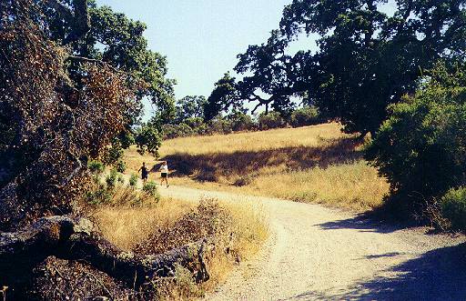
Arastradero Preserve
Part 1
![]()
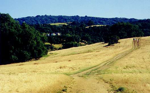
Arastradero Preserve
Part 2
![]()
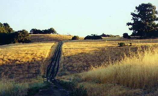
Arastradero Preserve
Part 3
![]()
Arastradero Preserve Virtual Reality Tour
![]()
Arastradero Preserve Stewardship Project

Directions
Park
Info
Map
![]()
SF Bay
Rec. &
Travel
Part 3 - Other Trails

![]()
|
Bay Area Parks |
Bay Area Hiking |
County Parks |
Feedback |
Other Trails
There are many other trails in the preserve, many unmarked and not on the current map.Northeast Hills
You can explore the hills to the north of the parking lot at the northeast corner of the preserve. These rolling grass-covered hills adjoin Stanford University's pasture lands. The trails provide views of Hwy 280, Felt Lake, and the Stanford antenna dishes and hills. A line of eucalyptus trees runs along the eastern boundary of the preserve. Felt Lake, which is off-limits, is just beyond the northwest corner. Looking back to the southwest, most of the rest of the park can be seen below the Santa Cruz Mountains. Below are pictures from this section:(Click on the thumbnails for a larger picture. Hit the Back
button on
your browser to return.)
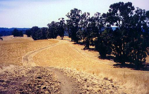
 A gap in the parking lot fence allows
access to the hills. One trail leads
up the hill to the right.
A gap in the parking lot fence allows
access to the hills. One trail leads
up the hill to the right.
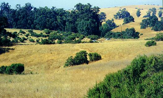
 On the way up the hill, looking back, you
can see the parking lot, the
private inholding across from it, and the park hills.
On the way up the hill, looking back, you
can see the parking lot, the
private inholding across from it, and the park hills.
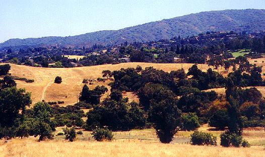
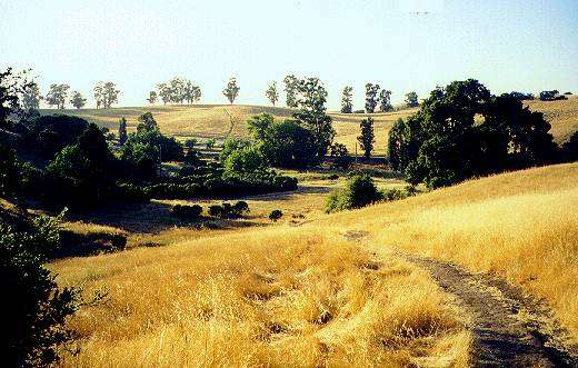
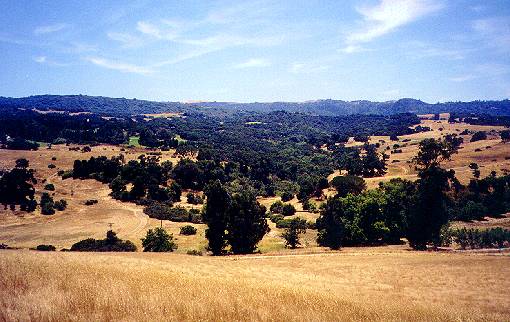 From the top of the hill, you can see the
park entrance below to the left,
with the golf course in the hills above it.
From the top of the hill, you can see the
park entrance below to the left,
with the golf course in the hills above it.
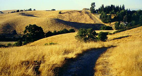
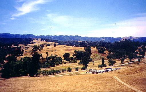 From the hilltop, you can see the parking
lot and the rest of the preserve
below and to the southwest.
From the hilltop, you can see the parking
lot and the rest of the preserve
below and to the southwest.
 A trail leads down from the hills and
runs
parallel to the fence on the
preserve's northern border.
A trail leads down from the hills and
runs
parallel to the fence on the
preserve's northern border.
 Looking beyond the eastern border, you
can
see Stanford's open space lands
and Hwy 280. A small forest runs in a valley from the park boundary to
Hwy 280.
Looking beyond the eastern border, you
can
see Stanford's open space lands
and Hwy 280. A small forest runs in a valley from the park boundary to
Hwy 280.
 A line of eucalyptus trees lines the
fence
along the preserve boundary.
A line of eucalyptus trees lines the
fence
along the preserve boundary.
 Beyond the fence, you can see Felt Lake.
The lake is part of the San
Francisquito Creek watershed. It is an artificial reservoir created
in 1929 when Stanford University built a diversion dam on Los
Trancos
Creek. Felt Lake is part of Stanford's
nonpotable water supply. Water is used for irrigation and fire
protection.
In 1995, a fish
ladder was built to allow steelhead trout to migrate upstream past
the dam. The lake, like the surrounding lands, is a biological preserve
and off-limits to unauthorized personnel.
Beyond the fence, you can see Felt Lake.
The lake is part of the San
Francisquito Creek watershed. It is an artificial reservoir created
in 1929 when Stanford University built a diversion dam on Los
Trancos
Creek. Felt Lake is part of Stanford's
nonpotable water supply. Water is used for irrigation and fire
protection.
In 1995, a fish
ladder was built to allow steelhead trout to migrate upstream past
the dam. The lake, like the surrounding lands, is a biological preserve
and off-limits to unauthorized personnel.
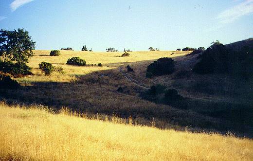
 A trail leads down from the middle of the
hills back to the parking lot.
A trail leads down from the middle of the
hills back to the parking lot.
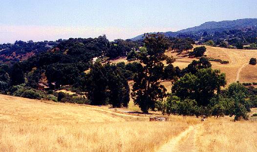
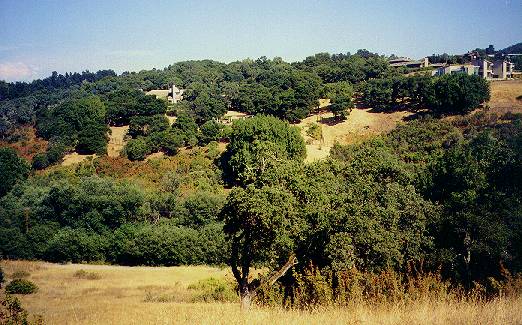
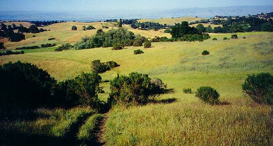
 Looking back at the main part of the
preserve from this middle trail, the
path of Arastradero Creek can be seen, marked by trees. In the hills
above
are trails running along the park boundary below the golf course.
Looking back at the main part of the
preserve from this middle trail, the
path of Arastradero Creek can be seen, marked by trees. In the hills
above
are trails running along the park boundary below the golf course.
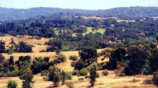 This view shows the golf course in the
hills above the preserve and the
Santa Cruz Mountains beyond that.
This view shows the golf course in the
hills above the preserve and the
Santa Cruz Mountains beyond that.
Along the Golf Course Boundary to the Corte Madera Trail
The trail described below is unnamed and does not appear on the current park map.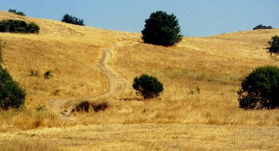 It starts just past the main entrance,
where 2 dirt single-track trails
lead off to the left from the Corte Madera Trail. One trail goes up the
hill on the right. The other goes up another hill on the left. This
describes
the trail on the left.
It starts just past the main entrance,
where 2 dirt single-track trails
lead off to the left from the Corte Madera Trail. One trail goes up the
hill on the right. The other goes up another hill on the left. This
describes
the trail on the left.
 This trail begins as a narrow, bumpy dirt
single-track and widens into
a dirt double-track. The view to the right shows the other trail
running
up the hill to the south.
This trail begins as a narrow, bumpy dirt
single-track and widens into
a dirt double-track. The view to the right shows the other trail
running
up the hill to the south.
 Continuing uphill, the trail begins to
level off. Looking back downhill,
the parking lot and the northern hills beyond them can be seen.
Continuing uphill, the trail begins to
level off. Looking back downhill,
the parking lot and the northern hills beyond them can be seen.
 From the crest of the trail, the view to
the north along the preserve boundary
shows the northeastern hills and a wide firebreak protecting the
private
property next to the preserve.
From the crest of the trail, the view to
the north along the preserve boundary
shows the northeastern hills and a wide firebreak protecting the
private
property next to the preserve.
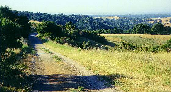
 Ahead, you can see the trail running
along
the upper edge of the preserve
below the Palo Alto Hills Golf & Country Club.
Ahead, you can see the trail running
along
the upper edge of the preserve
below the Palo Alto Hills Golf & Country Club.
 The trail reaches a junction. Ahead, a
trail drops steeply downhill to
exit the park at Paseo Del Roble.
The trail reaches a junction. Ahead, a
trail drops steeply downhill to
exit the park at Paseo Del Roble.
To the left, the firebreak runs along the hills to the north. To the right, the trail follows an old paved road below the golf course.
 Looking back, the trail which started to
the right of the trail you're
on can be seen running over the hills below and eventually comes up to
meet the current trail.
Looking back, the trail which started to
the right of the trail you're
on can be seen running over the hills below and eventually comes up to
meet the current trail.
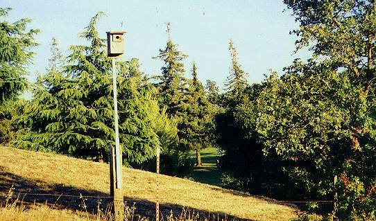 The trail turns to the right. A birdhouse
stands at the edge of the golf
course. Nest
boxes
have been installed all over Arastradero Preserve by conservation
groups
and volunteers to help restore bird populations.
The trail turns to the right. A birdhouse
stands at the edge of the golf
course. Nest
boxes
have been installed all over Arastradero Preserve by conservation
groups
and volunteers to help restore bird populations.
 The trail finally heads steeply downhill
to Arastradero Lake. (This is
the view looking back up the trail.) See the 0.68 mile point in part
1.
The trail finally heads steeply downhill
to Arastradero Lake. (This is
the view looking back up the trail.) See the 0.68 mile point in part
1.
Meadowlark Trail
The Meadowlark Trail was seen and taken in Part 2. However, this was not the whole trail. This shows the section between the Corte Madera Trail and the Acorn Trail.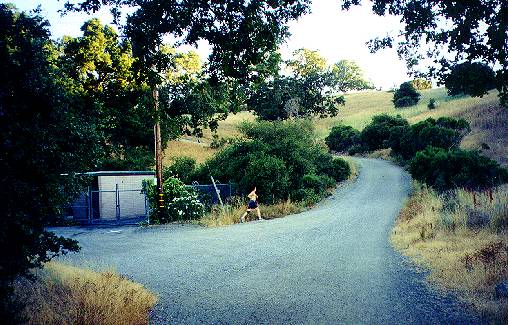 This starts at the junction on the Corte
Madera Trail at the pump
station
at 0.87 miles in part 1. At the
junction,
take the wide gravel service road to the right.
This starts at the junction on the Corte
Madera Trail at the pump
station
at 0.87 miles in part 1. At the
junction,
take the wide gravel service road to the right.
 It runs uphill and follows along the
hills, curving to the right.
It runs uphill and follows along the
hills, curving to the right.
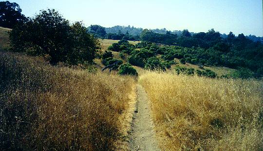
 The
service road levels off and reaches the junction with the Meadowlark
Trail. Take the Meadowlark Trail to left. It is a wide gravel path that
gradually leads uphill at the edge of a wide meadow.
The
service road levels off and reaches the junction with the Meadowlark
Trail. Take the Meadowlark Trail to left. It is a wide gravel path that
gradually leads uphill at the edge of a wide meadow.
 Looking back from the top of the rise,
you
can see the meadows and hills
below.
Looking back from the top of the rise,
you
can see the meadows and hills
below.
 The trail turns right at the top of the
hill. It then climbs up another
hill. Looking back, the golf course can be seen in the background.
The trail turns right at the top of the
hill. It then climbs up another
hill. Looking back, the golf course can be seen in the background.
 After passing the closed Acorn Trailhead
on the left, the Meadowlark Trail
passes the new Acorn Trail on the left. The Acorn Trail continues on to
the right. The Meadowlark Trail then begins a steep climb up a hill to
join upper Acorn Trail as seen at the 3.47 mile point in Part
2.
After passing the closed Acorn Trailhead
on the left, the Meadowlark Trail
passes the new Acorn Trail on the left. The Acorn Trail continues on to
the right. The Meadowlark Trail then begins a steep climb up a hill to
join upper Acorn Trail as seen at the 3.47 mile point in Part
2.
 The
Meadowlark Trail becomes a wide gravel service road. It parallels the
Acorn Trail, making a wide U-curve and heading downhill to rejoin the
Acorn
Trail. See the 4.56 mile point in Part 2.
The
Meadowlark Trail becomes a wide gravel service road. It parallels the
Acorn Trail, making a wide U-curve and heading downhill to rejoin the
Acorn
Trail. See the 4.56 mile point in Part 2.
Acorn Trail
The upper part of the Acorn Trail is covered in Part 2. One section of the trail not covered there is the lower section between the Corte Madera Trail, the Meadowlark Trail, and the water tank service road.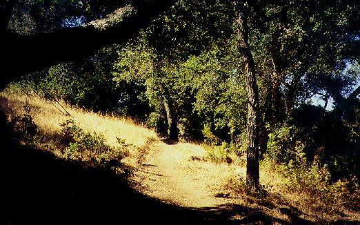 The Lower Acorn Trail begins at the Corte
Madera Trail (see the 1.46 mile
point in Part 1). It runs uphill into
an
oak and poison oak forest. The trail is a wide dirt single-track.
The Lower Acorn Trail begins at the Corte
Madera Trail (see the 1.46 mile
point in Part 1). It runs uphill into
an
oak and poison oak forest. The trail is a wide dirt single-track.
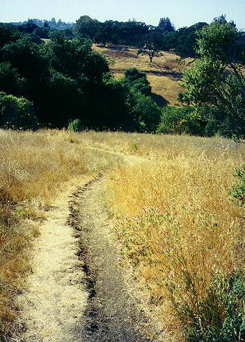
 It climbs steadily up the hill at an easy
incline. Trees provide cool shade.
It climbs steadily up the hill at an easy
incline. Trees provide cool shade.
 The trail levels off and emerges into a
clearing. You can see the
golf course and large houses in the hills above the preserve.
The trail levels off and emerges into a
clearing. You can see the
golf course and large houses in the hills above the preserve.
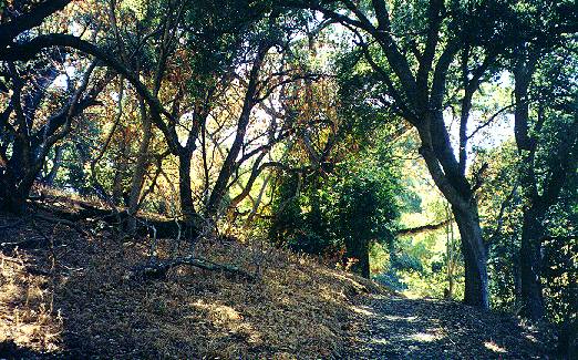 The trail enters a cool oak and buckeye
forest. It runs slightly downhill
to cross a tiny creekbed, then rises uphill again.
The trail enters a cool oak and buckeye
forest. It runs slightly downhill
to cross a tiny creekbed, then rises uphill again.
 Soon it reaches the wide gravel road of
the Meadowlark Trail. (This is
a view looking back at the Acorn Trail from the Meadowlark Trail.)
Soon it reaches the wide gravel road of
the Meadowlark Trail. (This is
a view looking back at the Acorn Trail from the Meadowlark Trail.)
 The Acorn Trail begins again on the other
side of the Meadowlark Trail.
It is a narrow single-track running through high grass on the side of
an
open hill.
The Acorn Trail begins again on the other
side of the Meadowlark Trail.
It is a narrow single-track running through high grass on the side of
an
open hill.
 Looking down from the hill, you can see
the Gate B entrance, seen at 5.20
miles in Part 2.
Looking down from the hill, you can see
the Gate B entrance, seen at 5.20
miles in Part 2.
 The
trail crosses an unmarked single-track trail running up and down
the
hills.
The
trail crosses an unmarked single-track trail running up and down
the
hills.
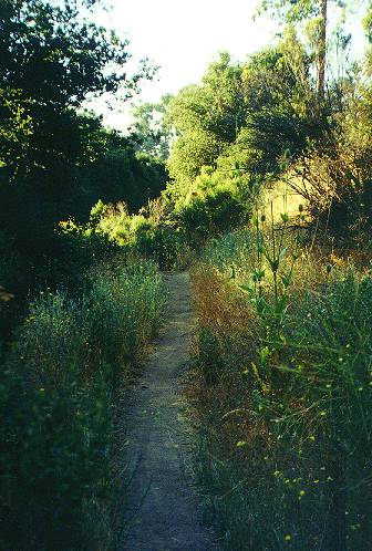
 It then runs downhill. You can see a wide
firebreak on the hills ahead.
The trail runs downhill and to the left.
It then runs downhill. You can see a wide
firebreak on the hills ahead.
The trail runs downhill and to the left.
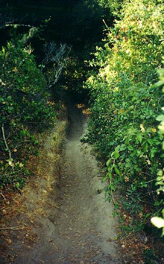
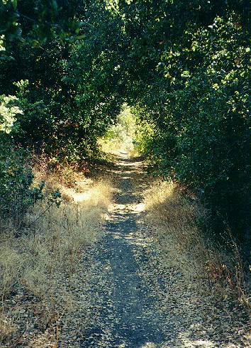 It begins to parallel and descend to the
creek below. It enters a shady
tunnel formed by oaks and poison oak.
It begins to parallel and descend to the
creek below. It enters a shady
tunnel formed by oaks and poison oak.
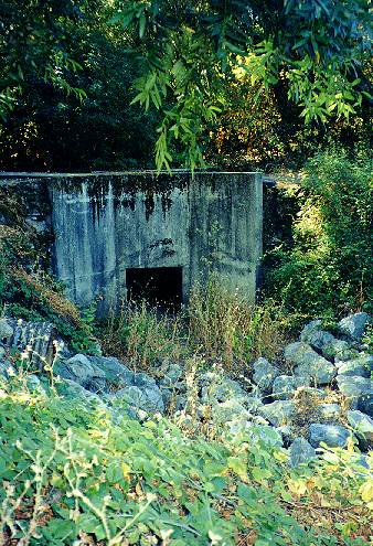 Soon you reach the bridge over the creek
at the trail junction at 4.82
miles in Part 2.
Soon you reach the bridge over the creek
at the trail junction at 4.82
miles in Part 2.
Perimeter Trail
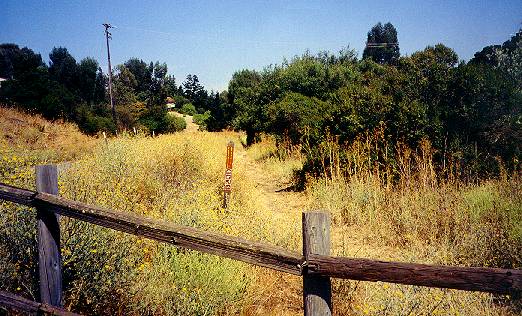 The Perimeter Trail continues from the
preserve's main entrance,
parallels
the fence, and leaves the preserve at the park boundary in Los Altos at
Arastradero Road. It is a narrow foot path running along the perimeter
of the preserve. It is the only official trail that is closed to
bicycles.
The Perimeter Trail continues from the
preserve's main entrance,
parallels
the fence, and leaves the preserve at the park boundary in Los Altos at
Arastradero Road. It is a narrow foot path running along the perimeter
of the preserve. It is the only official trail that is closed to
bicycles.
 This is a view of the trail near the bend
in the trail at 5.09 miles in Part 2.
This is a view of the trail near the bend
in the trail at 5.09 miles in Part 2.
 This is the trail near the trail at the
4.94 mile point in Part
2.
This is the trail near the trail at the
4.94 mile point in Part
2.
![]()
Created 7/9/01, updated 9/27/06 by Ronald Horii