 |
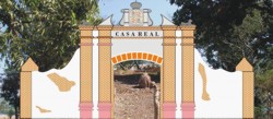
1st Capital of Abra |
|
|
|
1st Capital of Abra |
|
|
Photo of manuscript in the National Archives |
| North is
on the left side, poblacion (residential area) on the south side
to the right. The poblacion is laid in a grid pattern with the town's
Plaza
(square) and Fort on the Southeast, the highest point in the town that
slopes down towards the north and northeast.
West (bottom) are the foothills of the Ilocos Range with a stream flowing north that is dammed at several places providing irrigation to agricultural lands of rice sementeras and hortalizas (rice nurseries and vegetable orchards) with more of them at bottom right. The row in the maps south (right center) are granaries. And visible on the top (east) is the Ryo Pryncypal or Abra River, lapping the foothills of the Cordillera. |

Original in the National Archives
of the Philippines is some 3.5 feet wide by two feet tall.
|