Plates
List
| 1: Topographic map
of Abra |
10: Casa Real: architectural
rendition of the 1849 plans: Main Façade |
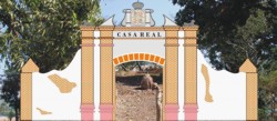
| 2: Decree creating
the Province of Abra, first page |
11: Casa Real: axonometric
plans, second and ground floors |
| 3: Bucay, Map, 1848.
Photo of manuscript in the National Archives |
12: Casa Real: isometric
drawing, whole building |
| 4: 1848 Bucay maps
symbols contrasted with actual pictures |
13: Plans of proposed
provincial jail: 1848 |
| 5: Bucay Poblacion,
digital drawing from map in the National Archives |
14: Bucay, center of
town, digital drawing of portion of the Cariño map |
| 6: Plaza and Casa Real |
15: Location of the
fort ruins |
| 7: Casa Real renovation:
1849 plan of main façade |
16: Tajonera expedition
to Cagayan Valley in 1849 |
| 8: Casa Real renovation:
1849 ground floor drawing |
17: Abra tunnel, only
gate to the province |
| 9: Casa Real renovation:
1849 upper floor drawing |
18: Calzada Real, Tayum,
League marker |
|
The materials for this
set of plates are gathered from the topographic map of Abra issued by the
old Bureau of Coast and Geodetic Survey in 1976, several manuscripts from
the National Archives of the Philippines, architectural renderings by Patricia
Perdigon and digital drawings, graphics, and pictures by the author.
The facsimiles of the manuscripts
in the National Archives published here consist of digital photos taken
by the autor with the consent of the Arcives' curators.
All the materials in the plates
are covered by copyright and no plate or part thereof may be reproduced
to any extent or in any media without the consent of the author.
|
|