|


Look to the stars &
listen what they tell you
about our planet
Earth
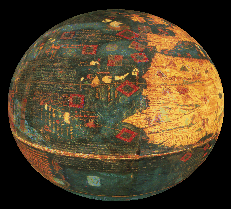
I do believe that the
Earth is.. flat, a sphere,..
..pear shaped,..

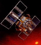
Satellite geodesy for
measurements at our dynamic planet Earth
GPS satellites, used
all over the world, ..
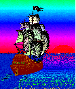
..not only in ocean and
maritime sailing,..

..magnetic compass
(nearly) lost its importance
|

Geodesy, Surveying, etc.
Ever since man evolved into thinking creature, she has
been interested in learning about the Earth. Natural phenomena are often
intimately related to the size, shape, gravity field of the Earth, and their
time changes, and to understand them requires a certain knowledge of geodesy.
For many centuries, the only way to learn about the geometry of the Earth
was through astronomy. Together with astronomy, geodesy is among the oldest
sciences; it is doubtless the oldest geoscience.
Following the classical definition of Friedrich Robert
Helmert (1880), geodesy is the "science of the measurement and mapping
of the Earth's surface". This definition includes the determination
of the surface of the ocean floor, as well as the Earth's external gravity
field.
Geodesy
(or surveying) may be subdivided into the special disciplines
- geodesy
- plane surveying
- photogrammetry including remote sensing
- cartography
Sometimes geodesy for maritime areas also is called "Marine
Geodesy" and it is linked to hydrography.
Geodesy is concerned with the study and measurement of the
external shape and gravity field of the solid Earth, the oceans, and the
major ice sheets, including their temporal variations. The construction of
the Earth's core and mantle as well as the internal dynamics and the
exchange of angular momentum between these components are of interest to the
section, especially their contribution to changes in Earth's rotation.
Geodetic measurements are crucial to the study of climate change, the
advance and retreat of ice sheets and glaciers, sea level rise, and charting
the motion of the Earth's crust through time.
Geodesists are constantly
striving for more accurate measurements to complement their existing
techniques, and today new, exciting technologies are expanding the
possibilities of their research.
Space techniques, such as very long
baseline interferometry and laser ranging, which chart positions on Earth
with unprecedented accuracy have been applied for more than a decade, but
Global Positioning System (GPS) receivers are now being installed for continuous
monitoring of crustal motions, especially in seismically active areas. In
addition, altimeters carried by satellites and aircraft are being used to
monitor ocean topography, including ocean circulation and sea level, as well
as variations in the polar ice sheets. The TOPEX/POSEIDON and ERS-1/2
satellites have returned a wealth of information using radar altimetry, and
future satellite altimeters will further expand this base.
Satellite geodesy comprises the observational and computational
techniques which allow the solution of geodetic problems by the use of precise
measurements to, from, or between artificial, mostly near-Earth satellites.
Today, the objectives of satellite geodesy mainly are considered in a functional
way, which are
- determination of precise positions
- determination of the Earth's gravity field
- measurement and modelling of geodynamical phenomena
If you still believe geodesy is an enigma, then you should
read "Geodesy: The Concepts". The authors Vanicek and Krakiwsky
(1986) try, as one of their goals, to work on the demystification of geodesy.
Geodesy is not an occult discipline, but a vivid, fascinating,
multi-disciplinary science. |