| Table of Contents | ||
| Day | From - To | Distance |
| 1 | Anchorage - Portage Lake | 97.3 km |
| 2 | Portage Lake - Park/Glenn Hwy Jct | 158.2 km |
| 3 | Park/Glenn Hwy Jct - Trapper Creek Trading Post | 129.1 km |
| 4 | Trapper Creek Trading Post - Carlo Creek Lodge | 175.8 km |
| 5 | Carlo Creek Lodge - Nenana | 131.7 km |
| 6 | Nenana - North Pole | 110.3 km |
| 7 | North Pole - Cherokee Lodge | 147.4 km |
| 8 | Cherokee Lodge - Tok | 159 km |
| 9 | Tok - Chicken | 127 km |
| 10 | Chicken - Dawson City | 180 km |
| 11 | Sightseeing in Dawson City | - |
| 12 | Dawson City - McQuesten River | 130 km |
| 13 | McQuesten River - Pelly Crossing | 115 km |
| 14 | Pelly Crossing - Twin Lakes | 151.8 km |
| 15 | Twin Lakes - Whitehorse | 120.7 km |
| 16 | Whitehorse - Otter Falls Cutoff | 117 km |
| 17 | Otter Falls Cutoff - Million Dollar Falls | 122.8 km |
| 18 | Million Dollar Falls - Haines | 156.3 km |
| 19 | Haines - Carcross | 117.3 km |
| 20 | Carcross - Mukluk Annies Salmon Bake | 142.5 km |
| 21 | Mukluk Annies Salmon Bake - Morley River Lodge | 52.1 km |
| 22 | Morley River Lodge - Walkers Continental Divide | 89 km |
| 23 | Walkers Continental Divide - Jct37 - Watson Lake - Jct 37 | 164.9 km |
| 24 | Jct37 - Jade City | 123 km |
| 25 | Jade City - Dease Lake | 119.5 km |
| 26 | Dease Lake - Willow Ridge Resort | 140 km |
| 27 | Willow Ridge Resort - Bell II | 107.7 km |
| 28 | Bell II - Meziadin Jct | 100.8 km |
| 29 | Meziadin Jct - Stewart - Salmon Glacier - Stewart | 159 km |
| 30 | Stewart - Meziadin Jct | 60.3 km |
| 31 | Meziadin Jct - Yellowhead Hwy Jct | 169.8 km |
| 32 | Yellowhead Hwy Jct - Telkwa | 161.8 km |
| 33 | Telkwa - Burns Lake | 135.7 km |
| 34 | Burns Lake - Brookside Resort | 160 km |
| 35 | Brookside Resort - Purden Lake | 133.2 km |
| 36 | Purden Lake - McBride | 155 km |
| 37 | McBride - Mt Robson | 86 km |
| 38 | Mt Robson - Mt Kerkeslin | 128 km |
| 39 | Mt Kerkeslin - Wilcox Creek | 87.1 km |
| 40 | Wilcox Creek - Mosquito Creek | 105.2 km |
| 41 | Mosquito Creek - Banff | 98.5 km |
| 42 | Banff - Calgary | 144.3 km |
| Total | 5270 km | |
| Average | 128,5 km/day |
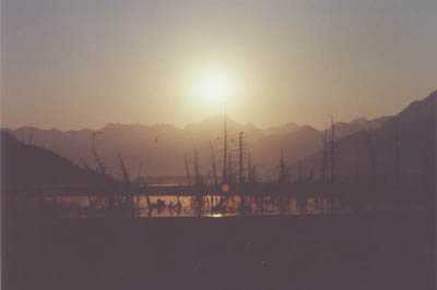
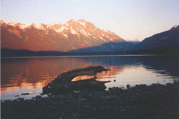
Sunrise in Turnagain Arm. The trees in the foreground have died because of salt water, reaching their roots when Alaska got hit by a huge 9.2 earthquake in 1964. The earthquake tipped the entire southern Alaska and thereby lowered some of the this area below sea level. |
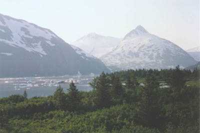
Portage Lake scattered with ice chunks from the nearby Portage Glacier. I arrived here around 9:00 AM after having biked the 97 kms from Anchorage during the night. |
||
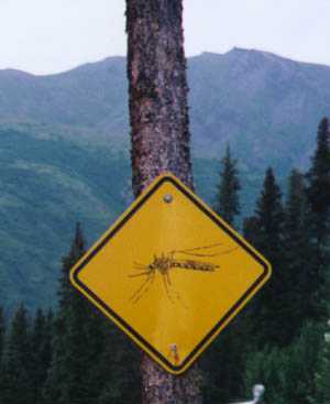 |
This is mosquito country! Carlo Creek RV Park near Nenana River. | 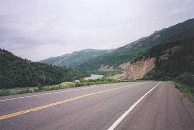
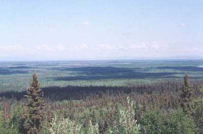
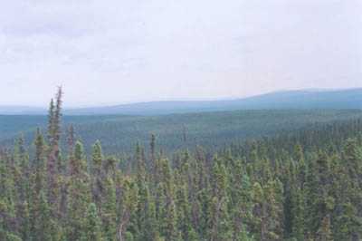
Nenana River Valley. Here the Parks Hwy, going from Anchorage to Fairbanks, runs along the Nenana River. |
|
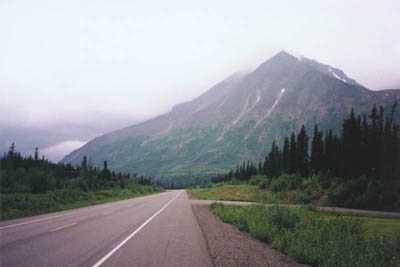
Parks Hwy, AK |
Parks Hwy just west of Fairbanks. When I passed the 6200 m peak of Mt. McKinley it was hidden by clouds. But from this point, looking south, I had a clear view of it, from at distance of more than 300 kms! Unfortunately the photo is a little overexposed - McKinley was right over my saddle. |
||
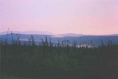
Looking north from the same place as above. In the horizon is Kokrines Hills 250 kms away.. |
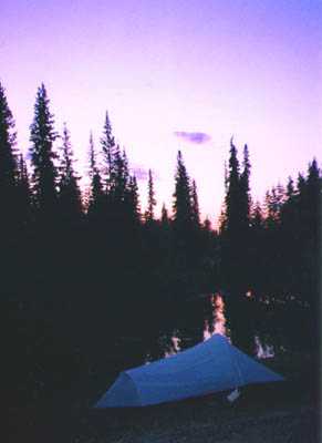 |
My
tent on the camground in North Pole, photographed at 1:00 AM. North Pole
is a small town a little southeast of Fairbanks, celebrating Christmas
all the year around...
This was my most northernly camp, and as you can see it doesn't really get dark here. |
|
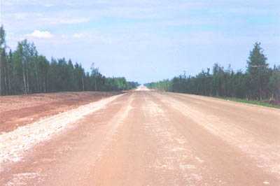
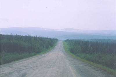
Construction near Tok. No pavement, just gravel and rocks for 20 km. This is not uncommon on the northern highways. |
Alaska Hwy near Tok |
||
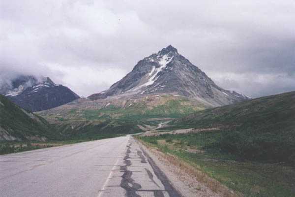
Taylor Hwy. This 100 km gravel/mud road is one of only two road connections between Alaska and Canada and connects Alaska Hwy with Top of the World Hwy, and ultimately Dawson City. |
Taylor Hwy, this is truly a remote place on Earth. From here and north to the Bering Sea is 1000 kms of dense forest and tundra - no houses, no roads! |
||
Taylor Hwy again. This is a very bad road. Chicken is the only community along the road (pop. 25 ). After crossing the Canadian border the road is rougly paved, but it still took me 14 hours to bike the 180 kms from Chicken to Dawson City. |
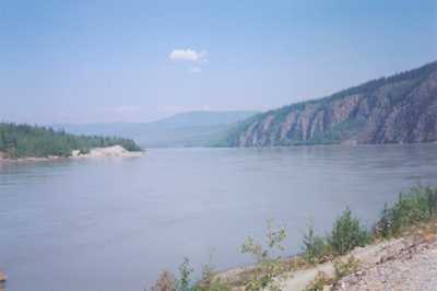
Yukon River. |
||
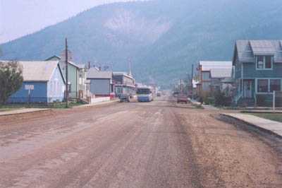
5th Avenue in Dawson City. When gold was discovered in Bonanza Creek, people from all over the world rushed to the Klondike area. Dawson City, located at the confluence of the Yokon and Klondike Rivers, once had over 40.000 citizens during the gold rush days of 1898-1901. |
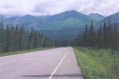
Looking north near the junction of Alaska Hwy and Haines Hwy. |
||
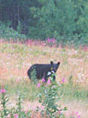 |
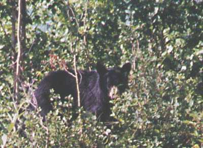
Black bear on Haines Hwy. I watched 9 black bears and 2 grizzly's on the tour. | 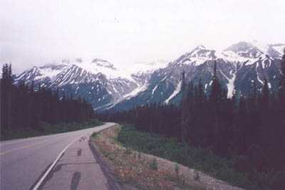 |
|
Three Guardsmen Mtn. This pass was once guarded by the Indians, along with the famous Chilkoot Pass which the many stampeders had to cross during their journey to the northern goldfields. |
|||
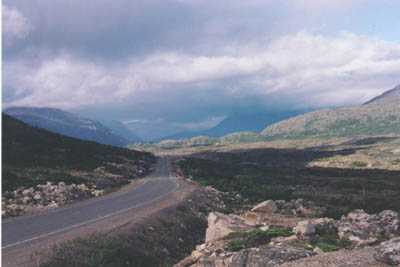 |
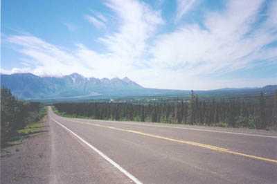
On the lonely Cassiar Hwy (Hwy 37) in British columbia. This magnificent road runs through one of the most remote and desolated areas in the world for nearly 800 kms, without any intersections. |
||
Meziadin Lake, on the intersection of Cassiar Hwy and Stewart Hwy. |
|||
|
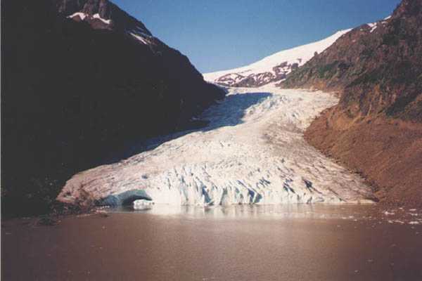
Bear Glacier seen from Stewart Hwy. (The road from Hwy 37 to Stewart AK). |
|||
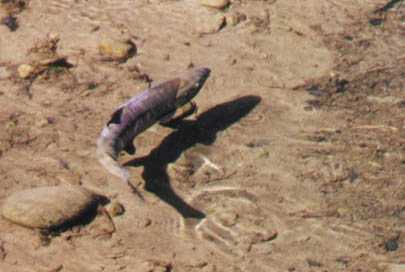
30 kg Chum Salmon in the clear waters of
Fish Creek, Hyder AK |
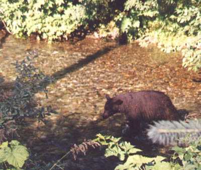
Black bear in Fish Creek, Hyder AK. |
||
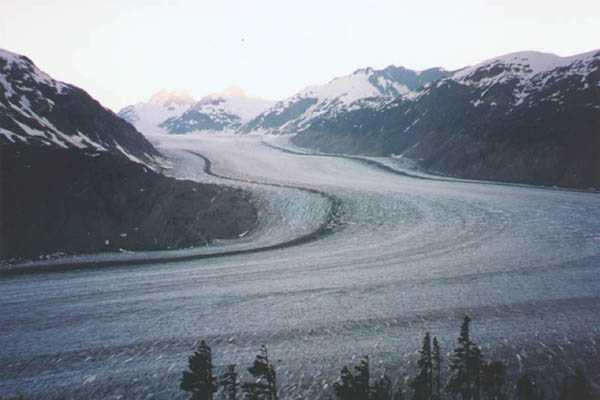
The enormous Salmon Glacier far above Fish Creek, Hyder AK |
|||
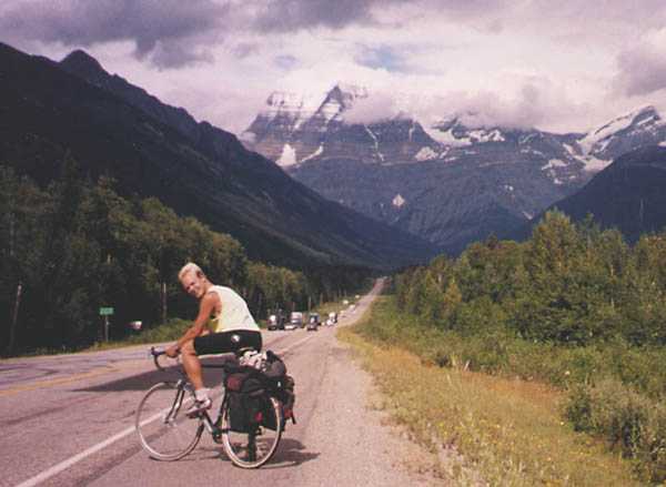
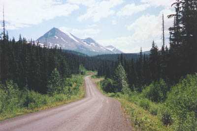
On the way to Mt. Robson, the highest peak in the Canadian Rockies. |
|||
Black bear at Moose Lake, BC. This bear was only 5 m away, standing in the bushes on right side of the road. |
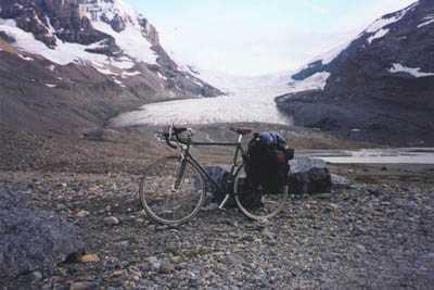
Atabascha Glacier in Banff Natl. Park, AB. You can walk on this glacier, but be careful - people have died in the crevasses. |
||
 |
Chephren Lake in Banff Natl. Park | 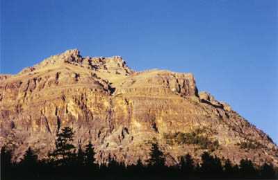
Sunset at Mosquito Creek, Icefields Parkway AB. |
|
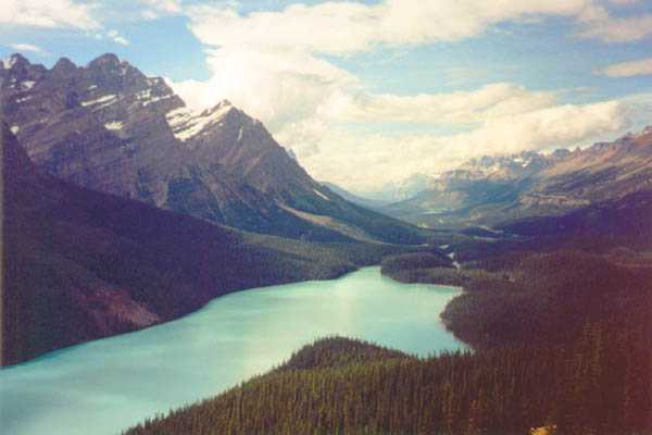
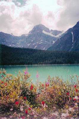
Beautiful Peyto Lake in Banff Natl. Park. The lake is fed from a nearby glacier. The pale blue color originates from the cobber minerals washed out of the mountains. |
|||