|
TCC won a bid to map and conduct an oceanographic
survey of all the basins of the Tartous Harbor in January of 2000. In turn, they
contracted Mansour Architect to carry out the mapping, quantity analysis and
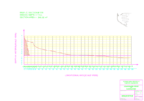
final presentation of this huge and time consuming project. Individual depth
points were taken at 5 m intervals for a total of 309 sections comprised of over
26,000 individual points. GPS and ultra-sound depth equipments were used in
collecting the data. We were able to come up with the complete study using CAD
within the short deadline specified by the port authorities. General layout of
the harbor and specific piers and basins were plotted on a 1/1000 scale. In
addition, over 600 sections were calculated and plotted to come up with the
final quantities of dredging and cleaning required to return the basins to their
optimal and design depth.
A similar project
was undertaken in 1998 for the port of Tripoli in Lebanon. TCC and Mansour
Architect also submitted the complete study well within the time frame specified
by the Lebanese Port Authorities.

|