 |
||
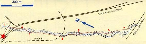
| START: At the Chalet car park |
END: Return following trails along east bank of river, or examine exposures of volcanic rocks in road cuts of new CBS By-pass and Manuels Access Road (if you do this, be mindful of traffic) |
|
Please be patient as this page may take some time to load.
|
||
| START: At the Chalet car park |
END: Return following trails along east bank of river, or examine exposures of volcanic rocks in road cuts of new CBS By-pass and Manuels Access Road (if you do this, be mindful of traffic) |
|
1. Conglomerate (Brigus Formation): a 550 million year old beach rock. An ancient shore line ran through this spot and its beach is now exposed in the waterfall below the bridge. The beach was formed from debris eroded from nearby cliffs made of volcanic rocks and granite (see stops 2 and 3).
| 2.The Holyrood Granite formed deep below the Earth's surface 620 million years ago. It is now exposed as large outcrops divided by sub-horizontal fractures. Exposures near the campfire site show fresh surfaces of coarse crystalline rock with colorless quartz, pink-orange feldspar, dark green hornblende and black biotite. The granite also contains blocks of pre existing volcanic rock which fell into it from the roof of the volcanic magma chamber. |
|
 View looking downstream across the contact (red line) between smooth granite outcrops in the distance and more rugged volcanic rocks in the foreground. |
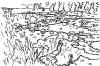
3. Volcanic rocks (Harbour Main Group) intruded by the younger Holyrood Granite, and baked by it so that they are very hard, close to the contact. The baking makes it difficult to see the structure of the volcanic rocks but, upstream, their fragmentary nature can be seen: most of them are ashes, rather than lavas, deposited mainly in water, after being blown out from explosive volcanoes. Explosive volcanism is characteristic of eruptions of magmas observed in continental mountains (e.g., the Andes). |
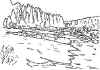
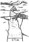
| 4. The valley upstream from the trestle is broad and gently rounded, in contrast to the narrow gorge below the Chalet. Here the valley was moulded more than 10,000 years ago by a valley glacier draining the Avalon ice cap. Post-glacial river action has removed much of the evidence of glacial erosion on the rock surfaces. Abundant potholes and channels were cut in bedrock by the fast-flowing, debris laden meltwater river. |
View or river upstream from the trestle, showing valley shaped by glaciation |
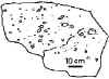 Boulder of volcanic ash |
5. The rock exposures here show steep bedding of the volcanic ashes, with their angular volcanic fragments. There are also several 'dykes' of basaltic lava: they fill old fissures that cut up through the layers of ash and fed magma from below to later volcanic eruptions. Here some of the rock surfaces have escaped the effects of recent river erosion and preserve the glacially-smoothed, grooved and streamlined form produced by ice moving downstream. |
| 6,7: These localities show further examples of the volcanic ashes of the Harbour Main Group, together with excellent examples of feeder dykes cutting vertically up through them. The canyon (7) originated from river erosion cutting a channel along the joints in the bedrock of the gently U-shaped valley cross-section, that was produced by ice flow. |
 Vertical dyke cuts across volcanic rocks at the lower end of the canyon |