Summary, Introduction, Methods, Analysis, Results, Discussion, References, Acknowledgements, Photos, Links
![]()
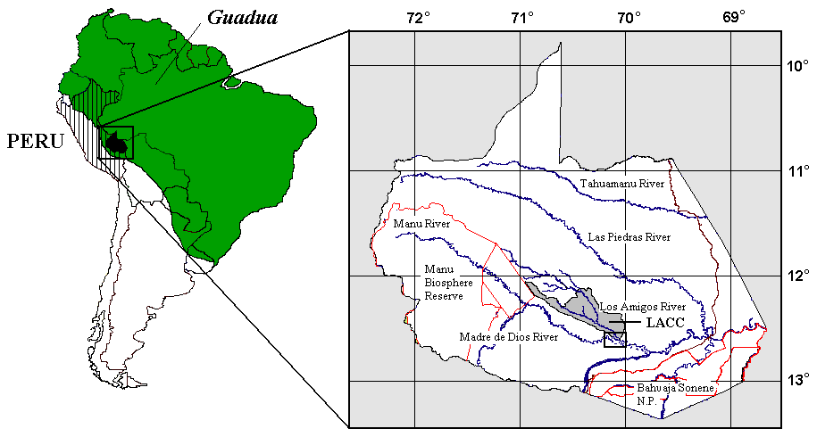
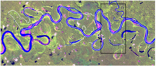

Fig. 1 Location (top) and false colour composite images of study site (middle) and core area (bottom) in Madre de Dios. Study site = 23.5 x 8.5 km, and core area = 4 x 8 km. Images depict routes surveyed by boat and transects as determined using GPS data (white lines). BA = Boca Amigo Community; C = Cloud; CL = Cocha Lobo; LAR = Los Amigos River; LARC = Los Amigos Research Center; LI = Lago Indara; LP = Lago Pichon; MDR = Madre de Dios River; PC = Paña Cocha.
![]()
Summary, Introduction, Methods, Analysis, Results, Discussion, References, Acknowledgements, Photos, Links