
A quick geography lesson…
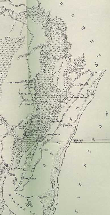
The dots represent salt marshes and the "plants" represent swampy areas (most of which is suitable for rice growing)
Below is a view of southern Georgetown County. The North and South Santee Rivers are in view, along with the town of Georgetown to the north. Charleston County is to the south, but the city of Charleston is about fifty miles south, while Georgetown is about ten miles north of the two rivers.

This is northeastern Georgetown County. The Waccamaw Neck is labeled here as All Saints Parish. In colonial times, this was separate area from Georgetown, which was in Prince George Winyah Parish. By the nineteenth century, they were united, but the old names were still used. Sandy Island is the solid area amongst the swamp, with the Pee Dee on the left and the Waccamaw on the right. This area was better suited to growing rice than anywhere in early America. The Atlantic Ocean is only about two miles from the Waccamaw River on the other side of the Waccamaw Neck.
This is an overview of Georgetown County in relation to the rest of South Carolina. Notice that the railroad goes to Charleston and bypasses all of Georgetown County.

Source of maps is Easterby's book,maps were originally drawn by Robert Mills, 1825.
Front Gates / Table of Contents / Introduction of Rice / Rise of the Rice Plantations / Planters / Slaves / Georgetown County / Geography of Georgetown County / Examples of Plantation Homes / Demise of the Rice Plantations / Gallery of the Abandoned Rice Fields / Explanation of Certain Terms / Links to other sites / Bibliography