Tijuana Gringo : Tur Info
How to Get Out of Town

Other Turinfo Pages:
Tijuana Maptext.
September 2003
by Michael Thomas & Charlotte Duston
There are four basic directions out of town: West spreads the Pacific Ocean; North is San Diego and Los Angeles; East leads to Tecate, Mexicali and the Colorado River; and South will take you past Rosarito and Ensenada into deepest Baja California. Details Below.
Transportation Options
You can leave town by airplane, car, motorcycle, truck, bus, on foot, bicycle, horse, burro or mule.
EXCEPT for the trolley north of the border into San Diego (a very important except), you cannot leave by train -- a historic option now, alas, lost and gone forevermore croak raven etc. -- Ah distinctly I remember it was in the bleak December and each separate dying ember cast its ghost upon the floor....
THE LOST RAILROAD??
Yes, it's true! In the "golden age" of Tijuana tourism (1919-1935) and as late as the 1940s, you could take the train between here and San Diego and points north, as well as east to the mountain town of Tecate and then over down through the ridiculously jagged and impossible landscape of the Carrizo Gorge. You can read allllll ABOARD!!! alll about it that is by clicking on the cover of/in the issue of The Journal of San Diego History (Fall 1994, Volume 40, Number 4) shown here as free advertisement and bibliographic citation enjoy they are Real Historians not like us bad poets.
EXTRA!! Word and WORK continues of and ON the IMpossible Railroad!!!
As you can see by this picture below from another local historical group (the San Diego Railroad Museum), the "impossible railroad" reached for - and accomplished - rather more than most railroads ever dare to attempt.

Persons visiting or living in San Diego may wish to stop by the Model Railroad Museum in Balboa Park which has been constructing a truly splendid version of Carrizo Gorge (which weirdly enough looks verrrryyy much like the unbelievable gorge pictured above) in HO-scale.
Backpackers and desert hikers/campers may wish to visit the real thing (access from Anza Borrego State Park).
AND Railroad Buffs should note that the Pacific Southwest Railway Museum in Campo offers weekend train rides on some of the old tracks (not in the canyon but still very pleasant) from their back-country museum facility. Regretably it appears the special trips into Tecate are not available at this time.
But we digress....
Back at the Rancho Tijuana on the milder coast, the Agua Caliente Casino and Hotel even had its own train stop. Alas, no more such luck (except almost, via trolley from the border into San Diego). Passenger trains have not run into Tijuana or on up to Tecate  (see old ticket) for more than fifty years; there are occasional freight trains from here to Tecate, but passenger service exists only on the U.S. side of the line (the San Diego Trolley) or way up in the mountains as excursion trips on the U.S. side of the line, that sometimes cross to Tecate, but (so far as we know) nothing scheduled to Tijuana.
There has been some talk in recent years about building a light-rail trolley on the rails in Tijuana (like in San Diego), but so far no real construction for this "tren ligero" has taken place. Our personal prophet Nostraindamus says this will come to pass, however, sometime before the polar icecaps melt. (Unless that asteroid hits first.) In the meantime, you can take the trolley on the U.S. side of the border, north into San Diego. All three sets of trackage discussed here were originally pieces of the historic SDA&E "impossible" railroad. (And here's another article about it.)
At the old Santa Fe depot in downtown S.D., you can catch Amtrak to L.A.'s Union Station and connect with more trains to the north and east.
Back to Top
The airport -- Aeropuerto Internacional Abelardo L. Rodriguez -- is served by several airlines. It sits up on Otay Mesa next to the border fence, west of the Otay border gate (turn right after entering Mexico). Every night you can hear the jets whining from there up over the river and downtown.
We do not like flying, but we must say here that it is forty some hours by bus to Mexico City, and if you want to save time, well, you really might consider taking an airplane into central Mexico and then bussing around from there. There are also airplanes to Loreto, La Paz, and Cabo, all popular destinations in Baja California.
In Tijuana, city busses going to the airport will say AEROPUERTO or APTO or something like that on their windshields. To be certain, when you get onboard and pay your five and a half pesos (55 cent) (2003), ask: "�Aeropuerto?" -- S�Ese�ora pasale pasale.
The bus stops in front of the terminal building after pulling off the big street rushing beside the border fence covered with white crosses in memory of the hundreds who have died in recent years crossing the border without documents. FYI: They were traveling on foot through the desert and mountains, not in airplanes.
Taxis to the airport include especial (bargain with the driver) and libre (with meter and set price). It should not cost you more than ten dollars. [PHIL!!!! GET SOME ROUTE TAXI INFO!!!!!!]
Long-Distance Tijuana Bus Stations
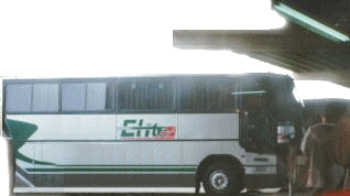
The bus is our favorite way to leave town -- since we cannot go on the train any more... not even from Mexicali, like before, since the passenger train to Guadalajara stopped running about ten years ago. There are only two passenger trains left in the country: the fabulous mountain trip over the Copper Canyon country from Chihuahua to Los Mochis, and the Tequila loop train out of Guadalajara. **sigh**
(DETAIL: ONE Baja California bus line website (en espa�ol, pues): http://abc.com.mx is IN CONSTRUCTION January 2004 and hopefully will be upgraded soon....)
But, bus service in Mexico is, if anything, better than in the United States, and there are plenty of busses from Tijuana, and even more from Mexicali. The number of people traveling by bus in this country, and not by car, is simply enormous. Every city has one or two large bus stations. Every town has the same. Every little village and hamlet and road crossing seems to have its share of busses stopping at the plaza or corner or little hole-in-the-wall office. Some of these off in deeper Mexico will be your classic rattletrap with chickens on the roof, but generally speaking the major bus lines all run air conditioned confortable coaches, with reserved seating and more legroom than you get on any airplane (outside of First Class, of course, but then, once you get down into central Mexico you will find luxury bus service with all kinds of perks but right now we just need to get out of town okay? Okei.).
The only real problems are:
Perhaps the easiest bus station for tourists who have just entered Mexico (at San Ysidro) is the L�nea Terminal, close to the border gate, after you pass the "sea of taxis and island of tacos" (copyright patent pending jo jo we serve notice voil�!) The bus terminal is to the right at the glorieta where all the city busses growl. Busses leave the terminal every half hour (during the day) for Ensenada. There are also busses to other points in Mexico, but not as many as at the big central bus terminal several miles up the valley.
The Camionera Central or Central de Autobuses for all of Tijuana is located some five miles or so up the valley echo echo. It has busses leaving for many points in Baja California and mainland Mexico. Even Greyhound comes there from Los Angeles and San Diego, although you can get off at the border if you want, but.... Whatever. The Camionera Central has more busses to more places than the other stations all combined together. Remember, however, that Tijuana is at the farthest corner of the country, and to really get anywhere you have to get down into mainland Mexico. But you can get to almost anywhere on the west coast (like big party Mazatlan), Guadalajara or Mexico City, direct from Tijuana.
To get to the Camionera Central in Tijuana, just catch a city bus that says CAM CTRL or something like that on its windshield.
The "old" Tijuana bus station with its lovely old mosaic map is actually worth a look just if you're visiting Tijuana, especially if you walk across the river, for you'll pass right by it as you climb the little hill up from the river. It's on the corner of Madero and Avenida Puente Mexico, one narrow block downhill from the big metal arch on Revolution. There ARE busses from there to Rosarito and Tecate, and sometime last year they started running long-distance busses from there to central Mexico but NO GUARANTEES on that information at all here!
Back to Top
Leaving by Car
The first thing you need to consider before driving from Tijuana is Where Are You Going, and what legal permits do you need?
No visa or car permit is required to drive your own vehicle in the Border Zone -- which includes Tijuana, Ensenada, Tecate, Mexicali and San Felipe. There is also a time limit: 72 hours (three days), but this is not enforced like the distance is. If you are going south into Baja California beyond Ensenada, you will need a Tourist Card, available at the Mexican entry gate, or in Ensenada at Servicios Migratorios. No special permit is necessary for your car UNLESS you go beyond Baja California (by ferry or by road) into mainland Mexico.
If you plan to drive your car into mainland Mexico, get a permit for your car from the Mexican entry gate. Be safe. This permit gives you a certain amount of security as a legitimate tourist, in addition to obeying the law. The automobile permit is also good for one person's Tourist Visa (normally the driver, but in any case the legal owner of the car).
DON'T FORGET TO BUY ACCIDENT INSURANCE from one of the little places in San Ysidro (before crossing the border). We have heard (but are still doubting) that there is no legal requirement per se for insurance in Mexico, but IF YOU GET IN AN ACCIDENT in Mexico you WILL be required to show an ability to pay for whatever MIGHT have been your fault. THAT is Why Insurance is SO Helpful... especially if you don't speak Spanish like a Lawyer!
So, you'll be driving, eh? Well, then, here are the routes in the four directions... or rather, three (forget driving west into the ocean heh heh).
Well, forget going west unless you have a boat and forget that anyway 'cause there ain't no marina or docks on the bay -- there Aint No BAY and There Ain't NO Harbour at Tijuana although there IS a beach, yes, yes, where "green sea moss and black mussels colonize our western tip of the new Berlin wall..." and the San Diego bay shimmers in the nearby distance across the international line.
But the beach, especially where the border fence plunges west into the sea, is well worth visiting just to see this strange place where two worlds collide and then disappear into the ocean, yes. But you can't really sail away from there. Just stand and watch the ships far out at sea going by....
There is a real port city on a beautiful bay some sixty miles south, at Ensenada on Bahia de Todos Santos. A couple cruise liners pull in at a wharf they built special to attract them to this pleasing, almost always good-weathered town which welcomes partiers and visitors and shoppers and seafood lovers galore.
If you want to gaze out to sea and pretend you actually are sailing off into the sunset of the west, well, you couldn't do much worse than the new waterfront promenade in front of downtown Ensenada.
It isn't Tijuana, but it is just a two hour drive from the border, or by bus from the bordergate bus station at the traffic circle beyond the island of tacos and sea of taxis.
Or maybe you have your own yacht, either power cruiser or sailboat, and you have come down the coast yourself from San Diego, before leaving west toward Hawaii, or south to explore Baja and its soon-to-be-built (ahem maybe) Escala Nautical... well, Ensenada has port facilities and supplies, right now. Don't forget to obey all the rules for yates (yachts)....
But, technically, however you get to Ensenada to gaze from the port city, out into the west, well... you have then already left Tijuana, by moving to the south.
Back to Top
North
And, as for going north, well, there's plenty of people going north, I mean this is the busiest border gate in the world, they say. But I think most of you know that already. I think you are more interested in going deeper into Mexico or into Baja California. Nevertheless, it is easy to drive north if you have the car and the papers, so... here goes... (shut up and write it already).
Immediately after the International Gate into the United States at San Ysidro, you will find yourself heading north on the Interstate Freeway Five. Within five or six heartbeats you must choose whether to take 805 (splits apart to the right) or stay on 5 (splits to the left). 805 is especially useful if you are going to the inland valleys and hills of San Diego, but it eventually rejoins five north of La Jolla before Del Mar, so if your real destination is Los Angeles, don't sweat it if you miss the merge here.
However, if your immediate destination is downtown San Diego or the airport or Point Loma or Mission Bay, you should stay on 5 north.
For touristic information about San Diego etcet., you may consider another site among others. We are not there any more...
;-)
But speaking of that organization we remember when her honor the Mayor in 1996 aka the burgermistress #2 threatened to cut the nuts off of their leader Reint Reinders and send them back to Sanity Clause yes aunque usted no lo cree je je heh.... just ask her -- we helped write the first version of that other page nine years ago... ummmmm You TOLD!!!!!.
Back to Top
East
Now where were we? Oh yes, we just sent you north into the sweet spieling gutzer of San Diego. But maybe you don't want to go north... maybe you want to go East.
Well, there are two basic routes from Tijuana, the free road to Tecate (which begins with two versions old and new) and the toll road to Tecate.
The older free road over the dam.
The older free road is the logical extension from "the boulevard," which will take you beyond La Mesa toward the neighborhoods of La Presa -- the dam/reservoir -- a rather stunning route which after leaving the endless miles of business behind, narrows down into a two-lane highway climbing the hill and then actually crossing Right Over On Top of the Rodriguez Dam! Please don't speed here -- see, there I am, watching you from the hill outside the frame heh.

If you drove there today (late summer 2003) you would notice how very high the dam is and how very low the water, unlike this ideal version presented here of the painted postcard variety. Baja California needs water. When the engineers finally build the EDUCTOR, then there will be much, much more available, distilled naturally by massive lakes under solar evaporation from the Gulf of California, risen as convecting vapor in huge tubes to the mountains and then after removing the energy (turning dynamos and generating electricity) & converting back to liquid, the precious gift of water is to be sent down river both for new agricultural fields and orchards and the thirsty city where we make now make our foreigner home.
That is, if we never get out of town at this rate....
The new free road (libre) to Tecate
The new free road east is, basically, an extension of Insurgentes, a mighty boulevard that runs along the eastern shores of the river, towards the foot of Cerro Colorado and up past the fancy cemetery toward the zones of inner and outer Florido.
You can catch this road quickly by taking the via rapida occidental from the river zone near the border. Follow green highway signs that say Tecate Libre. Follow and follow and follow... it's almost five miles from the border to where you will need to swoop and swerve into ramps up and over the river, following the TECATE LIBRE signs until you find yourself ramped down onto the big boulevard Insurgentes going on and on toward that big hill there, see? Go past the state park (all those trees and stuff on the right, veryyy nice place to visit. Go through more business neighborhoods along the feet of the hill (this Is THE Cerro Colorado) then up past the fancy cemetery toward the zones of... oh... we Are Repeating ourselves here aren't we...? Well the road goes on and on, like Bagginses said, and you will go through more valleys filling up with factories and little oceans of houses without water or electricity and finally, climbing the rocky mountains, reach Tecate.
Back to Top
The toll road (cuota) to Tecate
If you are looking for a SPECTACULAR driving experience, THIS IS the way to get to Tecate, let me tell you, let all of us here tell you we agree Absolutely SCMABSOloootely. It is a little tricky getting onto it... well, so, shut up and drive. You go upriver along the via rapida following TECATE signs, but eventually like five or seven miles or something (don't you just hate getting your directions from a poet heh heh) start looking for TECATE CUOTA signs and take the ramp that goes to TECATE CUOTA and then go across the river AND then up the great big one-way hill... by the way, that big building you pass at the foot of the hill is The Camionera Central the "Central" long-distance bus station only a hundred zillion light years from downtown ha ha shut up and drive....
Anyway, you climb up the big road from the river onto Otay Mesa, yes, that's right, passengers, ladies and gentlemen, we're are now climbing to an altitude upon Otay Mesa, and this means that... (drum roll, please)
THERE IS AN ALTERNATIVE ROUTE TO get to the TECATE CUOTA toll road from the United States, namely, cross the border on Otay Mesa and then turn left on Avenida Industrial. Or Tecnologica or whateverthehell it's called, we don't look at street signs we just learned by rote and route and well... if you are lucky there will be signs saying TECATE CUOTA from there, too.
ANYWAY if you have driven through Tijuana and crossed the river and come up the hill, well, you need to turn right onto the aforementioned Avenida Industrial, the first big right turn as you approach the HUGE traffic circle on Otay Mesa near the back end of the airport and campus of the autonomous university where as one local wag said scarcely eagles dare to land....
Follow Industrial Avenue or boulevard east toward the steep hills and sooner or later it will feed you into the superhighway... stop and pay your toll and maybe park there by the tollbooth, it's the only safe place to stop and park and look around at the teeth of the mountains who are about to eat you up alive in this spectacular drive toward Tecate. See all those thousands of little paths going up the mountain? Yep, that's right, those are the trails where migrants without documents climb up into the mountains now that the new fence has shut down the easier route from Tijuana along the mellow coast. They must go up into the mountains and get cold or hot or live or die. Think about that when you go to the restaurant next time and someone serves you for minimum wage with tips. Don't tell me about it either, you're the one in the car. So what can you do? Lobby Congress for immigrants' rights. Or not, if you disagree. America is free, after all, or it was, the last time I went home again, Ed. That's right. I can't leave you alone, can I. Cause I miss you even here in the middle of my great passion to scribble on the cutting edge of rough draft I will later revise and delete... maybe.
Anyway, enjoy the drive. It is truly worth the fee for the toll road (maybe three or four dollars, I don't remember -- sorry poet very am, Yoda).
Tecate is another municipio entirely, you are no longer in Tijuana and we should just leave you there, but... well, once again, as one of our other favorite literary creations said, the road goes on and on. And after Tecate both the free road and the toll road continue east into and across the mountain plateau, until you reach La Rumorosa and fall down five thousand feet into the desert of Mexicali. Don't drive off the cliff here!
But, back at Tecate there is a gate into the United States and many of our Mexican friends like to cross over there and take the California Highway number 94 (State Hwy 94) east through the mountains, and then down east along Interstate 8, rather than the Mexican highway over and down la Rumorosa. Whatever. Now you know what your options are. Remember this is a web site written by poets, NOT Road Engineers! *grin* By the way, highway 94 on the north side of the border will take you through Campo where the railroad museum offers its back-country train rides on weekends. Hint hint.
Back to Top
La Rumorosa
Or you can keep heading east in Mexico from Tecate, until you eventually take the plunge over one of the world's most dramatic precipices: La Rumorosa. Sunrises here can be unbelievable -- we've seen several from bus windows crawling up or down the long twisting highway. The trip from bottom to top is just long enough to take you from darkness into light, if you time your drive right. But then, most Unitedstatesians will not want to drive at night in Mexico. There are always cows and donkeys wandering around, and worse, you might hit some people. Take the bus or drive in the daylight hours.
This highway -- la Rumorosa -- plunges from like five thousand feet above sea level down to practically nothing. From the mountain plateau -- it's pretty damn flat up there, as you will note when you pass by (the famous Baja California mountains are a bit further south) -- the divided highway twists and turns down and down around the edges of canyons and mountainsides until it finally emerges on the edges of the vast Mexicali and Sonora deserts.
It is pretty damn hot there between April and October, but in winter the nights can be colddddddddd. And if you go by bus, you will also have the air conditioning on on on On ON ONNNNNNNN and blowingggggggggg brrrrrr and then you step out at Mexicali in the desert and WHAM the heat will hit you like a solid wall of dark fire. Or bright fire, if it is daytime. Heh heh in the summer we and our friends here in Tijuana complain about the heat, oh my it even gets up into the 90s sometimes here on the coast of these Californias, but then we will say OH It Could Be Worse... We Could Be in HELL ITSELF heh heh Mexicali...
Too bad the best Chinese food in all of Mexico is over there in the burning hell of the desert!
Seriously.
Back to Top
South
There are two main roads south from Tijuana: the free road (el libre) and the scenic toll road (la cuota). Direction signs, however, tend to say LIBRE for the free road, or SCENIC ROAD for the tollway. Both roads lead to Rosarito (via separate routes) and then they go on to Ensenada, part parallel, part separate.
The free road LIBRE leaves Agua Caliente Boulevard a little ways before (west) of the "downtown" bullring. Coming along the boulevard from head of Revolution (where the boulevard begins at the old moorish Tijuana Tower), you go about ten blocks or so along the very busy commercial street, past some of the city's most popular restaurants (Chinese, Italian, etc. -- in case you want to eat in town before driving south), and then turn right onto LIBRE Ensenada Rosarito at the CALIMAX supermarket.
You can get to the LIBRE road by coming up from Zona Rio on the street that leaves the traffic circle at the Aztec Warrior monument (Cuauhtemoc -- at another CALIMAX -- they are everywhere here) and zig-zags up the slope to cross the boulevard and become the free highway south.
Leaving the boulevard behind, the LIBRE free road -- by the way, the free road is NOT a freeway, only a crowded highway. If you want a freeway, take the SCENIC tollroad from the beach....
The LIBRE meanwhile climbs up a long, long canyon that always fools me from bus windows into thinking we've finally reached the valley itself but no, just more canyon turning on and on into the hills that go for miles, until you pass the libramiento intersection (the ring road that encircles most of central Tijuana), and at last you approach the outlying canyons and hilltops of La Gloria. An army camp that looks like some kind of public campground goes by on your right. A bit more climbing brings you to the top of the mesa, outside of La Gloria, where thousands and thousands of dead cars and trucks are all crowded together up there on top of those hills... totally weird but hey, that's the way it is when people love cars....
Then the LIBRE road, now four lanes, sometimes two, descends down another long valley toward the coastal plains of Rosarito Beach and its giant fuming power plant stacks looming closer and closer in the smog as you crawl down a long strip of business shacks and shops and stores and restaurants rich and poor all tangled up together with stoplights and pedestrian overpasses and all. Soon there comes a snarl of ramps and bridges and you choose either to get on the supertollway or to take the main drag into booming Rosarito.
Distance between town centers (TJ/Ros) is about 20 miles.
The SCENIC toll road follows the coast all the way to Rosarito and is much faster and more beautiful, it is, in fact and in name, scenic. Worth the two dollars or something (another four something will almost get you to Ensenada) it costs in 2003. At present there is also a page telling tolls and such.
To get onto the SCENIC road, you must first catch the Via Rapida to the beach. Fortunately the access to it is signed. As you cross the river from the border gate, move into the left lanes and follow directions to SCENIC ENSENADA ROAD (or something like that). Warning: they're building new ramps and this might change next year (2004) sometime. Once on the via rapida Fast Road you will rattle along beside the border fence heading west across the bottom of downtown and then climbing up a GIGANTIC hill near one of the new U.S. sewer plants and then coming down again into another canyon, at which point you MUST take the ramp to the right which should say PLAYAS or SCENIC ROAD and presto you are on the autopista a las playas freeway to the beaches.
If you miss the Via Rapida Scenic Road entrance, and end up downtown, you can easily go along Third (Tercera) past the park where we live nearby and then two blocks later zig zag first right down to Second (Juarez) and then left up Second up the hill, climbing the twisting boulevard snake, winding up past the cemeteries, until you shortly transform into the freeway to the beaches autopista a las playas.
The first toll booth on the scenic road is located just after the Only Exit to Playas (beaches) de Tijuana. I repeat and We Repeat :
there is only one exit to Playas (beaches) de Tijuanaand if you want to stop and see the world-famous border fence plunging into the sea near the mouth of the Tijuana river swamps, you must get off here, and then get back on here. The border fence at the beach is behind the bullring by the sea and its lighthouse (really trippy at night but donnnnnnttttttt do anything but alcohol.... Just say no... to the migra. There is also a shopping center by the highway near the exit, with a big Comercial Mexicana, kind of a giant box store with everything and groceries, too, if you want or need to stock up.
Anyway, the tollroad continues from the first tollbooth, bending around the playas neighborhood and then clinging to the hills above the sea as it rushes south toward Rosarito. Once you arrive there you'll have the choice of continuing on the toll road or taking the free road further south toward Ensenada. For a while, both roads intertangle like snakes, and there are a few exits to access the long long line of restaurants, homes, campsites, trailer parks, etc.
And now you are on the road(s) South. For more information on this route, please see our beginning explorations of Baja California, the "Gold Coast" Touristic Corridor, Tijuana/Rosarito to Ensenada or Ensenada to San Quintin and Rosario.
Back to Top
Copyright 2001-2003 Daniel Charles Thomas; email = tijuanagringo@yahoo.com