![]()
![]()
![]()
![]()
![]()
![]()
![]()
![]()
![]()
![]()
![]()
![]()
![]()
![]()
![]()
![]()
![]()
![]()
![]()
![]()
![]()
![]()
|
|
|
|
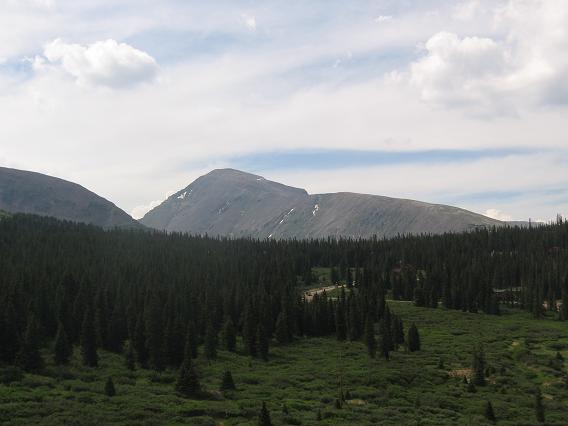
A view from the road up Hoosier Pass
Victoria enjoying the early morning hike
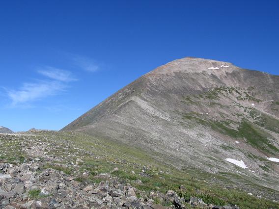
The upper route on Quandary
And finally the summit, can you see Cameron, Lincoln and Bross in the background?
And last but not least a picture of Horton the Quandary Wonder Dog. Horton lives at the base of Quandary and tags along with hiking groups year round. Victoria and I met Horton coming up as we were going down but never took his picture, duh! Wouldn't you like a hiking partner like Horton who always tags along and doesn't bail on you at the last moment? Quandary Peak Scramble: Class 1 – Steep Hiking Altitude: 14,265 ft, Trailhead 10,850ft Elevation Gain: 3,400 ft approx, Round trip 6.75 miles Start Time: 5am to 8am to be on your way down by noon and avoid potential lightning storms Ascent Time: 2 1/2 – 3 1/2 Hours
Highlights This scramble is easy, has some great views of Cameron, Bross and Lincoln. If you’re lucky you will meet "Horton" the Quandary Wonder Dog. Horton, a gold colored lab lives at the base of Quandary and likes to attach himself to climbing parties and escorts them up Quandary. Probably has the record for most summits of Quandary. We met Horton on our way down as he had attached himself to a couple and their dog. Getting There Quandary Peak Trailhead – 10,850ft – No Restrooms From Breckenridge, drive 8 miles south on Colorado 9. Turn right (west) on the Blue Lakes 850 Road. Drive a few hundred yards and turn right on the McCullough Gulch 851 Road. There is a sign for the Quandary Peak Trail at this junction. Drive 0.1 mile to a small parking area on the right side of the road. This is the trailhead. The U.S. Forest Service has installed a sign/kiosk that faces away from the road. Walk up the road to the next corner and the trail starts on the left. This is a new trailhead and replaces the previous trailhead 1 mile up the road. The new trailhead is fairly small (perhaps 7-8 vehicles) so come early for the best parking. There is parking along the road further up. Camping From the new trailhead you can drive a couple of miles up the road to McCullough Gulch trailhead. Near the end of this road stay left, don’t take the road down into the Gulch and you will come to the end of the road where there is a locked gate. This is the McCullough Gulch trailhead. Along this road and at the locked gate there are a few spots and pullouts that could be used for dispersed camping. Of course there is the old sleep in the vehicle at the new Quandary trailhead if you want the earliest start.
Route Description The Quandary Peak Trail starts across the road from the trailhead and winds its way up the slopes all the way to the summit. Once on the trail it’s almost impossible to get lost. As you near what you think is the summit (ie some red colored rocks) you are close but the true summit is a hundred yards of fairly level hiking farther back. The descent takes almost as long as going up due to the type of rocks and terrain. Rocks on the trail are baseball size and it is hard to descend very fast.
|