
Pittstown is a rural community in Alexandria and Franklin Townships in western New Jersey. The map underneath the inscription "R U Lost" is of Hunterdon County. |
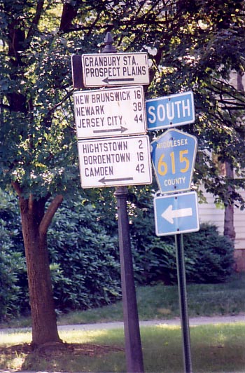
This assembly in Cranbury, NJ, dates from the days when NJ 25, the main route from New Brunswick to Camden in the 1930s and 1940s, passed through town. Traffic now bypasses Cranbury on US 130, which probably accounts for the town retaining much of its charm. |

This appears to be either a restored sign or one designed in a 19th-century mode. It is located on US 6 in Windham County in eastern Connecticut. The use of the term Free Soil dates it to the mid-19th century. |
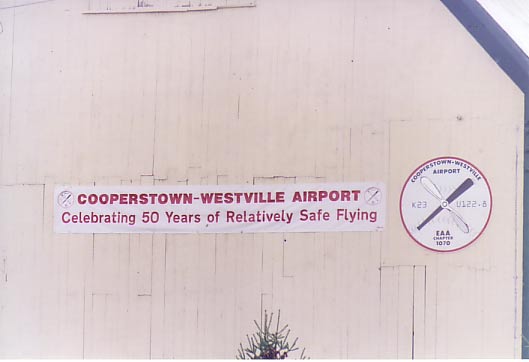
This sign would not encourage me to use the airport's facilities. My brother, who lives in the area, told me that there was a fatal accident here a few years back. The Cooperstown-Westville Airport is a grass landing strip in the town of Milford, NY, a few miles south of Cooperstown (note the shape of the darker propeller blade on the airport insignia). |
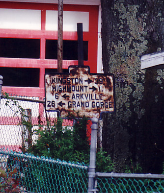
This old directional, somewhat the worse for wear, is on the grounds of a motel in Fleischmanns, NY. New York was very precise in its mileage; note the distance to Highmount of 1 1/2 miles. The last time I passed by, this sign had been painted over in white, possibly in anticipation of restoration. |

So far as I know, this directional at the Highmount, NY, crossroads is unique in New York and was probably erected locally. Traffic from the Belleayre and the now-defunct Highmount Ski Resorts reaches NY 28 here and the village of Fleischmanns no doubt was intent on attracting the skiers' business. Those state route shields have been there a while too. The road on the other side of Route 28 leads up to a condo development on the site of what was the Grand Hotel, the largest of its kind in the Catskills. I remember as a child visiting relatives who lived for many years on Belleayre Mountain and looking across the valley at the hotel. It was demolished in 1963. |