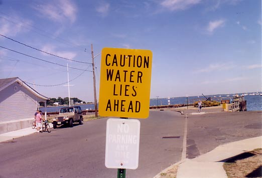
Apparently, this sign on Broad St. in Keyport, NJ, is for the drivers who don't see Raritan Bay in the distance. |
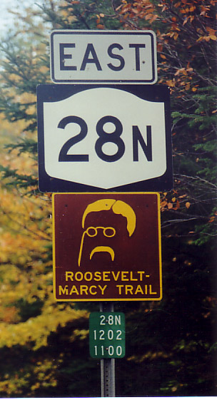
Bully! Theodore Roosevelt was vacationing at Camp Tahawus in the Adirondacks when word reached him that William McKinley, recuperating from his shooting in Buffalo, had taken a turn for the worse and was sinking fast. Roosevelt raced by horseback and stagecoach to North Creek, where a train sped him to Buffalo, but he arrived 13 hours after McKinley died. NY 28N follows Roosevelt's trail to North Creek. A roadside monument marks the approximate spot where Roosevelt became President. Roosevelt had been called to Buffalo when McKinley was shot, but had returned to Tahawus because McKinley seemed to be recovering and Roosevelt did not wish to appear to be waiting for him to die. Mount Marcy, the highest peak in the Adirondacks, is nearby. |

Many old highway bridges in New Jersey bear markings such as this displaying the road's pre-1953 number, but this one goes all the way back to the earliest numbering system in New Jersey, instituted in the 1920s. Route 12 ran from Paterson to Phillipsburg, parallelling the present-day US 46 and NJ 57. Some segments of the old road that did not become part of the new are still in use, such as Fairfield Rd. in Fairfield and this section of Old Bloomfield Ave. in Montville Township (Pine Brook). |

For years, I stopped at this light at the corner of Valley and French Hill Rds. in Wayne, NJ, and wondered when someone in the county highway department would realize that the arrow pointed right (properly), not left. Apparently, they never did, because the sign remained until a recent overhaul of the intersection. |


These old welcome signs have survived because NY 30, which once entered Schoharie (Sko-HAR-ree) here, has been realigned. The road now ends at Schoharie Creek, where a covered foot bridge built by convict labor spans the stream.
|