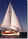
 The Comfortable Pocket Yacht
|
|
|
Trailer Sailing |
The Florida Keys Cruise - Part Two November 13, 1998 This day was a the time to stock up on provisions and plan the next phase of the trip. I did confirm that there is sporadic water taxi service in Key West and channel 68 was the calling channel for service. The taxi ran mostly during the morning hours and then again after 5PM. I wrote a sail plan and gave it to Sue who would pass on the information to the Coast Guard if I failed to return on schedule. My plan was to leave Sea Bird Marina on the morning of the 15th and sail down the northern ICW route to Key West. This route would take me north at Moser Channel up Big Spanish Channel and then southwest to the entry into Key West Harbor. I would then wait in Key West for appropriate weather conditions to travel to the Marquesa Keys for one or two days prior to returning to Key West. I would then follow the same route back to Sea Bird Marina and arrive not later than 11/30/1998. I also spent a number of hours talking to Bill about his wooden boat the Key Bee and his plans to cruise the Keys till April. We went over some of his requirements and I described the electrical provisions on my boat. We did do some tests on his solar panel and I showed him that his flexible panel was not producing any electricity in the early evening while my panel was still at 12.7 volt output. Bill decided to investigate replacement of his panel during his next three week projected stop in Boot Key harbor. At that time, Bill also wanted to see about picking up a muffin fan similar to the one I had. Bill was using an oil lamp for cabin lighting and had a Loran unit for position information. Bill's prolonged refit was due to the fact that his boat had suffered major damage during a tornado last year and many halyards and sheets needed to be replaced. This was in addition to a rebuild of the aft starboard deck area that had been destroyed when the vessel slammed into a dock. During the time I was there, Bill had lowered the mast three times to adjust some of the rigging and anchor light wiring. November 14, 1998 I traveled to Ft. Lauderdale again to visit the Sailorman facility and browse among all of the used equipment. The main purpose was to talk about a used watermaker - they had one that was scheduled to arrive soon. They would refurbish and sell at about $800 to $900 but I was most interested in a manual model rather than the electric unit. They indicated that manual models had not been available in the past. I then returned to Long Key and completed preparations for departure. November 15, 1998 I filled 3 six gallon containers with water and stored them in the cabin. I had also purchased an additional 5 gallons of bottled water to represent an emergency supply. I also had a total of 5 gallons of fuel mix (50 to 1) and a quart of 2 cycle oil to mix more as required. 08:30 - After almost one week of 10 to 15 knot winds from the east, the morning weather report is for winds of less than 10 knots from the east. With all sails up, I could barely make any forward progress downwind toward Key West. Time to fly the Iron Genoa and motor sail. 12:00 - Position at 24 degrees 47.48 North and 080 degrees 58.58 West 14:30 - I had been doing well with my navigation but on passing Marathon and approaching the seven mile bridge, I missed the turn at Bethel Bank. I suddenly saw brown water dead ahead (Brown, Brown, Run Aground) and turned hard to port. A quick scan of the area showed that I was about 1/8 mile too far north and had missed the marker for the shoals. This was easy to correct and I was soon back on course paralleling the bridge and crossing Moser Channel. Entering the lower portion of Big Spanish Channel, I need to continually watch the grass and weeds that wrap themselves around the motor and create drag as well as reduce water circulation. I slow down to clear this accumulation about every 20 minutes. 15:55 - Sunset is at 17:40 so I need to pick an anchorage fast. I decide to enter Big Spanish Channel and anchor in the lee of Little Pine Key rather than try to anchor off Bahia Honda Key. 18:19 - I drop the hook in the approaching darkness in 7 feet of water. Turn on the anchor light and arrange a quick bath in the cockpit. I had been concerned about the right soap for the ocean but found that the "SoftSoap" product I used at home was fine for salt water. Dinner was a quick heating of a can of chunky soup followed by a toast to the stars with an ersatz painkiller. Given where I was, I would not be able to make Key West the following day. The trip up Big Spanish Channel to the light at Harbor Key was relatively short (about 15 miles) but the trip from Harbor Key to the Northwest Channel marker at Key West was 29 statute miles followed by another 7 miles to the anchorage. Therefore, my plan would be to make tomorrow a short day and reach either Cudjoe Channel or Johnson Channel for the evening. Hopefully, this would enable me to anchor earlier when there was still daylight. The boat was relatively quiet during the night but I did awake in the midnight time frame and look around to confirm that I had not dragged at anchor. I could still see the strobe lights from the Navy Base radio towers and the glow on the Horizon from Marathon in roughly the same position so anchor drag was not a problem. However, I was amazed at the number of stars visible. Being accustomed to the night sky in a suburban area, I had forgotten just how bright and star filled the sky was once you got away from the light pollution of the "civilized" world. November 16, 1998 The morning forecast had changed dramatically - last night the forecast was for clear skies and 10 knots wind from the east. Now, the sky is dark with clouds and obvious rain in the direction of Marathon. The forecast is for heavy showers with rain at 1 inch per hour in spots throughout the early morning hours. The storms were forecast to move out of the area by late morning. I stayed at anchor and read my charts and a cruising guide again while waiting for the forecast clearing. By 09:15, the heavy rain arrives and I loose sight of Bahia Honda and all but the nearest keys in the storm. 11:00 - Locally and to the southeast, the sky has cleared but the weather report indicates heavy rain currently in Key West. I raise anchor and proceeded up Big Spanish Channel with motor alone since there is now no wind since the rains passed. 13:49 - I have passed the last of the Big Spanish Channel markers and am heading for the marker at Harbor Key. The shoal area of Big Spanish (just at Big Spanish Key) is well marked but VERY narrow. Looking at the succession of markers on the northbound route, each is easy to identify since they stand out against the empty horizon; however, looking over my shoulder at how the return journey will look is another matter. The markers for a southbound passage are very difficult to see since they blend in to the mangrove keys and navigation in this direction will need to be much more carefully done - I make a note not to try this passage except in good light. I still need to continually watch the grass and weeds that wrap themselves around the motor. I slow down to clear this accumulation about every 30 minutes. 14:25 - I'm in the clear north of Harbor Key shoals and have turned for Cudjoe Channel and Key West. I am still trying to sail down wind but make absolutely no progress in the calm conditions so motor sail southwest hoping for occasional gusts to assist with my progress - what happened to all the great sailing conditions from last week. I begin to monitor fuel consumption more closely. Fortunately, the weed problem seems to be gone in this part of Florida Bay. 17:04 - At anchor in Cudjoe Channel position 24 degrees 45.95 minutes North 081 degrees 33.56 minutes West. I had wanted to anchor earlier and in a better position in the lee of a Key but this was not really possible. I anchor at the edge of the channel where there is still significant chop and the boat rolls at anchor. November 17, 1998 The forecast is for winds from the southeast at 10 knots with 1 to 2 foot seas inside the reef and a light chop on the Bay and nearshore waters. I believe this is really a local code for zero winds since there is nothing moving here. 06:23 - A lobster boat passes outward through Cudjoe Channel and the wake almost knocks me out of my berth. I get up to see what is going on and observe a large gray shape rise out of the water to just breach the surface. A sigh is heard and the shape sinks slowly back below the surface. A Manatee! I guess I was not the only one disturbed by the passing boat. 07:00 - Under way again and in a hurry to reach Key West. The GPS reports 19.9 nautical miles to the marker for the Northwest Channel at Key West. The sails are up looking for any help from mother nature but winds have disappeared. 08:30 - The sky ahead shows thunderstorms and rain but it looks like they will pass north of my course - there goes my chance for a fresh water rinse without using my own water supply. 10:09 - I'm still sailing on the 20 to 25 foot depth contour with the GPS reporting 9.95 nautical miles to the channel marker. For the first time, a breeze starts up out of the southwest and my speed picks up. 11:00 - I'm approaching a heavy squall line and the winds are really picking up. Speed is up accordingly and I make really good progress . 12:00 - The GPS reports 3 miles to go and a position of 24 degrees 39.55 minutes north 081 degrees 50.71 minutes west. A strong storm is moving out of the southeast from Key West to cross my path. Heavy rain is visible with the storm front and I am uncertain as to the best course of action. As the storm front gets closer and turns much more threatening, I decide to drop the sails and close the companionway hatch to keep the interior dry during the frontal passage. As I pass through the squall line, the rain is just on the north of my course so again I miss out on the fresh water rinse. The winds blow hard with gusts in every direction and a chop builds. I'm glad I buttoned everything up and dropped the sails. 13:00 - I am now past the channel marker and on the approach into Key West Anchorage. A number of larger fishing boats barge in at speed raising a wake that I must be careful of. The Coast Guard is broadcasting warnings due to a cruise ship leaving the harbor and bound for sea. I can see the vessel and am relieved that it is southbound and will not cross my path. 14:00 - I review my charts again and find I have moved too far south and am now off Tank Island. I move further north and look for a suitable spot to anchor. Shortly, I select a spot just behind and to the north of Wisteria Island. This seems far enough away from the traffic and protected from wind and wave action. I drop the anchor in 9 feet of water. I do notice the hull and mast from a sunken vessel directly ahead and a vessel out of the water and up on some shoals ahead of it. 15:00 - A hot meal and two cups of coffee put me in a more relaxed mood in anticipation of an excellent view of the approaching sunset. A Degero Pilothouse Motor Sailor (28 foot with a canoe stern, roller furling main and roller furling jib) travels by and I wave to the owners and call out about the great look of their vessel - they wave in return but keep on moving. As it passes, I notice that there is a German flag on the stern staff and an American flag on the starboard spreader. Within an hour, the Degero has returned and comes close by - I call out in German this time and get a surprised answer back. The vessel comes closer and we discuss how good the anchorage is - I admit that I have just arrived and have no idea - they take a chance also and drop anchor about 150 feet away. I have 100 feet of rode deployed and appear to swing at anchor a little more than the boats around me however, most of them are larger vessels and appear to be using chain for their anchor rather than nylon rode. At this time, I continue planning for the next phase of this trip with the crossing to to the Marquesa Keys. The GPS shows this is 18.6 nautical miles away and the weather forecast continues to be for winds from the east to southeast at 10 knots with 1 to 2 foot seas inside the reef and a light chop on the Bay and nearshore waters. So far, I get the distinct feeling that I'll need to provide more fuel on board - at least for the return trip which will be directly into any wind, seas, or chop that does manage to come up. The westbound trip required 3 1/2 gallons of fuel and I have tankage to store 6 gallons. I'll try to pick up an additional 5 or 6 gallon tank prior to the return trip to Long Key. In the morning, I'll hit the fuel dock and fill up my tanks prior to leaving. My water usage so far has been minimal. I had planned for 1 to 1.5 gallons per day for all purposes assuming a little more than 3/4 gallon for drinking and the remainder for washing. The first day, I used more for drinking due to the heat but the next two days were cloudier and I am back on plan with the water. The ration system is simple since I transfer all water from the 6 gallon tanks to a 1/2 gallon jug I keep in the cockpit and can keep track of how often I refill the cockpit jug each day. This jug also makes a serviceable shower but I'll also pick up a solar shower device when the opportunity presents. I had wanted to do this during the outfitting but it fell off the list for some reason. Decision time about ice - I have been without ice for three days since I really do not need to refrigerate anything. All food is in cans or dried so the only use for ice is for drinks. No real need for this so I'll continue to do without this luxury. 17:40 - Sunset and a great view. Another ersatz painkiller to celebrate. This recipe is starting to grow on me. November 18, 1998 07:30 - A quiet ration of hot coffee to start the day. The weather forecast has changed to include a 20% chance of rain with scattered thunderstorms. A low is projected to pass through the area the next day and by Friday a high pressure system is to settle over southern Florida. The cruising guide says that boats with 3 to 3.5 feet can pass to the inside of the Marquesa Keys and stay there in shelter. I decide to take off and return to Key West by Friday evening. 08:30 Everything is stowed and I up anchor to go to the fuel docks. The chart shows good water south between Wisteria Island and Tank Island even though a number of boats have gone north around Wisteria Island staying close inshore. I go south and am immediately hailed by the German couple who have just come on deck. I pass close by and we exchange good mornings - they invite me aboard to talk some more so I tie off to their stern cleats and hop on. For the next almost two hours, we manage a reasonable conversation between my German and their English. Willy and Marlene are from Germany and have had their 3 year old Degero 28 Motor Sailor transported to the USA on a Freighter. They have a one year cruising permit and have just started from Ft. Lauderdale. From Key West, they plan to take IDUNA north along the western coast of Florida and then across the Okeechobee waterway back east. They then will slowly make their way north and plan to spend the summer months in the Chesapeake Bay before returning to Florida and shipping their vessel back. Willy was a chief engineer for an oil company and filled a role as trouble shooter on their tankers. His last assignment had resulted in significant lung problems so that he had spent a considerable amount of time on oxygen. Now, they had decided to make this trip while they still could since there had been an improvement in his health to the point that he could do without the oxygen tanks if he took it easy. We discussed my plans and they indicate that they will probably leave Key West on Friday for Naples. After parting company with Willy and Marlene, I fill up ($1.50 per gallon) at Conch Harbor's fuel dock in the Key West marina area and ask about a 5 gallon gas tank. The dock master allows me to tie up at a finger pier and gives me directions to a local marine supply store where I pick up a 6 gallon tank. On the walk back up the dock, I stopped off and talked to Ben aboard the Phoenix. He was getting prepared to voyage across the Gulf to Texas and Timora had already returned home due to pressing business requirements. The interesting thing about this walk is that the land seems to be moving - too many ersatz pain killers? or do I really have my sea legs? 10:30 - After filling the 6 gallon gas tank and securing it in the cockpit, I'm off down the southeast channel out of Key West. At the channel exit, I meet a small Hawksbill Turtle that looks up and then dives for the bottom. The morning breeze selects this opportunity to die off completely so I'm back to motor sailing 13:20 - . I pass a Portuguese Man Of War. The pale violet gas bag "sail" and bright color of the trailing tentacles are warning enough that this is a creature to be avoided - and I do not have the recommended ammonia treatment aboard in case I should meet one up close and personal. 14:30 - The Marquesa Keys are dead ahead and I make for the gap reported to have been staked with a route to the interior. Nothing visible and a lobster boat makes a wide detour past the entrance I had been heading for. The depth finder shows rapid shoaling and the angle of the sun doesn't help me in trying to find a safe passage - all the water ahead shows the brown of shallows. 15:54 - I have moved south along the coast and tried two more approaches in the area of the Gull Keys - still no luck at a passage to the calmer interior that is clearly visible. I can see a larger sailboat at anchor on the other side of the islets through a gap in the chain but it too is outside. With the approaching sunset, I anchor in 6 feet of water at 24 degrees 32.55 minutes north and 082 degrees 08.52 minutes west. Mission accomplished, I have made it well past the end of the road. After dark, I see three lobster boats make a very careful approach at a crawling speed and anchor closer in so there must be a partial channel for knowledgeable local sailors. I'm stuck out and the chop is enough to roll the boat by more than 20 degrees side to side. Additionally, the updated weather forecast does not sound promising with increased winds and small craft advisories. This evening is the best yet despite the continuous rolling of the boat. There is only a faint glow of artificial light in the eastern sky from Key West. Mother nature has arranged an even better show to the distant west with a strong thunderstorm and fantastic streaks of lightening. Overhead, the stars are simply spectacular with occasional meteors from the Leonid shower. The interesting thing about this to me is that the tail of the meteor is visible for so long. I am accustomed to seeing little more than the bright glow of the meteor head itself and have not been able to notice the extensive tail as it slowly fades away. November 19, 1998 06:20 - The sunrise shows that the lobster boats I saw last night have already departed from their raft-up. The winds are 10 to 15 knots from the northeast and the seas are 2 to 3 feet and projected to rise along with the winds. Conditions do not look good and the forecast is worse. I'd rather not spend another night at anchor in the projected conditions so even though I'd like to stay and explore, it's up anchor and off back to Key West. I steer 180 degrees looking for deeper water and hoping to avoid the two coral heads that the chart shows. Once I find the 20 foot contour, I turn to 090 degrees and try to make some progress into the seaway. Tacking against this is doable but really not comfortable. Looking at the chart, I feel that turning northeast into Boca Grade Channel and making for the Northwest Channel entrance into Key West would take me a little longer but I would have some protection from the lee of Boca Grande Key and the lee of the shoals of "The Lakes" region. The main drawback of this course would be the presence of unmarked shoals in the channel. I turn up the channel anyway and spend the next few hours trying to read GPS, Chart, Compass, and still tiller steer. This is hopeless since one or the other tasks generally fails and I find myself way off course. I now understand why someone would want to install a tiller steering autopilot on a small boat. Fortunately, I make enough headway against the seaway - better than trying to slog head on into 2 to 3 foot seas. The spray still flies and I am pounding into a chop so the hatch is closed to keep things as dry as possible. Suddenly, the sea surface ahead of me becomes confused and lighter in color - simultaneously, the depth finder which had been showing 15 feet jumps to 6 feet and begins indicating even more shallows - is this the shoal indicated as 2 feet? I luck out and the depth finder never indicates less than 3 feet before the water deepens again and I'm back to pounding against a significant chop. I had traveled quite a bit due north in order to avoid the marked shoals and now start a turn to the east as I near the charted route from the Dry Tortugas to Key West. As I continue to steer more easterly, I do find myself outside the three mile limit and this marks another goal for me. The channel marker for Key West is now 6 nautical miles distant and the wind is shifting and building along with the chop. The worst of the chop appears to be as I move northeast. A Coast Guard patrol boat passes by to the north and turns for home while a large ketch rigged sailboat passes south and cuts the corner of the channel marker. At my rate of progress, both of these boats will be in Key West with their crews enjoying a cold beverage before I even get to the channel entrance. 12:00 - I've turned the corner and sail southeast following the channel. A large tour boat races down from astern and creates a 3 foot wake that I must quickly adjust to. From this point, I keep a closer watch astern so that I don't get surprised again. Once abreast of daymarker Green "15A", the lee of Key West is more noticeable and conditions steadily improve - however, I do see another Portuguese Man of War floating nearby. I do wonder if this is why the adjacent region is named Man of War Harbor on the charts. I intend to anchor for a few days and rest up in the calm conditions here so I tour the entire anchorage looking for a location. The area all the way north along Flemming Island seems like it would be the most quiet but right now, it is crowded. The area east of Wisteria Island has a few spots that I could use but this would expose me to more powerboat wakes. I determine to anchor behind the shoals north of Wisteria Island again and move to Flemming Island to try it out before I leave. I use the rest period to clean up the boat and take a relaxing swim. I am still using the first 6 gallon water tank so I can splurge a bit on the fresh water rinse. November 20, 1998 07:20 - While fixing breakfast, two dolphins swim by 15 feet from the boat. I jump for the camera but get to it too late. They swim about 100 feet away from the boat for 10 minutes collecting their breakfast also. I am kicking myself that I did not have the video camera out and ready for use. 10:30 - A lazy day and I read while watching the military hold paratrooper jump operations on Flemming Island. 12:10 - I decide to go ashore and have a small celebration so I call the water taxi on Channel 68. By 12:35, I get an answer and Captain Ric comes alongside 10 minutes later. Ric tells me he generally operates from 08:00 to 10:00 and again from 17:00 to 02:00 or whenever. He can be reached on Channel 68 or by cell phone at 305-304-5822. During the trip to the dock, he points out a motor sailor in a slip and comments on how nice it looks - it's Willy and Marlene so I wave to them and call out. Ric drops me off in front of Turtle Kraals restaurant and I go over to IDUNA and practice my German again. Willy and Marlene have been on a brief tour of the area and have decided to splurge on a one week stay at a Conch Harbor slip. They also have decided to visit the Dry Tortugas as soon as their week in a slip is up. We discuss my experiences and the need to watch for a weather window before trying it in their 28 footer. They also tell me that they had inquired about a one or two month stay at Conch Harbor and were told that all slips were reserved during the Christmas time period and again during the mid to late January time period. We agree to meet in two hours at Sloppy Joe's Bar on Duval Street and drink to the memory of Hemmingway as well as to our own trip. After a large Margarita for me and Willy and a Rum Runner for Marlene ( a new experience for both of them), we part company but exchange email addresses so that we can keep in touch. Marlene says she will return to Duval Street with her video camera - her intention is to create a video record of the experiences that she can even play back on her deathbed as a reminder of the special times. I call Ric on the cell phone for a pickup and also buy a bag of ice to take back to the boat. During the return trip, I talk to Ric about the entry to the inside of the Marquesa Keys - he says there is a path open that I could use on the south side. Well - that sounds like a reason to go back again. I should have asked around for more local knowledge before going there. Speaking of local knowledge - for those of you that may want to avoid
water taxi fares, the current (November 1998) dinghy dock fees at the Key West harbor are
as follows: Once back on the boat, I celebrate with a glass of Ice Tea - even with ice in it. Ice is one of the things I really thought I would miss most since I use so much of it at home - not true. However, now with a full glass and lots of ice, I consider it as more of a special treat and cold drinks are no longer an absolute requirement. November 21, 1998 The weather forecast is for a frontal passage tonight or early Sunday. Winds building and seas to 4 feet inside the reef. Sounds like a perfect occasion to stay at anchor and read a good book. I finally figure out the rigging noise that has bothered me over the last two days. At anchor, as the boat swings, the anchor roller shifts from side to side slightly and clicks. Inside the boat, this noise sounds like the shrouds are being hit with a hammer but outside, I can barely hear it. 13:20 - A pod of dolphins returns swimming 50 feet from the boat - more than 2 this time and I dive into the supplies looking for the video camera. I come up on deck in time to get a few minutes of pictures as a momento. The revised forecast is for winds rising to 20 knots with gusts and a cold frontal passage late tonight. I empty the last of my first tank of fresh water - not too bad considering that I have only used 6 gallons during the trip so far. A nice long swim is almost a mistake since I fail to realize there is a current in the harbor and the swim back is a real chore - next time I won't be so ambitious on the way out and reserve more energy for the return. The remainder of the afternoon and evening is spent reading and doing small chores around the boat. I consider turning on the radio to catch the world news but determine that its just not worth it. November 22, 1998 The wind is gusty and 15 knots but the forecast now calls for the front to pass by tonight. I spend the morning thinking about my experiences during the past year and what I would like to do next year. The remainder of the time is spent reading and checking charts for the projected return trip tomorrow. 11:30 - The anchorage here is somewhat noisy at night due to the late night live music in the restaurants on shore. I move to the far north along Flemming Key and anchor there. 15:38 - A Com-Pac 16 (sail number 2083) goes past with three people on board - nice to see another Com-Pac in the area that is actually getting some use. 16:50 - A Ranger 26 sails up close and anchors - the owner gets in his Kayak and comes over to talk. Peter is another German on two months vacation in the Keys - he has owned 7 boats previously and even crossed the Atlantic in his steel sloop a few times. He climbs on board and we talk boats till dusk. He wanted to sail the Com-Pac 19 but it is really too late and I plan on raising anchor at 06:30 tomorrow for the return trip. 19:00 - The front finally arrives and the wind starts to howl. No real problems since the anchorage is in the lee of Flemming Island and very well protected. November 23, 1998 06:30 - Up anchor and motor down to the fuel dock to top off all tankage. I expect to have to motor almost all the way against a significant chop today. The forecast includes winds to 20 knots and small craft advisories. The winds are expected to die down later in the day with the seas calming later still. 07:54 - I cut the corner at the red daymark "12" and turn due north rather than follow the channel. This route will clear the shoals and save me a mile or two by passing outside the harbor's submerged jetty. 09:06 - Heading is for Harbor Key light and the entry to Big Spanish Channel with 25.1 nautical miles to go. The chop is wild and the spray cold. I'm wearing Foul weather gear to avoid the worst of the conditions. 12:00 - 14.2 miles to go. I've taken off the foul weather gear but the salt spray has completely coated me and the boat with salt crystals. I wipe the solid salt off the solar panel to keep up the battery charging. 14:20 - As the reader is no doubt aware, things have been going far too smoothly. and it's time for Murphy to step into the picture. The motor dies and will only restart for a minute or two before dying again. This goes on for several tries till I decide that this is hopeless. I'm opposite the Contents Keys about 1.5 nautical miles off the shore so I raise sail and head to some shelter in shallower water and see if repairs are possible. 15:30 - I'm at anchor in 7 feet of water but not really in a sheltered position. The motor still refuses to run for more than a minute or two at idle before quitting. Everything points to a fuel supply problem or maybe the air bleed into the fuel tank being clogged from the salt spray. I determine that the air is not the problem since the motor still quits if I leave the gas cap off the tank. Therefore, time to open up the cover of the engine and start tracing the fuel supply. A quick inspection shows that there is a fuel filter and I do not have a spare. Fuel does appear to flow fine all the way to the fuel pump but it must be just marginal. I have no spare filter and no fuel hose to bypass the filter for tests. After much searching, I find a mechanical pencil where the barrel of the pencil is about the correct diameter to use for a fuel filter bypass. I cut the barrel to length with a section of saw blade from the tool kit and insert it into the hose - low and behold, the motor starts and runs fine on the first pull. I carefully inspect the fuel filter and find I can blow air through it and fuel appears to run fine - it just appears to provide too much resistance for operation. Since I'm not sure about how the plastic of the pencil barrel will hold up when exposed to gasoline for more than a few minutes, I punch a hole through the filter element of the fuel filter with a very fine tipped screw driver and rinse out any debris. I then replace the fuel filter in position and the motor appears to run well again. I have always heard that problems come in threes but I clean up and have everything ready for an early morning departure by 17:30. The forecast is for 40% chance of thunderstorms this evening and 20% tomorrow with winds of less than 10 knots. November 24, 1998 06:30 - Hoist anchor and start the motor - it works on the first pull and does not fail. I steer a course of due north looking for deeper water and once again turn for the Harbor Key light as soon as I hit the 20 foot plus contour. 07:15 - The motor does not seem at 100% but it works good enough. This is a major relief since the wind is effectively zero and the sea is as calm as glass - what a change since yesterday. Only 3.92 nautical miles to the entry point on Big Spanish Channel. 8:21 - I'm past the light at Harbor Key and steering 168 degrees looking desperately for the next marker. The day markers are impossible to see against the low mangrove islands. There are mats of floating sea grass and pine needles all over the channel. 10:00 I'm sweating bullets with the exposed shoals on either side of the channel. This section is very narrow and I have found myself in 3 feet minus several times already. It's low tide and there is no margin for error. The cormorants and wading birds are standing on the shoals like vultures waiting for me to make a mistake. The bottom is clearly visible when the mats of floating debris allow. I check the engine and clear away more accumulated debris from the water intake a number of times. There is a significant tidal current that keeps the lobster pots pointed north and moves mats of sea grass and pine needles from the prior storms around the channel. 10:15 - Just south of Big Spanish Key and I shut of the motor when I see that no water is circulating. I clear the intakes again and the motor runs at idle but above idle, the water circulation quits and I have to shut the engine off. Murphy has struck again! It's about 10 nautical miles to Bahia Honda but the park is closed so that will not be of any help. Frank Pappy's cruising guide refers to a marina at Sunshine Key and I try to raise them on the VHF radio several times - no response. I know that there is no way to repair this since I don't have a spare impeller and I suspect that there is chopped up grass already up in the cooling tubes. This is a major problem since the wind is still at zero and I can only get about 3 to 4 miles out of my electric motor. Option one is to wait till later on in the day and hope that the wind builds enough to sail south and see what help I can get once I get closer to the inhabited keys. Option two is to get a tow in to a marina where I can get repairs made. Option three is to get a tow to a marina with a deep water ramp where I can pull the boat from the water. As a cross-check, I used the cellular phone to call Sue at Sea Bird Marina. Joe was there but did not know of any marina's in my area with a good ramp. Looking at the chart and listening to the weather forecast, I feel that it may take till late tomorrow to sail south and find others to talk to on the radio about repairs or ramps. I'm not comfortable with this arrangement so I call Boat/US at Marathon for a tow in. The 25 watt radio with the mast head antenna operates like a champ and communications are clear. This takes a while since I give them a daymark location reference from my chart and forget that all the daymarks have been renumbered. The tow boat they send out has lost radio communication so they must get relay's from Marathon. I finally report my Latitude and Longitude from the GPS and they figure out the problem and get there for the tow. While waiting there at anchor, a manatee surfaces about 15 feet away and again about 10 minutes later a little further across the channel. When they arrive, Steve (the tow boat captain) and his daughter are is as puzzled as I am about where to go since there is no marina in the vicinity that they know about with a really good ramp and the nearest marina with a lift is oceanside and that would even more trouble. Steve has me call Sunshine Key again but there is still no answer on the radio. Time to try another direction so Steve gets out the cell phone and calls home to get the number and then calls Sunshine Marina via cellular. Sunshine claims that they have enough water at their ramp for me to pull out but they are closed due to hurricane damage and will not open till the weekend. Given the situation, they agree to let me pull the boat at their ramp so I get hooked up for a tow in. Halfway there, we do slow down to observe another pod of Dolphins playing at the foot of Big Spanish Channel. About this time, Steve's 200 HP motor quits when it ingests a big chunk of sea grass. Steve is able to clear it and we continue to within site of the opening to Sunshine Key marina and it's privately maintained markers. Murphy uses this opportunity to raise another objection to a smooth completion of this voyage when Steve runs out of gas. Fortunately, I still had 8 gallons on board and no motor to use it in so Steve transferred it (along with a spare quart of two cycle oil) to his tanks and we were under way again in 10 minutes without having to call for another tow. Steve repaid me for the gas with a considerable break in the towing bill. Once we got to Sunshine and checked out the marina ramp, it seemed like it might work at high tide and they agreed to let me tie up alongside their fuel dock for the night while I got my car and trailer ready. Sunshine personnel were hard at work on rebuilding and getting ready to re-open the marina for December 1st. Steve also called a local Taxi for me so that I could get to Long Key and retrieve my car and trailer. Jenny the taxi driver appeared about 30 minutes later and I got up to Long Key and Sea Bird Marina where I settled the bill with Sue and Joe, got my car and trailer, and returned to Sunshine Key marina for the night. I debated if this was the best decision and if I should have tried to sail in instead of the tow untill about 19:00 that night when I heard the weather forecast and the special marine warnings for 35 knot winds, strong storms moving out of the everglades and traveling southwest across Florida Bay, and advisories for all vessels to stay in port until the storms passed. The storms hit later in the evening with strong winds, gusts, and heavy rain so I was glad to be in port. November 25, 1998 06:30 - The storms have mostly abated and there are only occasional rain showers and wind squall lines moving through the area. The next high tide is due at 15:36 and I measure the water depth at low tide at the foot of the ramp to be about 3.5 feet. I'm still uncertain but as a practice drill, I backed the trailer down the ramp at low tide and see that there is no problem - I could pull the boat now if it were ready. 10:00 - I have everything tied down and almost ready for the return. I had wanted to stay in the Keys area till after the Thanksgiving weekend madness on the roads but if I leave now, I'll be on the road mostly during the least traveled parts of the Holiday. 11:30 - Everything is prepared and I load the boat to the trailer. This was the easiest load I have done since with the clear water, I can see the keel and that it is properly centered in the keel guides before pulling up the ramp. I move the boat to an out of the way location on the parking lot and go for a nice hot shower before starting the long drive back. 19:00 - I'm in a motel outside of Fort Pierce Florida and looking for a place to get a bite to eat. No luck - even the Waffle House has a line waiting for seating and the only other thing in walking distance is a McDonalds with a much longer line. A good night's sleep sounds like a better choice. November 26, 1998 The northbound trip seems easier since there is almost no traffic in the afternoon and I can make some progress without being paranoid of the other crazy drivers. I do see a few southbound sailboats on the road this time including two Hobbie Cats and a Marshall Sanderling along with one Corsair F24 Trimaran. By nightfall, I am just south of Atlanta Georgia and hold up for the evening. November 27, 1998 This is the Friday after Thanksgiving - one year to the day since I brought the boat home from Nebraska. Somehow, it is fitting that I'm approaching home again with the boat safely in tow. Reflections The trip was everything I had hoped for. I met a number of interesting people and saw things I would not otherwise be able to experience. Taking the time to get to know the people was one of the unexpected pleasures of the cruise. Ten days of single-handed travel and anchoring out every night was a test to see if I really wanted to continue sailing or if I would be better off staying ashore. The complete answers to this will need some additional thought since the experiences are still too fresh; however, I know now a little more of what could be in store and I have a better basis to make the judgement. I do know that I will be back to this area again. Maybe with the Com-Pac 19 or maybe with a bigger boat. For those of you that may be sailing on the Chesapeake Bay in the summer of 1999, or elsewhere on the east coast portion of the ICW, please keep an eye out for the sailing vessel IDUNA (28 foot pilothouse sloop with white hull and blue trim - German flag on the stern staff) and wish Willy and Marlene a good voyage. I have received one email from them already where they report on an unsuccessful attempt to cross to the Dry Tortugas. They got caught in 6 foot seas around the Marquesa Keys and had to turn back for Key West after a rough night at anchor. For those of you that pass by Sea Bird Marina, stop off and say Hi to Sue, Joe, Mokisatima, and Shadow. This marina isn't too fancy, but Sue and Joe are constantly working to make it better. The ramp is one of the few in the area suitable for fixed keel sailboats and the location with it's proximity to Channel Five makes for a good base of operations at very reasonable prices. For those of you sailing the Keys this winter, keep an eye out for Bill and his wooden Cornish Crabber named Key Bee (green hull with white deck - yawl rigged - seagull outboard). Sail up and say Hi - you'll enjoy the chance to chat with someone that intends to cruise the simple life for 6 months. Lessons Learned 1) Check out your spares collection and service records prior to
departure - I should have changed the fuel filter before trhe start of the trip and had a
spare on board. This page was last updated: 09/14/00 05:13:26 PM |
|
Copyright © 1998-2000 Jobst Vandrey |