|
The website was last updated May 2006. This site was created in 1997 as part of a high school geology class project. The original website, in all of its technicolor glory, can be viewed here.
|
Longs Peak rises commandingly above all else in Rocky Mountain National Park. It is one of the 54 "fourteeners" in the Rocky Mountains of Colorado. The peak reaches a height of 14,255 feet (4,347.8 meters) and can be prominently seen from Longmont, Colorado, as well as from the rest of the Colorado Front Range piedmont. The peak is named after Major Stephen Long, who explored the area in the 1820s. It is very popular to climb.
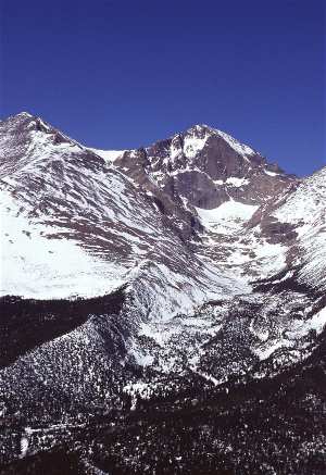 Photo Credit: Scott Bauer [via Wikipedia] |
When taken with its neighbor Mount Meeker, they are sometimes referred to as the Twin Peaks. This is not to be confused with another pair of mountains, called the Twin Sisters.
As the only fourteener in Rocky Mountain National Park, the peak has long been of interest to climbers. The easiest route is not "technical" during the summer season, and was probably first used by American Indians collecting eagle feathers, but the first recorded ascent was in 1868 by the surveying party of John Wesley Powell. The East Face of the mountain is quite steep, and is surmounted by a gigantic sheer cliff known as "The Diamond" (so-named because of its shape, approximately that of a cut diamond seen from the side and inverted - see image at right). Another famous profile belongs to Longs Peak: to the southeast of the summit is a series of rises which, when viewed from the northeast, resembles a beaver.
The first proposal to climb the Diamond, in 1954, was met with an official closure by the National Park Service, a stance not changed until 1960. The Diamond was first ascended that year, and the route was listed in Fifty Classic Climbs of North America, although today the "Casual Route" (5.10-) is considered a better climb.
As with Pikes Peak, there is officially no apostrophe in the name, although a number of Colorado residents continue to object to this ruling by the Board on Geographic Names.
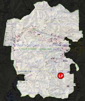 Map scanned by: Nina Drew |
No technical climbing is required to reach the summit of Longs Peak during the summer season, which typically runs from mid July through early September. Outside of this window the popular "Keyhole" route is still open, however its rating is upgraded to "technical" as treacherous ice formation and snow fall necessitates the use of specialized climbing equipment including, at a minimum, crampons and an ice axe. It is considered to be the most difficult non-technical fourteener in Colorado. Those intending to summit would be advised to read the National Park Service guide linked below for tips on proper preparation and equipment to bring. While the climb is non-technical it is by no means easy or without serious danger. The hike from the trailhead to the summit is 8.0 miles each way. Most hikers begin before dawn in order to reach the summit and return below treeline before the frequent afternoon thunderstorms bring a risk of lightning strikes. The most difficult portion of the hike begins at the Boulder Field, 5.9 miles into the hike. After scrambling over the boulders, hikers reach the Keyhole at 6.2 miles. The following quarter of a mile involves a scramble along narrow ledges, many of which may have sheer cliffs of 1000 feet or more just off the edge. The next portion of the hike includes climbing over 1,000 vertical feet up the Trough before reaching the most exposed section of the hike, the Narrows. Just beyond the Narrows, the Notch signifies the beginning of the Homestretch to the football field-sized, flat summit. It is possible to camp out overnight in the Boulder Field (permit required) which makes for a less arduous two day hike, although this is fairly exposed to the elements. According to the National Park Service, one person, on average, dies every year attempting to climb the mountain. In the summer of 2005 a Japanese climber was blown off a ledge after reaching the summit.
The text on this page was obtained/adapted from this page on Wikipedia