Unfortunately, the textual sources that relate to this frontier are far less useful than those that illuminate ancient Egyptian activity on its other borders, such as the "Semna Dispatches" from the Nubian Second Cataract forts (Smither 1945). There are no administrative documents, letters or other texts that reveal anything of the details of how this frontier functioned, or at least, not that we recognise as such. The only relevant ancient sources that document it in any way are certain texts, principally monumental inscriptions, which record the victories of the pharaohs Merenptah and Ramesses III over invasions from the west in the 19th and 20th Dynasties. In the course of these accounts, certain localities are mentioned, some of which are fortresses:
Merenptah, Year 5 (c.1270BC)
The king's victory against an alliance of primarily Rebu Libyans and the "Sea Peoples" is recorded on the walls of the Temple of Amun at Karnak and upon a stela from Athribis. Both of these sources refer to several locations involved in the battle. One reference describes how Merenptah pursued the Libyans from a fortress called "Merenptah, destroyer of Tjehenu (Libyans) ", in the district of "Per-Iru" to a point called "the mountain of Up-Ta", which translates as "the beginning of the Earth" (Breasted 1906a:239, 248, 255; O'Connor 1983:274). There is also a reference to the defeated enemy chief fleeing past the "Fortress of the West" (Davies 1997:161).
Ramesses III, Year 5 (c.1178BC)
Egypt was subjected to another attempted invasion by Rebu and Meshwesh Libyans, recorded at the king's mortuary temple at Medinet Habu. These events take place partly in the vicinity of a fortified settlement known as "(Ramesses III) is the Repeller of the Tjemehu (Libyans)" (Edgerton & Wilson 1936:13; Gardiner 1918:135).
Ramesses III, Year 11 (c.1172BC)
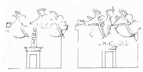
Six years later, a further invasion was staged by the Meshwesh that saw them routed between the "town of Ramesses III which is upon the mountain of Up-Ta" and "the town Hwt-Sha" (or Enclosure/House of Sand) (fig.i) (Edgerton & Wilson 1936:61-62; Gardiner 1918:134-135).
So what can we learn from these various sources?
Whilst we need to bear in mind that they were created essentially as propaganda for the king and in support of ancient Egyptian ideology, they are still an important source of historical information. Particularly important for us is the fact that they reveal several fortresses did exist somewhere on Egypt's western frontier, and that these were involved in its defence. However, beyond this they tell us very little about these forts.
For example, the "mountain of Up-Ta" is mentioned in the Merenptah and Ramesses Year 11 texts. This term was normally applied to the southern limits of Egyptian territory, but obviously it is used here with reference to the west, but where precisely is not known and neither is whether it refers to the same place in both sources (Breasted 1906b:60; Gardiner 1918:135; O'Connor 1983:274).
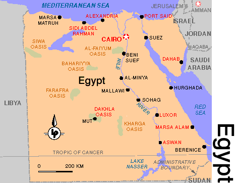
Furthermore, whilst there is little doubt that the locations mentioned in the various sources did lay somewhere to the west of Egypt, typically assumed to be along the coast and western edge of Delta, this need not necessarily be the case. The Merenptah inscription records that the invaders (or at least part of their number) had passed through the vicinity of the Western Desert Oases (see map below), perhaps Farafra or Bahariya (Davies 1997:155; Giddy 1987:48, 92, 97). If this is correct, perhaps the fortresses that played a role in this battle were further south than generally believed, near the Oases if not actually located there.
Thus we are left with a series of tantalising but insubstantial references. To identify any of these ancient toponyms with modern locations is more or less impossible. Some scholars have attempted to do so (see Daressy 1916:239-240; Gardiner 1918:135; Rowe 1953, 1954), but this is really nothing more than speculation. As the archaeological evidence from each of the proposed fort sites is discussed below, I shall mention these identifications where relevant, but as they are so uncertain we won't dwell on them too much.