"Virtual Hike" page 7:
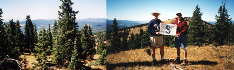
View to the southwest from Headwaters Hill
This is the view to the southwest from the summit of Headwaters
Hill. That's Windy Peak behind us: 11,862' above sea level. The town
of Sargents is about 10 miles on the other side (see
map). The Continental Divide follows the ridge between Headwaters
Hill and Windy; in this photo, the Rio Grande basin is to the left,
and the Gunnison/Colorado basin is on the right. If you have a decent
monitor, you can probably just make out the Colorado/Continental
Divide Trail behind my elbow (the guy on the left), making its way
across the south shoulder of Windy Peak.
From Windy Peak, the Continental Divide continues west and a
little south, over the Baldys in the Cochetopa Hills. I think that
tall mountain on the horizon (a little left of Windy) is Long Branch
Baldy. Basically everything left (south) of there drains into
Saguache Creek, while everything right (north) of there flows into
Tomichi Creek - a tributary of the Gunnison.