|
|
|
...
JUNGLE GEOGRAPHY ...

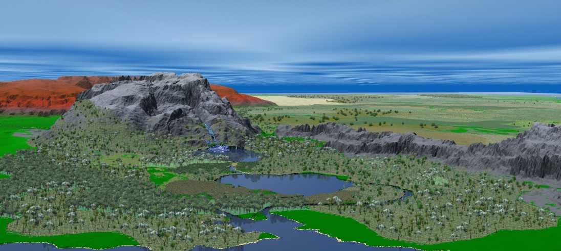
Lake Ushindi
(Victory) : Lake Ushindi or Lake Schendi, is the first of
the three known sub-equatorial lakes. Ushindi is filled by the
Cartius river (not the Thassa Cartius) and drained by the Kamba
and Nyoka rivers.
"Tell
me what you know of the Cartius," he said.
"It is an important subequatorial waterway," I
said. "It flows west by northwest, entering the rain
forests and emptying into Lake Ushindi, which lake is drained
by the Kamba and the Nyoka rivers. The Kamba flows directly
into Thassa. |
Ushindi then,
receives the Cartius river via the EAST-SOUTH-EAST shore which
means that it would be above (North) this river on a map.
Schendi
was an equatorial free port, well known on Gor. It is also
the home port of the League of Black Slavers.
"It was, at one time, conjectured," said Samos,
"that the Cartius proper was a tributary of the Vosk."
"I had been taught that," I said.
"We now know that the Thassa Cartius and the subequatorial
Cartius are not the same river."
"It had been thought, and shown on many maps,"
I said, "that the subequatorial Cartius not only flowed
into Lake Ushindi, but emerged northward, traversing the
sloping western flatlands to join the Vosk at Turmus."
Turmus was the last major river port on the Vosk before
the almost impassable marshes of the delta. |
Though most of this quote
speaks of what isn't (or what was proven NOT to be), it also gives
us interesting clues. First, that there are sloping flatlands
to the North-West of the lake (actually between lake Ushindi and
the Vosk river in the area of Turmus - which in turn is quite
precisely located for us). This quote also confirms that it is
more likely that the Cartius flows into Ushindi from the South
since it was once believed it went THROUGH it and came out on
the OTHER SIDE -- this theory could not have ever been even considered
if the Cartius has entered Ushindi from the North.
"Calculations
performed by the black geographer, Ramani, of the island
of Anango, suggested that given the elevations involved
the two rivers could not be the same. His pupil, Shaba,
was the first civilized man to circumnavigate Lake Ushindi.
He discovered that the Cartius, as was known, enters Lake
Ushindi, but that only two rivers flow out of Ushindi, the
Kamba and Nyoka. The actual source of the tributary to the
Vosk, now called the Thassa Cartius, as you know, was found
five years later by the explorer, Ramus of Tabor, who, with
a small expedition, over a period of nine months, fought
and bartered his way through the river tribes, beyond the
six cataracts, to the Ven highlands. The Thassa Cartius,
with its own tributaries, drains the highlands and the descending
plains." |
We now add two rivers flowing
FROM lake Ushindi, the Kamba and the Nyoka though we do not yet
have their position. We also learn that what was thought to have
been one river is clearly two rivers; one still called the Cartius
river which is the one known to feed lake Ushindi and therefore
the one we are interested for the moment, the other, will be referred
to as 'the Thassa Cartius' and is a tributary of the Vosk. We
will speak of that river a bit later.
"There
was good reason to speculate that the Cartius entered the
Vosk, by way of Lake Ushindi," I said.
"I know," said Samos, "tradition, and the
directions and flow of the rivers. Who would have understood,
of the cities, that they were not the same?"
"Even the bargemen of the Cartius proper, the subequatorial
Cartius, and those of the Thassa Cartius, far to the north,
thought the rivers to be but one waterway."
"Yes," said Samos. "And until the calculations
of Ramani, and the expeditions of Shaba and Ramus, who had
reason to believe otherwise?"
"The rain forests closed the Cartius proper for most
civilized persons from the south," I said, "and
what trading took place tended to be confined to the ubarates
of the southern shore of Lake Ushindi. It was convenient
then, for trading purposes, to make use of either the Kamba
or the Nyoka to reach Thassa."
"That precluded the need to find a northwest passage
from Ushindi," said Samos.
"Particularly since it was known of the hostility of
the river tribes on what is now called the Thassa Cartius." |
More information on the
two Cartius's and their position - we learn that the Cartius 'proper'
is also sometimes called the sub-equatorial Cartius, which would
indicate that it is indeed located below the equator. Further,
we learn that most of the Cartius is 'locked' to most as it requires
entering the rain forest.
The Nyoka flows into Schendi
harbor, which is the harbor of the port of Schendi, and moves
thence to Thassa.
"Yes,"
said Samos.
"But surely, before the expedition of Shaba,"
I said, "others must have searched for the exit of
the Cartius from Ushindi."
"It seems likely they were slain by the tribes of the
northern shores of Ushindi," said Samos.
"How is it that the expedition of Shaba was successful?"
I asked.
"Have you heard of Bila Huruma?" asked Samos.
"A little," I said.
"He is a black Ubar," said Samos, "bloody
and brilliant, a man of vision and power, who has united
the six ubarates of the southern shores of Ushindi, united
them by the knife and the stabbing spear, and has extended
his hegemony to the northern shores, where he exacts tribute,
kailiauk tusks and women, from the confederacy of, the hundred
villages. Shaba's nine boats had fixed at their masts the
tufted shields of the officialdom of Bila Huruma."
"That guaranteed their safety," I said.
"They were attacked, several times," said Samos,
"but they survived. I think it true, however, had it
not been for the authority of Bila Huruma, Ubar of Ushindi,
they could not have completed their work."
"The hegemony of Bila Huruma over the northern shores,
then, is substantial but incomplete," I said.
"Surely the hegemony is resented," said Samos,
"as would seem borne out by the fact that some attacks
did take place on the expedition of Shaba."
"He must be a brave man," I said.
"He brought six of his boats through, and most of his
men," said Samos.
"I find it impressive," I said, "that a man
such as Bila Huruma would be interested in supporting a
geographical expedition."
"He was interested in finding the northwest passage
from Ushindi," said Samos. "It could mean the
opening up of a considerable number of new markets, the
enhancement of trade, the discovery of a valuable commercial
avenue for the merchandise of the north and the products
of the south."
"It might avoid, too, the dangers of shipment upon
Thassa," I said, "and provide, as well, a road
to conquest and the acquisition of new territory."
"Yes," said Samos. "You think like a warrior,"
he said.
"But Shaba's work," I said, "as I understand
it, demonstrated that no such passage exists."
"Yes," said Samos, "that is a consequence
of his expedition. But surely, even if you are not familiar
with the role of Bila Huruma in these things, you have heard
of the further discoveries of Shaba."
"To the west of Lake Ushindi," I said, "there
are floodlands, marshes and bogs, through which a considerable
amount of water drains into the lake. With considerable
hardship, limiting himself to forty men, and temporarily
abandoning all but two boats, which were half dragged and
thrust through the marshes eastward, after two months, Shaba
reached the western shore of what we now know as Lake Ngao."
"Yes," said Samos.
"It is fully as large as Lake Ushindi, if not larger,"
I said, "the second of the great equatorial lakes."
"Yes," said Samos.
I conjectured that it must have been a marvelous moment
when Shaba and his men, toiling with ropes and poles, wading
and shoveling, brought their two craft to the clear vista
of vast, deep Lake Ngao. They had returned then, exhausted,
to the balance of their party and boats, which had been
waiting for them at the eastern shore of Ushindi.
"Shaba then continued the circumnavigation of Lake
Ushindi," said Samos. "He charted accurately,
for the first time, the entry of the Cartius proper, the
subequatorial Cartius, into Ushindi. He then continued west
until he reached the six ubarates and the heartland of Bila
Huruma."
"He was doubtless welcomed as a hero," I said.
"Yes," said Samos. "And well he should have
been."
"The next year," I said, "he mounted a new
expedition, with eleven boats and a thousand men, an expedition
financed, I now suppose, by Bila Huruma, to explore Lake
Ngao, to circumnavigate it as he had Ushindi."
"Precisely," said Samos.
"And it was there that he discovered that Lake Ngao
was fed, incredibly enough, by only one major river, as
its eastern extremity, a river vast enough to challenge
even the Vosk in its breadth and might, a river which he
called the Ua."
"Yes," said Samos.
"It is impassable," I said, "because of various
falls and cataracts."
"The extent of these obstacles, and the availability
of portages, the possibility of roads, the possibility of
side canals, are not known," said Samos.
"Shaba himself, with his men and boats, pursued the
river for only a hundred pasangs," I said, "when
they were turned back by some falls and cataracts."
"The falls and cataracts of Bila Huruma, as he named
them," said Samos.
"The size of his boats made portage difficult or impossible,"
I said.
"They had not been built to be sectioned," said
Samos. "And the steepness of the portage, the jungle,
the hostility, as it turned out, of interior tribes, made
retreat advisable."
"The expedition of Shaba returned then," I said,
"to Lake Ngao, completed its circumnavigation and returned
later, via the swamps, to Lake Ushindi and the six ubarates."
|
Recap of Ushindi with this
added information on what surrounds it. The Empire of Bila Huruma
began on the southern shores of Ushindi which were already used
for trade. We are told of 6 villages of the South shore forming
the beginning of this Ubarate but none of them are named. These
shores were well known then and still, the junction with the Cartius
had never been mapped. This means the Cartius must connect with
lake Ushindi further EAST than the inhabited area of the South
shores. We also see that the North shores are home to tribes and
villages ( hundreds of Villages) with a reputation for 'hospitality'
*L* although it seems some have been convinced to join the Bila
Huruma kingdom. We are given the name of only one of the Villages
on the North shore - NYUKI -- said to be noted for its honey.
His
father had, many years ago, fled from an inland village,
that of Nyuki, noted for its honey, on the northern shore
of lake Ushindi.
---Explorers of Gor, 16:219 |
Bila Huruma seeked a way
to move trade items Northward (to the Vosk trading towns) without
having to go to sea - hence why he hoped to find a connection
(the continuity of the Cartius or so was believed) between Ushindi
and the Vosk - a connection which was believed to be on the northwest
shores of lake Ushindi, and which incidentally was found NOT to
exist.
The above quote also speaks
of marshlands and bogs on the west shore, of unspoken sizes, AND
on the east shores, an area which took Shaba 2 months to cross
before he reached the west shore of lake Ngao. If you look carefully
to what Shaba did -- as he looked for the NorthWest passage, we
find that he bumped into marshes on the west side of Lake Ushindi
and basically waded through them looking for the passage -- I
have to think he was headed North since the passage was believed
to be NorthWest - finding nothing -- he then continues on EASTWARD
and likely traveled through the marshes avoiding the tribes on
the North shores of Ushindi as much as possible since his expedition
was quite reduced in numbers of men -- (I am seeing that they
are moving along the lake but around it ... in the marshes at
the North of the lake now) until 2 months later he ends up on
the west shores of Lake Ngao having still not found a passage.
They then return to the
east shores of Ushindi where their party was waiting. At this
point then, Shaba had covered all of the North half circle of
Lake Ushindi.
The quote goes on to say
how from the east shore of Ushindi Shaba then continued the circumnavigation
of Lake Ushindi, charted accurately, for the first time, the entry
of the Cartius proper, the subequatorial Cartius, into Ushindi.
He then continued west until he reached the six ubarates and the
heartland of Bila Huruma which we know to be on the southern shores
of Ushindi.
This AGAIN indicates that
the Cartius enters Ushindi at from the South-East of the lake.
The distance between Ushindi and Ngao is 400 pasangs. I place
Ngao a tad North of Ushindi so that traveling eastward above Lake
Ushindi as they did, through the marshes, they can end up on the
shores of Ngao.
Incidentally, my findings
conflict with Markus's rather NorthWest placement of the Kamba
river - If that area had not been explored yet and the Kambs was
being used then obviously the Kamba could not be in that place.
As to where exactly the
Kamba and the Nyoka come out of lake Ushindi --
I now regarded again the brownish stains in the water. Still
we could not see land. Yet I knew that land must be nigh.
Already, though we were still perhaps thirty or forty pasangs
at sea, one could see clearly in the water the traces of
inland sediments. These would have been washed out to sea
from the Kamba and Nyoka rivers. These stains extend for
pasangs into Thassa. Closer to shore one could mark clearly
the traces of the Kamba to the north and the Nyoka to the
south, but, given our present position, we were in the fans
of these washes. The Kamba, as I may have mentioned, empties
directly into Thassa; the Nyoka, on the other hand, empties
into Schendi harbor, which is the harbor of the port of
Schendi, its waters only then moving thence to Thassa.
|
The two rivers would be
then, at the south east ends of lake Ushindi with the Kamba being
the Northernmost river and the Nyoka somewhere below it. We will
speak of the rivers next.
Kamba (rope) river :
Likely a straight line shape as the name indicates. The Kamba
exits lake Ushindi and flows directly into Thassa.
Nyoka (serpent) river
:Likely a more serpentine flowing river which also drains
lake Ushindi and flows into Schendi Harbor, 200 pasangs upriver
from Schendi point.
The Nyoka is South of
the Kamba though both I believe start at the South-East edges
of Ushindi. Note that we here also learn about the location and
distances involving Schendi Harbor and Schendi Point (which would
likely be a point? *L*)
Lake Ngao (shield) :
Second of the great equatorial lakes, lake Ngao, named for
its oval shield-like shape (the word Ngao is native Schendi dialect
for shield), is said to be as large as lake Ushindi. It is fed
by a single river, the Ua, at its eastern edge, and drains into
swamps and marshes which border its western shores and fill the
400 pasangs that separate it from lake Ushindi.
Then
the marsh reeds parted and I saw, before us, sparkling in
the sun, broad and shining, the waters of Lake Ngao.
"How beautiful it is," breathed the blond-haired
barbarian, in English.
It had taken us fifteen days to reach the sill.
We had lived by spear fishing, and drinking the fresh water
of the marsh.
The sun shone on the wide, placid waters.
---Explorers of Gor, 25:277 |
On the NorthEast shores
of Ngao, we are told of a 'region' which is home to many Villages.
Ukungu is actually referred to as 'a country of coastal villages'.
We do not have the exact number of Villages this country assembles,
only that the 'central' village of the Ukungu region is called
Nyundo.
There is separate mention
of villages on the Northern shores of Ngao - I do not think that
these rebel villages are the same as those said to be of the NorthEast
as those are clearly identified as 'the Ukungu region' and spoken
of as 'allies' of Bila Huruma, not rebels, although it IS mentioned
that some of the rebels came from the formerly free Ukungu villages.
Given the size of the lake and the mention of 'hundreds' of villages,
it is likely that there are villages enough to cover both options.
"Ukungu,"
said Kisu, "lies to the northeast, on the coast."
Ukungu was a country of coast villages, speaking the same
or similar dialects. It was now claimed as a part of the
expanding empire of Bila Huruma.
---Explorers of Gor, 25:277-278 |
The size of Ngao is not
defined though we are told it is as large if not larger than Ushindi.
We also know that from the marshes between Ushindi and Ngao, Tarl
Cabot reaches the sill and enters Ngao via its west shore, headed
right across it from the Ua and travels in a canoe for 20 days
before he makes it across and reaches the Ua. If the shield shape
of Ngao is positioned so that the lake is longer (west-east) than
it is wide (North to South), given the shape of the askari shield,
we can figure the north-south distance across Ngao to be perhaps
half of its west-east size which would make it a ten day canoe
crossing, still resulting in a lake of enormous proportion.
We had been twenty days
upon the lake, living by fishing, drinking its water.
I could see brownish stains in the lake. I could smell flowers
Somehow, the mouth of the Ua must lie ahead.
Information on canoe travel
says the speed of canoe travel is approx 5 to 8 Km an hour - lets
say 7 km an hour given Goreans are strong --- and ten hours a
day of paddling .... that is 70 Km a day -- times 20 days - that
is1400Km wide divided by 2.5 to convert to miles -- makes Ngao
possibly over 500 miles across west-east - we are told Ngao is
'as large if not larger' than Ushindi - and that Shaba is the
largest of the three .... now clearly no one has ever drawn those
lakes anywhere near the size they are supposed to be -- and consequently
the jungle surrounding them needs to be considerably resized and
extended. (I am thinking the type of territory covered by the
Canadian/Us great lakes here since the lakes seem of similar proportion)
Ua (flower) river :
The flower river (Ua is the Schendi dialect word for flower)
said to be as large as the mighty Vosk itself (40 pasangs wide)
which flows from Lake Shaba into lake Ngao.
The Ua falls and cataracts
(at least 2 mentioned, the first of which are the falls of Bila
Huruma, 100 pasangs from the entry to lake Ngao) are said to be
of enormous proportion. When Tarl Cabot enters the Ua he speaks
of islands as wide as one pasang, here and there within the river
- there is also repeated mention of enormous quantity of flowers
along the shores, flower trees and bushes which fill the air with
strong floral scents - it is by scent that Tarl Cabot first mentions
how they must be close to the Ua. The following two quotes give
good indications of the sheer size and extent of what the Ua might
be like.
"And
it was there that he discovered that Lake Ngao was fed,
incredibly enough, by only one major river, as its eastern
extremity, a river vast enough to challenge even the Vosk
in its breadth and might, a river which he called the Ua."
"Yes," said Samos.
"It is impassable," I said, "because of various
falls and cataracts."
"The extent of these obstacles, and the availability
of portages, the possibility of roads, the possibility of
side canals, are not known," said Samos.
"Shaba himself, with his men and boats, pursued the
river for only a hundred pasangs," I said, "when
they were turned back by some falls and cataracts."
"The falls and cataracts of Bila Huruma, as he named
them," said Samos.
**********
The
sound of the falls, to our left, plunging some four hundred
feet to the waters below, was deafening.
It is difficult to convey the splendor of the Ua's scenery
to those who have not seen it. There is the mightiness of
the river, like a great road, twisting and turning, occasionally
broken with green islands, sometimes sluggish, sometimes
shattered by rapids and cataracts, sometimes interrupted
by flooding cascades of water, sometimes a few feet in height
and sometimes towering upwards hundreds of feet, and then
there is the jungle, its immensity and wildlife, and the
vast sky above it. |
When Tarl Cabot enters
the Ua he speaks of islands as wide as one pasang, here and there
within the river - there is also repeated mention of enormous
quantity of flowers along the shores, flower trees and bushes
which fill the air with strong floral scents - it is by scent
that Tarl Cabot first mentions how they must be close to the Ua.
The following two quotes give good indications of the sheer size
and extent of what the Ua might be like.
| "Away!
Away!" screamed one of the men, first in Ushindi and
then in Ukungu. He, and others, waved their arms aver-sively.
There were only men and male children on the scaffolding.
Back on the shore, almost invisible in the jungle, were
the huts of the village. On the palm-thatched roofs of these
huts, in rows, exposed to the sun, were drying fish. We
could see women on the shore, some with bowls, come out
to the edge of the river to see what was occurring.
|
The fishing village - about
one pasang passed the first island Tarl and Kisu go by in the
mouth of the Ua, they are welcomed into a small fishing village
which is described in the above quote. Further along the Ua more
villages are mentioned as the following quote attests -- we also,
in this quote, are given the width of the river at least for that
particular area.
We
were four days from the fishermen's village where we had
been cordially received. In these four days we had passed
two other villages, where farming was done in small clearings,
but we had not stopped at either.
The river was generally two to four hundred yards wide at
these points. At night we would pull the canoe ashore, camouflage
it, and make our camp about a half pasang inland, to minimize
any danger from possible tharlarion, which tend to remain
near the water. |
The Ua is lined with falls
and cataracts which are vicious enough to require portage - the
number and heights of these falls vary but the time traveled and
the many mentions of difficulty allows us a glimpse into their
breadth.
"Do
not permit the canoe to be swept away!" screamed Kisu,
straining to be heard over the rushing water.
We had been two weeks upon the Ua. We had come to another
of its cataracts.
It is impossible to paddle against these currents as the
river, descending rapidly, plunges in torrents among a jungle
of rocks. |
It is after the above quote,
incidentally, that Tarl Cabot is told that to travel further east
was dangerous for he was entering the lands of hostile tribes
and talunas. This gives us an indication of just how deep into
the jungle the Southern version of the panther girl hides.

A few quotes on falls and
cataracts and their size --
| The
girls cried out in anguish, slipping, trying to keep the
canoe from falling. Ayari struggled with the bow. Behind
him were the three girls, then Kisu, amidships, and myself,
at the stern. We could hear the cataract some two hundred
yards away. The canoe, on our shoulders, tilted upward at
a twenty-degree angle. Rocks slipped behind us, rolling
down the grade.
"This is impossible," said Ayari.
"Keep moving forward," said Kisu.
"I am tired," said Ayari.
"Upward, upward!" said Kisu.
"Very well," said Ayari. "I never argue with
big fellows."
The portage was not easy, and it was not our first. This
was the eleventh cataract of the Ua.
Sometimes we used rollers beneath the canoe, and hauled
with ropes.
The boats of Shaba had been sectioned, to facilitate such
portages. He had had numerous strong men to carry the burdens.
We had only ourselves, and three slight-bodied female slaves.
"I can go no further," said Ayari. This was the
fourth portage of the day.The sound of the falls, to our
left, plunging some four hundred feet to the waters below,
was deafening.
**********
It is difficult to convey the splendor of the Ua's scenery
to those who have not seen it. There is the mightiness of
the river, like a great road, twisting and turning, occasionally
broken with green islands, sometimes sluggish, sometimes
shattered by rapids and cataracts, sometimes interrupted
by flooding cascades of water, sometimes a few feet in height
and sometimes towering upwards hundreds of feet, and then
there is the jungle, its immensity and wildlife, and the
vast sky above it. |
6 more days of travel and
more river tribes further east on the Ua -
| "There
is a village on the right," said Ayari.
We had, in the past six days, passed two other villages.
In these two other villages the men, with shields and spears,
had rushed out to the shore to threaten us. We had kept
to the center of the river and had continued on.
"There are women and children on the bank," said
Ayari. "They are waving for us to come in."
"It is pleasant to see a friendly village," said
Alice.
"Let us take the canoe in," said Ayari. "We
can perhaps trade for fruit and vegetables and you can obtain
information on he whom you seek, he called Shaba."
"It will be pleasant to sleep in a hut," said
Janice. Here is often a night rain in the jungle, occurring
before the twentieth Ahn.
We moved the canoe in toward the shore.
"Where are the men?" I asked.
"Yes," said Kisu. "Where are the men?"
The canoe was now about forty yards from the shore. "Hold
the paddles," said Ayari. "Stop paddling."
"They are behind the women!" I said.
"Turn the canoe," said Kisu, fiercely. "Hurry!
Paddle!"
Suddenly, seeing us turning about, the crowd of women and
children parted. Streaming out from behind them, brandishing
spears and shields, knives and pangas, crying out, plunging
toward us in the water, were dozens of men. |
And it is months later
that we meet mamba people, talunas and little men.
| We
had now been on the river four months since we had, first,
on the looming height of the falls, observed the many ships
and canoes of the forces of Bila Huruma (this had been 2
or 3 weeks after entering the Ua) far behind us. We did
not even know, now, if they were behind us or not. Too,
we had seen no new evidence of Shaba ahead of us. A month
ago we had eluded the net of vines and, by paddling into
the darkness, had escaped our pursuers. They would not remain
on the river at night. It is impossible to convey, in any
brief measure, the glory and length of the river, and the
hundreds of geographical features, and the varieties of
animal and vegetable life characterizing it and its environs.
The river alone seems a world of nature in its own right,
let alone the marvels of its associated terrain. It was
like a road to wonders, a shining, perilous, enchanted path
leading into the heart of rich, hitherto unknown countries.
It, in its ruggedness, its expanse, its tranquillity, its
rages, was like a key to unlock a great portion of a burgeoning
continent, a device whereby might be opened a new, fresh
world, green, mysterious and vast. Not a geographer, I could
scarcely conjecture the riches and resources which lay about
me. I had seen traces of copper and gold in cliffs. The
river and forests teemed with life. Fibrous, medicinal,
and timber resources alone seemed inexhaustible. A new world,
untapped, beautiful, dangerous, was opened by the river.
I think it would be impossible to overestimate its importance. |
Lake Shaba : The
third, largest and highest of the equatorial lakes, furthest to
the east, which is fed by numerous streams and rivers and drains
westward into the Ua. The distance between Shaba and Ngoa can
only be estimated by the number of days spent traveling from one
to the other as well as the few mentions of distance between falls
and cataracts crossed along the way. Clearly this lake is high
above sea level and the Ua literally FALLS from it into Ngao -
the proportions of at least 2 of the falls passed along the journey
seem enormous.
| "It
is so vast," said Ayari.
"It is larger than Ushindi or Ngao," said Turgus.
We guided our canoe over the shining, placid waters of a
broad lake.
"It is, I am confident," I said, "the source
of the Ua."
"Into it must flow a thousand streams," said Kisu.
Two weeks ago we had come to another high falls, even higher
than that from which we had, long ago, caught sight of the
following forces of Bila Huruma, pasangs behind in the distance.
We must be thousands of feet Gorean, given the length of
the river, the numerous plunging cataracts, and the plateaus
and levels we had ascended, above sea level, above the entrance
points, west of Ngao and Ushindi, of the brown Kamba and
Nyoka into the green waters of Thassa. From the falls at
the edge of this unnamed lake we had been able to see far
behind us. The river had been clear.
**********
Here
and there, emerging from the lake, were great stone figures,
the torsos and heads of men, shields upon their arms, spears
grasped in their hands. These great figures were weathered,
and covered with the patinas of age, greenish and red. Lichens
and mosses grew in patches on the stone; vines clambered
about them. Birds perched on the heads and shoulders of
the great figures. On ridgework near the water turtles and
tharlarion sunned themselves.
"How ancient are these things?" asked Janice.
"I do not know," I said.
I looked at the huge figures. They towered thirty and forty
feet out of the water. Our canoe seemed small, moving among
them. I studied the faces.
"These men were of your race, or of some race akin
to yours, Kisu," I said.
"Perhaps," said Kisu. "There are many black
peoples."
"Where have the builders of these things gone?"
asked Ayari.
"I do not know," I said.
"Let us continue on," said Kisu, thrusting with
his paddle against the calm water.
**********
"How
beautiful it is," said Janice.
"There, at the landing, moored," said Ayari, "is
a river galley."
"It is the third galley," said Turgus, "the
last galley of Shaba."
Before us, more than four hundred yards in width, was a
broad expanse of stone, at the eastern edge of the huge
lake. It was a landing, a hundred yards deep. On it were
huge pillars, with iron rings, where vessels might be moored.
At the back of the landing, leading upward were flights
and levels of steps, extending the full length of the four
hundred yards of the landing. At the height, on that level,
set far back, was a great, ruined building, with stairs
and white columns. Behind it, extending backward, was a
ruined city, with crumbling walls. We could not, from where
we were, conjecture its extent. A tharlarion splashed from
the landing into the water. The landing was covered with
vines. |
Interestingly, this tells
us that it took Tarl and Kisu approximately two weeks to get from
the junction of the Ua and lake Shaba to the EAST shore of said
lake. This then means that if Shaba is indeed larger than Ngao,
its size is distributed differently - OR quite simply that the
Ua snakes and turns and connects with Shaba NOT on its western
edge but perhaps along its South or North Shore ... placing the
lake to the NorthEast or to the SouthEast of Ngao rather than
simply east of it.
All existing maps of Gor
place the lakes in a west to east straight line or almost ...
drawing the Ua flat and straight across which is highly unlikely
given its length. Everyone also has all the lakes basically oblong
shaped, lying down IE the furthest distance between two shores
being west to east, the shortest being north to south. Realistically
-- waterways don't sit there in neat little lines and perfect
symmetrical shapes ~w~
Further -- we are told
that it takes Tarl and Kisu at least 20 days to go from the West
shore of Ngao to its East shore (no guessing here, the entry and
exit points are clearly identified as the west shore and the east
shore) Then -- we are told of a 5 month trip up the Ua including
portage and at least 11 cataracts, falls of hundreds of feet high
etc ... and finally Lake Shaba. Oddly though, Shaba is said to
be larger than Ngao yet a mere two weeks after entering it, Tarl
and Kisu find themselves at the ruins of the ancient city ON THE
EAST SHORE of Lake Shaba.
My conclusion then, is
that Tarl and Kisu (and the Ua) did not enter Lake Shaba at its
far west shore but rather on an angle somewhere South or North
-- this is quite feasible if lake Shaba is not perfectly in line
with Ngao but rather a tad North of it or a tad South of it. The
Ua then could snake through and end up connecting to Shaba closer
to the Eastern shore than to have it connect straight across West.
This is further supported by the following quote, which shows
Tarl looking SouthWest to the smoke rising from the explosion
of the false ring which was taken by Kurii -- The Kur would have
been headed back toward the Ua in order to exit the jungles. The
Ua then -- would be SouthWest of where Tarl is -
| And
then it was quiet, save for the water lapping against the
landing and the sides of the wooden vessels. To the southwest
there was a darkness in the sky. In places the tops of standing
trees still burned. Then the fires, no longer sustained
by the heat of the blast, one by one vanished, unable to
overcome the living freshness of the wood.
**********
"There
is a map case there," he said, "and my notebooks.
I have, in my journey, charted the Ua, and in the notebooks
I have recorded my observations. Those things, though you,
of the warriors, may not understand this, are priceless."
"Your records would doubtless be of value to geographers,"
I said.
"They are," said Shaba, "of inestimable value
to all civilized men."
"Perhaps," I said.
"The maps, those records," said Shaba, "open
up a new world. Think not only in terms of crass profit,
my friend, of the bounties there to hunters and trappers,
to traders and settlers, to planters and physicians, but
to all men who wish to understand, who wish to know, who
wish to unveil bidden secrets and penetrate hitherto unsolved
mysteries. In these maps and records, for those who can
understand them, lie the first glimpses of new and vast
countries. In these maps, and in these notes and drawings,
there are treasures and wonders." He looked at me,
intently. "And that," he said, "is the second
reason I took the ring." |
My general conclusion on
the jungles and their water ways is that no one has come close
to giving them the space they occupy. I am also not so certain
the three lakes need to be in as straight a line as everyone places
them ... for example, I place Ngao slightly North of Ushindi when
I picture it, and we already know it is a bit over 400 pasangs
east of it. The time taken to cross Ngao speaks of a lake which
is larger than lake Superior and we know Ushindi to be of similar
size. We then proceed up the Ua for what would appear to total
5 maybe 6 months of canoeing and portage over at least 11 cataracts
(probably more like 30 since the 11th was met about half way)
- again the Ua is usually drawn in a straight line -- which is
not a very likely scenario - I would be tempted to make it swerve
all together North OR South before it opens into Lake Shaba which
is described as 'the largest' of the three and also the highest
... geographically the terrain of what is beyond Shaba and the
jungles surrounding it, whether is is the Voltai range, the northernmost
area of the Plains of Turia or part of Gor's unknown lands ...
will need to take into account the height of the land. Further,
if a thousand streams flow into Shaba -- they need to come from
somewhere --
The other MAJOR element
is the amount of undiscovered land and territory -- most mappers
downplay this aspect yet we are repeatedly told of how much of
Gor is unknown ... Shaba himself, when handing Tarl the maps of
his work ... speaks of how it gives the opportunity for new and
VAST COUNTRIES - mention of existing tributaries of the Ua important
enough to feed new countries, again an indication of the sheer
size of this area and how much of it is simply not yet explored.
Maps need to show the extent of these unexplored spaces between
the known sections of Gor -- something which is severely lacking
in existing maps.
|
"The
maps, those records," said Shaba, "open up a new
world. Think not only in terms of crass profit, my friend,
of the bounties there to hunters and trappers, to traders
and settlers, to planters and physicians, but to all men
who wish to understand, who wish to know, who wish to unveil
bidden secrets and penetrate hitherto unsolved mysteries.
In these maps and records, for those who can understand
them, lie the first glimpses of new and vast countries.
In these maps, and in these notes and drawings, there are
treasures and wonders." He looked at me, intently.
"And that," he said, "is the second reason
I took the ring."
**********
When
Lakes Ushindi and Ngao had been joined by the canal a continuous
waterway would be opened between Thassa and the Ua. One
might then, via either the Kamba or the Nyoka, attain Lake
Ushindi. One might then follow the canal from Ushindi to
Ngao. From Ngao one could enter upon the Ua. One could then,
for thousands of pasangs, follow the Ua until one reached
its terminus in Lake Shaba. And Lake Shaba itself was fed
by numerous smaller streams and rivers, each giving promise,
like the tributaries of the Ua itself, to the latency of
new countries. The importance of the work of Bila Huruma
and Shaba, one a Ubar, the other a scribe and explorer,
could not, in my opinion, be overestimated.
**********
I
shrugged. Much of Gor was terra incognita. Few knew well
the lands on the east of the Voltai and Thentis ranges,
for example, or what lay west of the farther islands, near
Cos and Tyros. It was more irritating, of course, to realize
that even considerable areas of territory above Schendi,
south of the Vosk, and west of Ar, were unknown.
---Explorers of Gor, 1:16 |
As far as mapping Schendi
itself and the islands which would be offshore from it, perhaps
we all have been hasty in making Ianda and Anango almost level
with Schendi ... I am beginning to think it is yet further South
although if we widen the Schendi territory we can keep Anango
level with the southernmost parts of the Schendi region.


|
|
|