Wantage and Didcot can be reached by partly off-road routes
in 20-30 minutes. This route is now being improved by Sustrans as Regional Route 44.  Parts of the National Cycle Network (NCN), between Didcot and Oxford, can be used to get to Abingdon and Oxford.
On-line maps of the NCN and Didcot to Wantage Route 44 are available from the Sustrans website.
Sustrans has also published information leaflets about the Oxford to Didcot and Didcot to Wantage and the Ridgeway routes. These can be downloaded as PDFs from the Free publications section of the Sustrans website.

We recommend that you use an Ordnance Survey map to find
your way around on off-road routes. The most detailed is the new 1:25 000
"Explorer" series. Map 170 "Abingdon, Wantage and Vale of White Horse"
covers most of the area. The 1:50 000 "Landranger" series shows all the
off road rights of way. Maps 164 "Oxford" and 174 "Newbury and Wantage"
are needed to cover all the routes described here, with Didcot lying on
the boundary between the two maps.
OS also publish a series of "Cycle Tours" guide books, the "Berks, Bucks and Oxon" guide includes off road routes between Wantage and Harwell. "Cycling in Oxfordshire" by Susan Dunne (Sigma Leisure publications) includes routes in the Vale of White Horse.
Didcot to Harwell | Wantage to Harwell | Abingdon to Harwell | Oxford to Abingdon
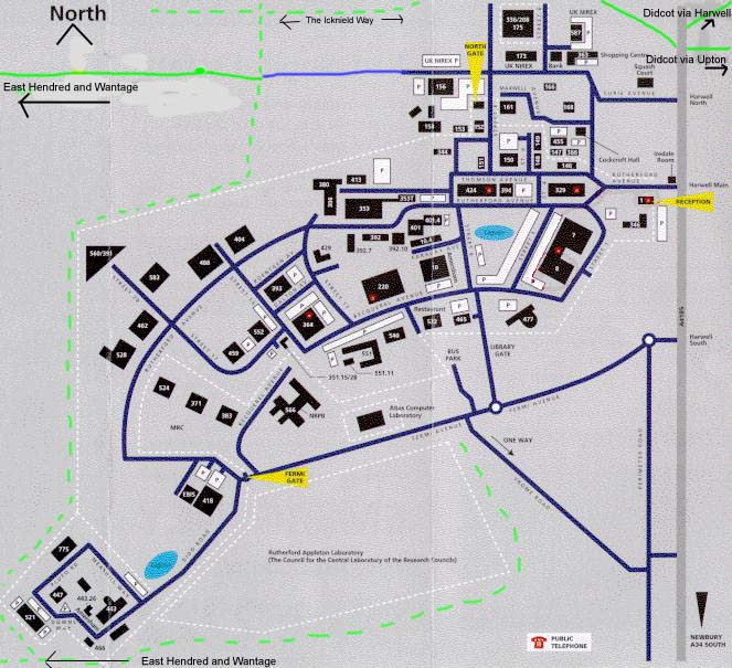
Detailed map of Harwell site showing access to off-road paths (140 K JPEG, use Back to return here)