Location 
Natural Features
---Geographic Features
---Hydrologic Features
Land-use
Flora/Fauna
Around the Park
Gallery
General Management Plan
Project
SuMMIT
---Components
---Partners
---PAMB
---CARE
---CARE
---NCIP
Sign Guestbook
View Guestbook
|
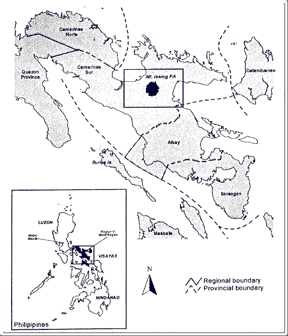
Mt. Isarog National Park (MINP) lies in the heart of Camarines Sur Province, in the southeastern portion of Luzon Island, Philippines
(See map below). It is located at the central part of the Bicol Peninsula at 13° 40' North Latitude, 123° 23 East Longitude with an area of 10,112.34 hectares. Mt. Isarog is the highest forested peak in southern Luzon (Heaney & Balete 1999) rising to 1966 meters above sea level (masl). The territorial jurisdiction of MINP is covered by six (6) municipalities of Camarines Sur, namely: Pili, Ocampo, Goa, Tinambac, Tigaon and Calabanga and the chartered City of Naga which is considered as the economic center in the Bicol Region.
From any point in the Philippines, you can reach Mt. Isarog by land or by air. From Manila, you can take a six-hour drive going to Naga City or if you opt for a plane, a Naga-bound aircraft would be 30 to 55 minutes. The nearest airport is located in San Jose, Pili, Camarines Sur.
Going to the foot of Mt. Isarog is accessible by jeepneys or pedicab. And then you have to continue on man-made
trails.
|