|
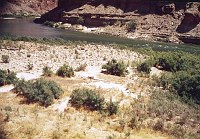
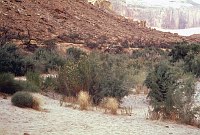
Filename: 041-3R
Description: RIGHT - LOPERS BOAT 41.3 CC=40. VEGETATION CONTROLED BY
CAMPING. 1975. NPS, BORDEN.
Object name: R41.3
Credit: 1-78
|
Click here to download
|
|
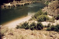
Filename: 041-5R
Description: RIGHT - ROYAL ARCHES 41.5 CC=10. 1975. NPS, BORDEN.
Object name: R41.5
Credit: 1-80
|
Click here to download
|
|
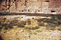
Filename: 047-1R
Description: RIGHT - SADDLE CANYON 47.1 CC=40. EXPOSED CAMPSITE. 1975.
NPS, BORDEN.
Object name: R47.1
Credit: 1-82
|
Click here to download
|
|
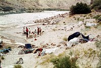
Filename: 053-0RL
Description: RIGHT - NANKOWEAP RUINS 53.0 (LOWER) CC=40. HEAVILY USED
BEACH. 1975. NPS, BORDEN.
Object name: R53.0L
Credit: 1-85
|
Click here to download
|
|
Filename: 053-0RU
Description: RIGHT - NANKOWEAP RUINS 53.0 (UPPER) CC=40. HEAVILY USED
BEACH.1975. NPS, BORDEN.
Object name: R53.0U
Credit: 1-84
|
Click here to download
|
|
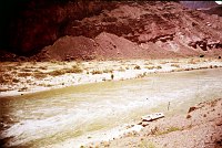
Filename: 053-9L
Description: LEFT - 54 MILE. CC=30. 1975. NPS, BORDEN.
Object name: L53.9
Credit: 1-87
|
Click here to download
|
|
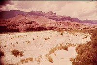
Filename: 065-5L
Description: LEFT - TANNER MINE (PALISADES) 65.5 (LOWER) CC=40+ HEAVILY
USED. AVAILABLE TO HIKERS. 1975. NPS, BORDEN.
Object name: L65.5L
Credit: 1-91
|
Click here to download
|
|
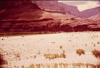
Filename: 065-5U
Description: LEFT - TANNER MINE (PALISADES) 65.5 (UPPER) CC=40+ HEAVILY
USED. AVAILABLE TO HIKERS. 1975. NPS, BORDEN.
Object name: L65.5U
Credit: 1-90
|
Click here to download
|
|
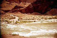
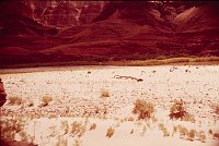
Filename: 068-0RL
Description: RIGHT - UPPER TANNER RAPIDS 68.0 (LOWER) CC=40+ EXPOSED
CAMPSITE. 1975. NPS, BORDEN.
Object name: R68.0L
Credit: 1-95
|
Click here to download
|
|
Filename: 068-0RM
Description: RIGHT - UPPER TANNER RAPIDS 68.0 (MIDDLE) CC=40+ EXPOSED
CAMPSITE. 1975. NPS, BORDEN.
Object name: R68.0M
Credit: 1-94
|
Click here to download
|
|
Filename: 068-0RU
Description: RIGHT - UPPER TANNER RAPIDS 68.0 (UPPER) CC=40+ EXPOSED
CAMPSITE. 1975. NPS, BORDEN.
Object name: R68.0U
Credit: 1-93
|
Click here to download
|