| TeamManley |
| TeamManley |
 |
Caradon
Hill Railways
South Caradon Mine Branch |
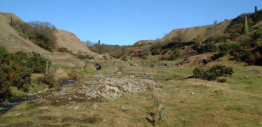
The remains of the South Caradon Branch Headshunt 2001. River seaton to the left with the burrows of West Caradon mine. To the right is the site of South Caradon's dressing sheds and miners drys. |
 |
The
South Caradon Mine provided the core traffic for the LCR for most of its
history and without the Railway the mine's development would have been
severely restricted. This interrelationship explains the presence of the
LCR trackbed within the dressing floors of the mine. 1844 was the year
that the LCR started transporting ore from South Caradon, seven years after
the mine has started production.
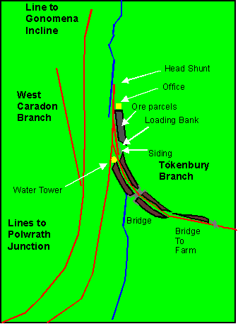
The
unusual layout of the lines Within the Seaton valley came about from
the historical development of the railways around Caradon Hill. The Original
LCR line split at Polwrath depot with one branch following the western
slope of the valley up to the Granite quarries at Cheeswring via the Gonamena
Incline. South Caradon Mine was served by the lower branch that ran to
a siding at Valley floor level. In 1861 the line was extended around the
Southern slopes of Caradon Hill to Tokenbury Corner with the siding at
South Caradon becoming a headshunt for trains using that branch. The layout
changed again in 1877 with the opening of the Kilmar Junction Railway which
enabled trains to reach Cheeswring around the Eastern side of the Hill
and therefore bypassing the Gonamena incline.
This Plan is based on OS Maps 1882( Copyright reserve),site visits, interprestions of the photographs in messenger,Notes within that book and the CAU Minions survey. |