
The Tramway
On the Dressing floor
|
|
The Tramway On the Dressing floor |
|
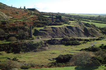
Transportation
of ore around the various processes on the dressing floors required a tramway
network that running on different levels along bridges, trestles and embankments.
Its exact layout is open to some speculation with the tracks shown in the
1882 OS map not fully coinciding with the evidence from the Victorian picture.
The track layout can be important evidence in an attempting to identify
the structures and processes that existed within the dressing floor area
of South Caradon.
The Picture below is a detail from this picture and it is fully reproduced in Michael Messengers Caradon & Looe The Canal, Railways and Mines .Detail within this view gives some fascinating clues to the operation and construction of the tramway and yet also leaves some question unanswered. |
||||||||||||||||||||||||||
Within the photograph one of the mines trucks can be seen sat on a raised track above piles of dressed ore. The map is my interpretation of the possible track layout based on the following evidence:
The raduis of the curves visible in the picture do not coincide well with those in the OS map and it is not clear how the wagons were moved around on the raised walkway. If anyone on closer inspection of the maps and photograph have alternative suggestions please email me and I will include them in the web site. |
|
| No
public right away exists to any of the mine sites visible from this footpath.
On many mine sites in Cornwall dangers may still exist, many hidden. This web site is published as a resource to those using the public right of way. |

