Antarctica Ahoy!
Around Scott Base
Expedition Begins
Exploration Area
Exploration Routes
Plateau Loop map
Polar Plateau
Icy Panorama
East Quartzite Range
West Quartzite Range
Upper Glacier
Glacier Route
Middle Glacier
Lower Glacier
Final Stretch
Destination
Conclusion
Diary: Introduction
Diary: Preparation
Diary: Polar Plateau
Diary: Quartzite Xmas
Diary: Into the Glacier
Diary: Home Run
Appendix: Polar Life
Appendix: Logistics
Appendix: Mapping
Thanks

Tararua Antarctic Expedition, 1962-63
Destination
![]()
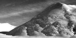
Tucker-Pearl Harbour glacier confluence,
west from the airlift point. 23 January.
![]()
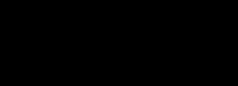
East from the Tucker Glacier airlift point.
![]()
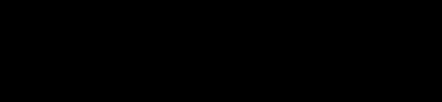
Southeast and down-glacier from the airlift point.
![]()

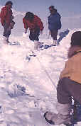
We built an igloo and an arch
to release exuberant energy
from completing the trip.
![]()

Mt. Pearson, photographed 50 km away
through binoculars from the airlift point.
![]()

In the two-rope method of crevasse rescue,
the victim steps out of a crevasse
in rope loops that are alternately raised.
Left: Gerald Holdsworth operates the two-rope rescue method.
Others supervise the rescue of John Hayton from the hand-dug "crevasse".
Right: John emerges smiling from the crevasse.
![]()