Foothpath Walks 

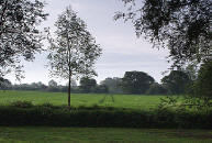
 Countryside view   

  ©Gamelin Photography


A  map showing all the parish footpaths and permitted rights of way is available, free of charge, from the Parish Council Office, Post Office, Museum and other locations in Coggeshall.
Blue Walk is a country walk but with the town always in sight. Most of the walk is on the Essex way. The posts are colour-coded.


Welcome


History


Coggeshall today


Guided Walk


Visitor Information


Sight-seeing


Museum


Footpaths


What's on & latest news


Our Visitors


Links


This walk begins from the car park. Leave by Church Street and then take the narrow way-marked passage opposite Vane Lane and cross the Recreation Ground. Turn left and then a little way along turn right onto the Essex Way. Stop and admire the abbot’s lodgings and the guest house as you pass through the grounds of the 12th century Cistercian abbey. You will pass the massive Grange Barn, one of the oldest in Europe, which was built by the monks of Coggeshall abbey. Later you will cross the footbridge made in 1896 by local blacksmith and public rights of way campaigner Dick Nunn. Stop to enjoy the public gardens, one dedicated to the Doubledays and the other created to celebrate the new millennium. This walk is approximately 3 miles. Allow 11/2 hours.

BLUE WALK MAP


Top

Red Walk  Leave the car park via Stoneham Street and Tilkey Road until the first marker post at the meadow. At any time of year this is a picturesque walk across fields and through woodland but it is particularly recommended in May during the bluebell season. Practically the only house you will see after leaving the town is the Cradle House. Here you will actually walk on the outskirts of its garden. Refreshments are available at Marks Hall visitors centre (weekends only in the Winter months). This walk is approximately 4 miles. Allow 11/2 to 2 hours. The posts are colour-coded.

RED WALK MAP

Top2