Mount Kinabalu - Page 3
      At the Timpohon Gate (6000 feet) ...
      Arch at the Timpohon Gate
      Sign Board At the Timpohon Gate
      The sign board says "From this point to summit (8.72km) the summit trail is being marked at intervals of 0.5 kilometer". The Trail Map is available here and the summit trail map is available at Imran's web site.

      And the journey begins ...

      Steep climb
      As you go up, you will experience a somewhat dry climate and the air will get thinner and thinner. The diversity of plant life at different elevations will be clearly seen.
      One thing that you would find interesting during the climb is the different varieties of pitcher plants. Each different from the other in colour, shape and texture. This is where the your guide's knowledge about botany becomes handy.
      Nepenthes villosa
      Nepenthes villosa
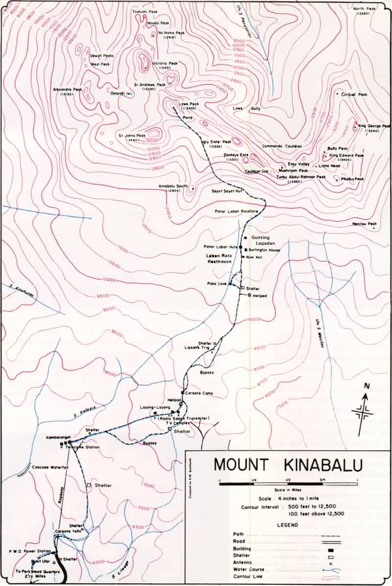
      First it was a steep climb in a lush green rain forest. At 1981m (6500 feet) you will find the first shelter, Pondok Kandis. Drinking water will be available At all these shelters, drawn from near by streams.
      Nepenthes rajah

      Nepenthes edwardsiana
      Nepenthes edwardsiana
      Nepenthes villosa
      Nepenthes villosa
      Please note that the resolution of the above images have been reduced for faster downloading. Still you could view a better image by selecting 'view the image' option in your browser since the size of the displayed image in this page is smaller than its actual size.
       
      All photographs - Copyright 1998-99 Jaanaka Wimaladharma


      Home
      Previous
      Page 1
      Page 2
      Page 4
      Page 5
      Page 6
      Page 7
      Next
      Links
      Counteraccesses 
      since 01 Aug 1999
       
       
      Send your comments to Jaanaka Wimaladharma
      First created 30/07/1999  Last updated 09/08/1999
      This page is hosted by 
      "Leaves" graphics from Jelane's Free Web Graphics