Maps of Kaladia - The District of Calthayes
|
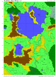
This is a reduced resize of Kaladian Map Frame C5, one of the 23 maps comprising the Atlas of Kaladia. This area encompassed in this map spans 1,050 miles in width, and 1,500 miles in length.
There are ten human countries, three barbarian lands and one humanoid realm depicted on this map.
Human countries include Blacksword, the District of Calthayes, Eirinland, the Wizard Lands of Jasulmyle, the Free State of Jitregann, the Kulaton Empire, the Vicounty of Pejduhl, and Silver League nations of Goarin, Merrizzian, and Welgredd.
Barbarian lands include the Blood Moons, the Wilds of the Blue, and the Raven Lands.
Humanoid realms include the Dwarven Crown of Riggencarn.
