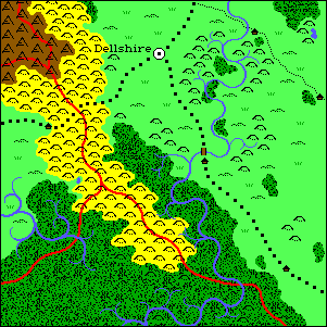
Here's One of the 23 (Resized) full-color Maps of Kaladia

There are no pages using frames in the Maps of Kaladia. When I originally hand-drew these maps in the early 1980's, I called them frames. Any reference here to frames simply means a map.
I have a massive and extensive atlas of Kaladia. Each of the 23 geographical maps is drawn at 300dpi, in two separate versions: one in 16-color for viewing on-screen, the other is a 2-color 8.5" x 11" printable map. Each map encompasses an approximate area of 1,050 miles x 1,500 miles, or roughly 1,575,000 square miles.
- The Continent of Kaladia (68k)
- This is the full picture of Kaladia also presented in the Maps of Roil showcase.
- Area Maps of Kaladia
- Overland maps detailing specific areas and nations of the continent. These map cuts are taken from the full-scale pictures in the Atlas of Kaladia, without any resizing.
- The Atlas of Kaladia
- This page contains resized versions of ALL 23 full-color map frames. This will take a while to load, and is included only for browsing convenience and for the curious.
- Maps of the Fiftieth Parallel:
- This region, from west to east, is displayed in three overland maps spanning from 50 degrees north latitude to 60 degrees north latitude.
- Map Frame A1
- Full-Color Map (66k) || Stylized Indian Ink Map (28k)
- Frame A1 is dominated by oceans and seas. It contains a number of islands, and the northwestern tips of Kaladia.
- Map Frame A2
- Full-Color Map (112k) || Stylized Indian Ink Map (51k)
- Frame A2 depicts the largest island off of Kaladia, and the northernmost regions of the continent.
- Map Frame A2
- Full-Color Map (54k) || Stylized Indian Ink Map (23k)
- Frame A3 is almost completely consumed by the Olgarn Ocean. It shows the Rhul Nugath, and part of Kaladia's northeastern coast.
- Maps of the Fortieth Parallel:
- This region, from west to east, is displayed in seven maps spanning from 40 degrees north latitude to 50 degrees north latitude.
- Map Frame B1
- Full-Color Map (115k) || Stylized Indian Ink Map (58k)
- Frame B1 contains the western region of the northern plains, and the western lands above the great plateau.
- Map Frame B2
- Full-Color Map (140k) || Stylized Indian Ink Map (65k)
- Frame B2 depicts the central region of the northern plains, and the northern lands of the Lyrmaddyn Desert.
- Map Frame B3
- Full-Color Map (181k) || Stylized Indian Ink Map (116k)
- Frame B3 shows the southeastern region of the northern plains, but is dominated by the Elven Lands.
- Map Frame B4
- Full-Color Map (87k) || Stylized Indian Ink Map (47k)
- Frame B4 contains the eastern areas of the Elven Lands, and the coastal region of the northern steppes.
- Map Frame B5
- Full-Color Map (135k) || Stylized Indian Ink Map (63k)
- Frame B5 holds the bulk of the northern reaches, and the western expanse of the Greybark Forest.
- Map Frame B6
- Full-Color Map (131k) || Stylized Indian Ink Map (61k)
- Frame B6 is a region known as the Darkened Realms. It is an area destroyed and perversed by the War of the Winds.
- Map Frame B7
- Full-Color Map (65k) || Stylized Indian Ink Map (35k)
- Fame B7 contains the eastern tip of the Darkened Realms, generally known as the northern point.
- Maps of the Thirtieth Parallel:
- This region, from west to east, is displayed in seven maps spanning from 30 degrees north latitude to 40 degrees north latitude.
- Map Frame C1
- Full-Color Map (87k) || Stylized Indian Ink Map (40k)
- Frame C1 depicts the western coast of Kaladia, and its southern wetlands.
- Map Frame C2
- Full-Color Map (150k) || Stylized Indian Ink Map (74k)
- Frame C2 shows the bulk of the Lyrmaddyn Desert, the heart of the great plateau, and the southern wetlands.
- Map Frame C3
- Full-Color Map (190k) || Stylized Indian Ink Map (109k)
- Frame C3 is dominated by the elven woodlands of Elven Tree and Silverwood, and contains the bulk of the Rogue Lands.
- Map Frame C4
- Full-Color Map (176k) || Stylized Indian Ink Map (109k)
- Frame C4 contains the southeastern portion of the Elven Lands, and much of the two largest concentrations of the Mists on Kaladia.
- Map Frame C5
- Full-Color Map (174k) || Stylized Indian Ink Map (87k)
- Frame C5 depicts the southern expanse of the northern reaches, the eastern fringe of the northern steppes, and the beginnings of the eastern grasslands and the southern plains.
- Map Frame C6
- Full-Color Map (205k) || Stylized Indian Ink Map (111k)
- Frame C6 is divided between the Darkened Realms of the north, and the eastern grasslands to the south.
- Map Frame C7
- Full-Color Map (117k) || Stylized Indian Ink Map (60k)
- Frame C7 is dominated by the Ultanic Ocean, but shows much of Kaladia's eastern seaboard.
- Maps of the Twentieth Parallel:
- This region, from west to east, is displayed in six maps spanning from 20 degrees north latitude to 30 degrees north latitude.
- Map Frame D2
- Full-Color Map (96k) || Stylized Indian Ink Map (48k)
- Frame D2 shows the central portion of the southwestern coastal states, and the great Canoba Islands.
- Map Frame D3
- Full-Color Map (108k) || Stylized Indian Ink Map (54k)
- Frame D3 contains the eastern regions of the southwestern wetlands, and the western beginnings of the southern plains.
- Map Frame D4
- Full-Color Map (108k) || Stylized Indian Ink Map (67k)
- Frame D4 holds the bulk of the southern plains, and a large concentration of the Mists.
- Map Frame D5
- Full-Color Map (128k) || Stylized Indian Ink Map (69k)
- Frame D5 depicts the mountainous eastern border of the southern plains, the Trobellican Sea and the Trobellican Isles.
- Map Frame D6
- Full-Color Map (134k) || Stylized Indian Ink Map (69k)
- Frame D6 contains the southeastern coastal states, the fringes of the eastern grasslands, and the Trobellican Isles.
- Map Frame D7
- Full-Color Map (76k) || Stylized Indian Ink Map (34k)
- Frame D7 is dominated by the Ultanic Ocean, but depicts Oudiryah Island, largest of the Trobellican Isles.
Top of Page
Home |
Gallery |
Introduction |
World of Roil |
Kaladia |
Deities |
Legends |
Saga |
Guestbook |
Links
The Maelstrom Fantasy Campaign Setting is Copyright © 1998 by Brian K. Moseley. All rights reserved.
This page hosted by  Get your own
Free Home Page Get your own
Free Home Page

|